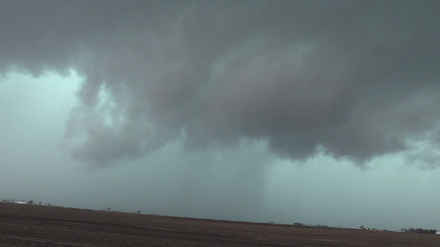
Storms prompt tornado warnings in Northwest Indiana, Central Illinois
In Iroquois County, crews on the ground said an apparent tornado blew apart barns and brought down power lines.
Watch CBS News

In Iroquois County, crews on the ground said an apparent tornado blew apart barns and brought down power lines.
We will be in alert mode on Wednesday, with all modes of severe hazards are possible.
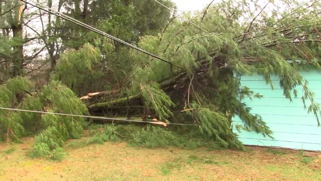
Wind gusts of 81 mph were reported in Valparaiso, Indiana.
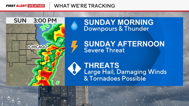
If the morning round of storms clears out quickly on Sunday, the severe storm threat is higher for the afternoon.

A warm front Friday will bring rain and thunderstorms with daybreak.
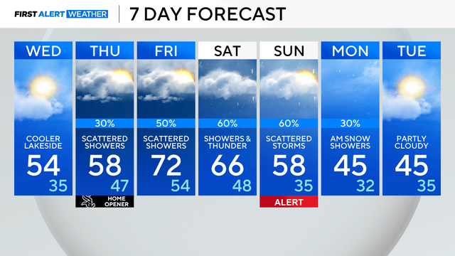
Showers are expected to return on Thursday, and this weekend could see the potential for strong thunderstorms.
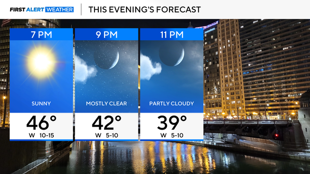
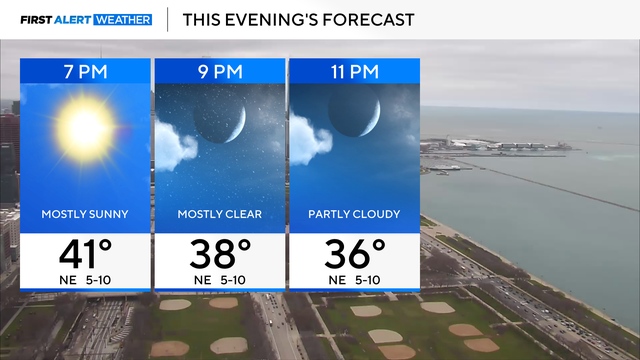
Winds will relax with highs in the 40s.
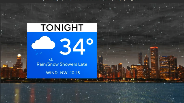
Building clouds ahead of the next system will bring scattered rain showers tonight, especially between 10 p.m. and midnight. These will be light and not well organized.
Tuesday will be mostly cloudy, breezy and warmer.
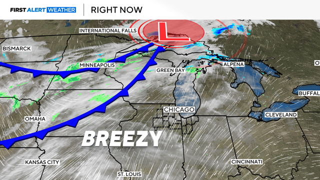
A warm and very windy day ahead, but a cold front brings falling temps.
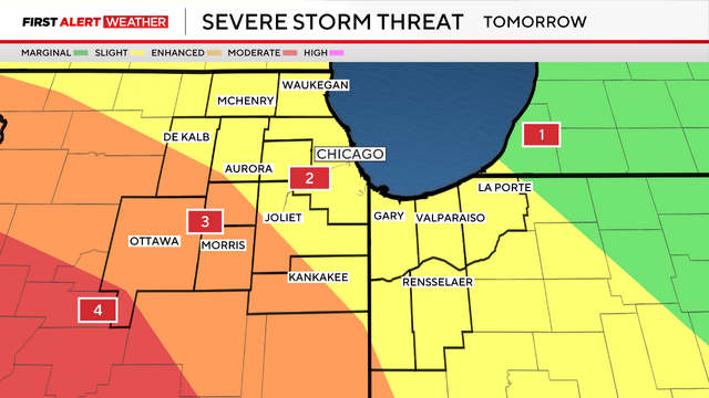
A severe weather outbreak could hit the Chicago area Friday night, bringing damaging high winds and the possibility of isolated tornadoes.
Partly cloudy skies continue through the week, until we get to late Friday.

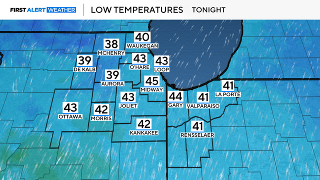
Rain and snow showers taper off tonight as high pressure moves into our area.
Wet snow is likely Friday. With temperatures hovering in the middle 30s, rain showers may mix into the picture at times.

A Wind Advisory was in effect until midnight Wednesday night as winds have been gusting 40 to 50 mph.