Sunny North Texas weekend in store
If you're headed outside, dress for the heat and drink plenty of water!
Watch CBS News

If you're headed outside, dress for the heat and drink plenty of water!

Some areas will wake up to temperatures in the 50s on Tuesday.

Scattered storms are popping up across North Texas, some of which may meet severe criteria.

Though conditions will be dry during the majority of the day, there is still a chance for an isolated shower or storm later in the afternoon through the evening.
An upper-level trough strengthens, moving from the west to the east.
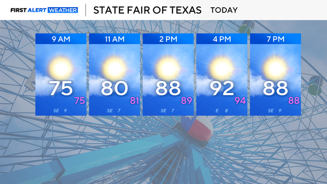
Highs will reach the low to mid-90s on Friday afternoon. Relative humidity will be low today, increasing the risk of fire in the afternoon west of I-35.

There is only a slim 10% chance of an isolated shower or rumble, mainly south of the Dallas-Fort Worth area, into Tuesday evening.

This cold front won't cool us down much, but it will drop our temperatures by a couple of degrees and slightly lower our humidity by Tuesday afternoon.

Today, DFW is expected to reach 100 degrees. If this happens, it will be the 52nd triple-digit day so far this year, the sixth most recorded on record.
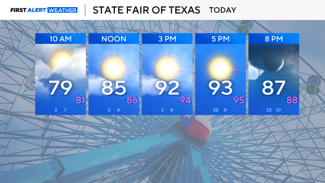
Looking ahead to the rest of the week, we'll barely drop into the 90s by Thursday, but the 90s look to stick around into this weekend.

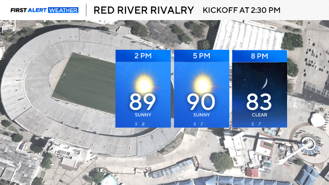
For Sunday, expect yet another sunny, hot and breezy day.
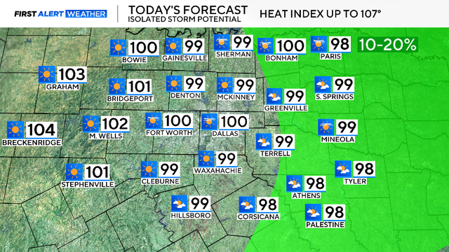
A heat advisory is in effect until 8 p.m. Saturday night due to a heat index, known as the feels-like value, reaching up to 107 degrees.

Feels-like temperatures will be as hot as 107° on Monday.

Over 36 million Americans are under heat alerts for Sunday, including North Texans.
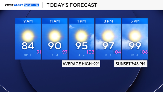
Triple-digit temperatures are here to stay through the next week.