
Smoke moving out of Minnesota Monday as heat and humidity encroach
The air quality in Minnesota will continue to improve on Monday as wildfire smoke moves out of the state.
Watch CBS News

The air quality in Minnesota will continue to improve on Monday as wildfire smoke moves out of the state.
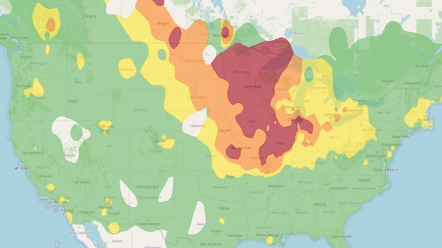
The state of Minnesota is entering another in a long string of summer days marred by air quality alerts. Poor air quality will continue through Saturday with lingering wildfire smoke from Canada.
An air quality alert covering the entire state of Minnesota continues on Thursday, marring otherwise fairly ideal weather conditions.

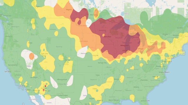
The entire state of Minnesota is under an air quality alert for the next few days, coinciding with a stretch of cooler, quieter weather.

Minnesota is headed for a much-needed break from the intense heat and humidity, but air quality concerns will linger over the state through the weekend.
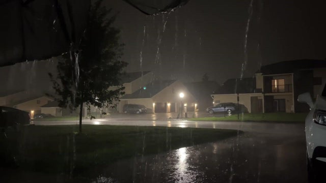
Strong to severe storms moved through the bottom half of Minnesota on Monday evening.

Parts of Minnesota will once again be under a heat advisory on Wednesday, and more storms are in the pipeline, too.

Heat and humidity return to Minnesota on Tuesday, and parts of the state are in for scattered thunderstorms.

Scattered storms will move through Minnesota Monday morning, and a surge in heat and humidity is not far off.

Severe storms moved through parts of western and southern Minnesota on Friday night.

High pressure moves in to help whip up a #Top10WxDay in the Twin Cities on Thursday, with highs in the mid 70s, low humidity and smoke-free skies.

Wednesday will be a wet one in the Twin Cities, with showers and storms continuing through the morning and another chance for moisture in the afternoon.

The advisory will be in place for Anoka, Carver, Dakota, Hennepin, Ramsey, Scott and Washington counties from noon to 8 p.m. as feels-like temps approach 100.

Get ready for a warm and humid Monday night in the Twin Cities ahead of a sweltering Tuesday.

Scattered showers and storms are possible on Friday with pockets of heavy rain and gusty winds. Plus, weather officials say the entire state will be under an air quality alert until Monday.