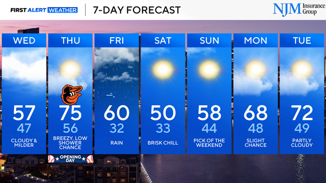
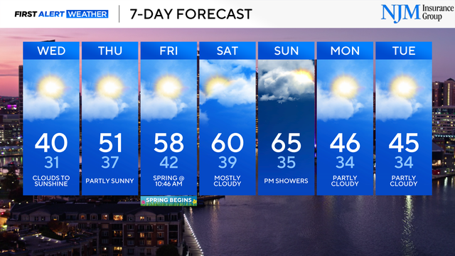
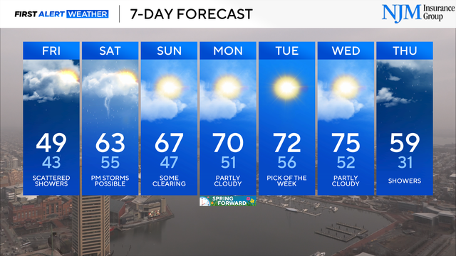
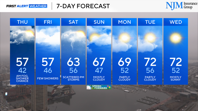
Warming trend across Maryland through the O's home opener
Temperatures will gradually trend warmer through Thursday afternoon.
Watch CBS News

Temperatures will gradually trend warmer through Thursday afternoon.
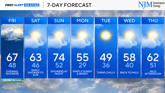
The chance of rain spikes this evening, followed by another round of rain Sunday night.
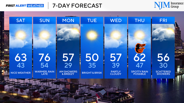
A warming trend continues into the weekend.
Temperatures will be warmest this weekend, ahead of another round of chilly weather.
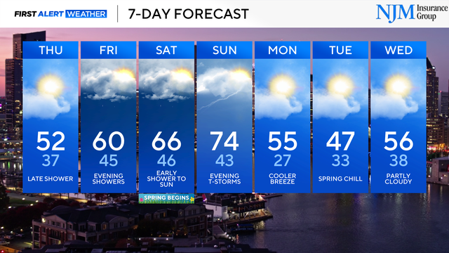
Grab a winter coat if you have outdoor evening plans.
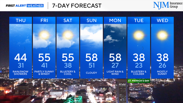
St. Patrick's Day will be cold and windy with wind-chills staying in the 20s and lower 30s through the afternoon.
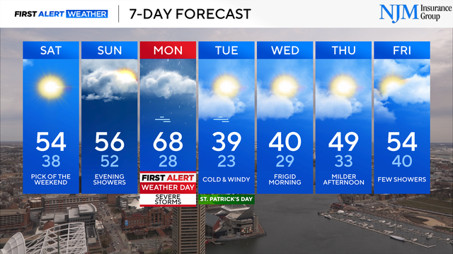
Monday is a First Alert Weather Day, following a cool and breezy weekend.
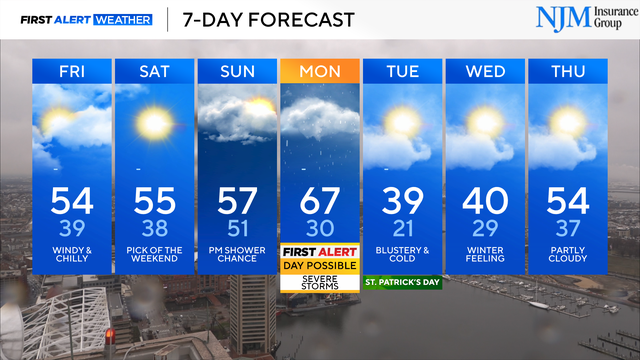
Temperatures dip below freezing in many areas tonight; a few slick spots possible.
The risk of severe weather has ended.
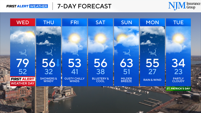
Wednesday is a First Alert Weather Day.
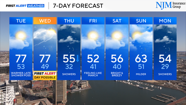
Wednesday is a Possible First Alert Weather Day.
More needed rain is on the way.
Wet weather will put a dent in the ongoing drought across the Mid-Atlantic.
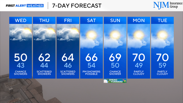
Additional rounds of needed rain are on the way.
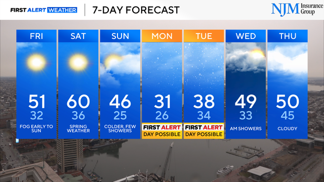
Monday and Tuesday are Possible First Alert Weather Days.