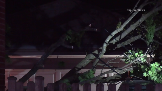
Storm system brings strong and damaging winds to Chicago area
Wind gusts reached 60 to 70 mph in Hampshire, Illinois, in Kane County.
Watch CBS News

Wind gusts reached 60 to 70 mph in Hampshire, Illinois, in Kane County.

Tinley Park saw golf-ball-sized hail and Orland Park saw ping-pong-sized hail, according to the National Weather Service.
Lovely weather is in store until Tuesday, but two rounds of strong to severe storms could come soon.

Sunday plans look lovely with cooler, dry weather behind a cold front. Periods of rain return much of next week.

While rain will be isolated throughout the day, widespread rain and thunderstorms move in overnight, when a nice soaking of 0.50" to 0.75" is expected.
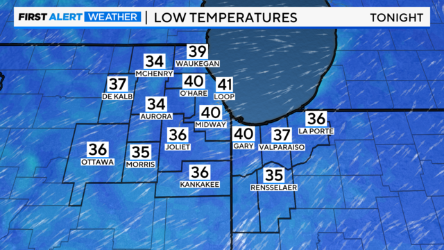
Skies will be mostly Wednesday night with temperatures in the 30s.
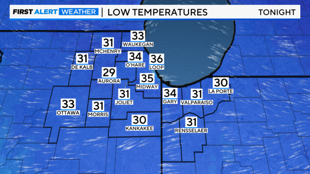
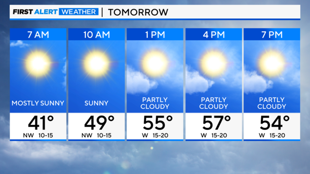
Lows in the 30s in the western suburbs, but staying in the low 40s in Chicago.
Other than a few rumbles of thunder and brief downpours, the severe weather risk is expected to remain south of the Chicago area.

Behind the front, windy conditions are in the forecast for Friday, with highs in the mid-50s.

CBS 2 is tracking a storm closely following the last system's heels. The storm is expected to bring rain and even a few thunderstorms on Thursday.
A small chance of showers and storms persists Wednesday morning.

The greatest threat for tornadoes in the Chicago area will be in the far western suburbs.
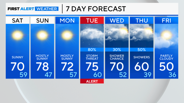
Waves of showers and thunderstorms are likely Monday night through Tuesday night. Some storms may become severe on Tuesday afternoon and evening.
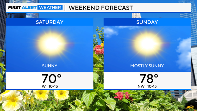
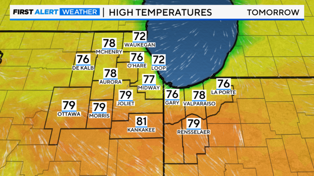
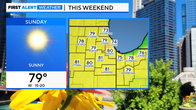
It will be in the low 70s on Saturday under a sunny sky and mostly sunny and warmer on Sunday, in the upper 70s.
After a brief early morning shower on Friday, expect a clearing sky and winy conditions. Gusts up to 40 miles per hour will be possible, and the high will be around 60 degrees.