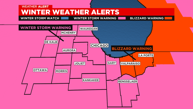
Chicago Weather Alert: Winter storm warning; blizzard-like conditions
Conditions are expected deteriorate quickly throughout the day Thursday as snow develops.
Watch CBS News

Conditions are expected deteriorate quickly throughout the day Thursday as snow develops.
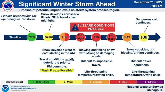
Widespread snow develops by noon, and continues through the evening hours. Temperatures will fall from the 30s in the late morning to the single digits by the late afternoon.
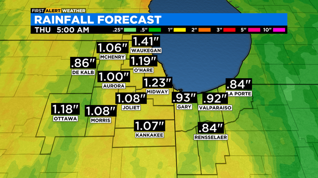
The latest models models are showing between 5 to 7 inches in Chicago, with much higher amounts possible in northwest Indiana.
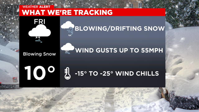
The potential for a significant winter weather system is likely to make Christmas travel difficult and, at some points on Friday, nearly impossible.
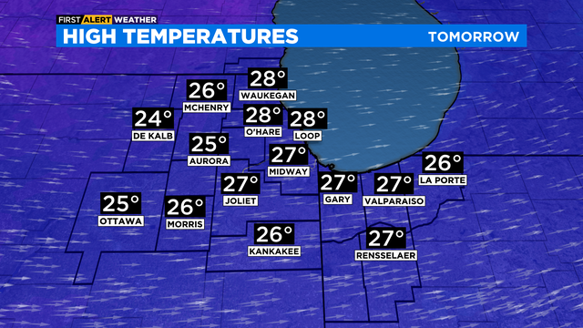
Saturday will be cloudy and cold with highs in the upper 20s. A chance for flurries throughout the day.
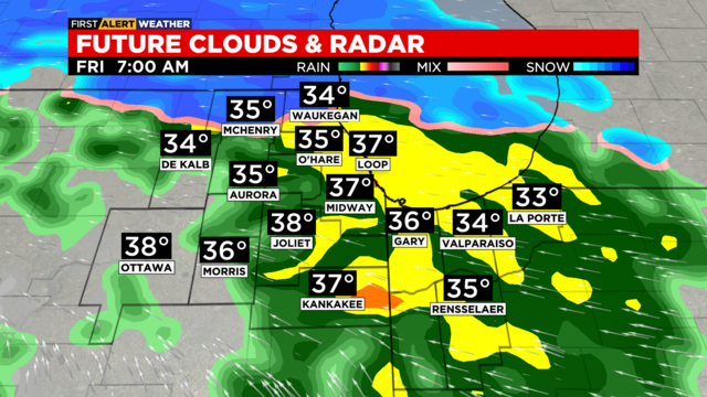
Another round of snow showers is in the forecast for Friday. Little to no accumulation is expected. Highs will be colder in the low 30s.
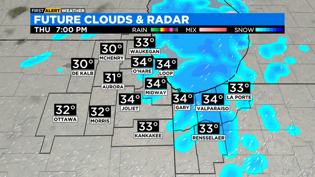
According to CBS 2 Chief Meteorologist Albert Ramon, rain chances linger through at least 3:00 a.m. It will be cold enough for areas northwest of Chicago to see a rain and wet snow mix.

Highs on Wednesday will be milder in the mid 40s. Shower chances linger through Wednesday night.
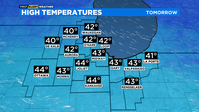
Highs will be stuck in the low 40s. Overnight lows in the mid 30s.
Rain chances decrease through the afternoon hours and we'll be mainly dry by Friday evening.
According to CBS 2 Chief Meteorologist Albert Ramon says patchy fog will be likely overnight. Some dense pockets of fog will be possible, but mainly for the northwestern suburbs.
According to CBS 2 Chief Meteorologist Albert Ramon, it'll be overcast with a chance for sprinkles and drizzle tonight, as a cold front moves through the area.
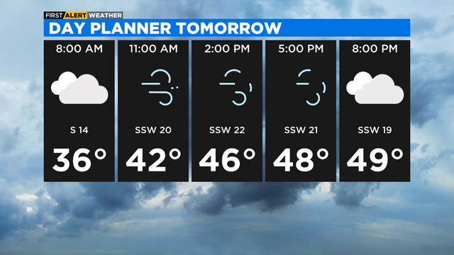
Despite full sunshine, wind chills will be in the teens for much of the day.
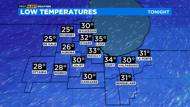
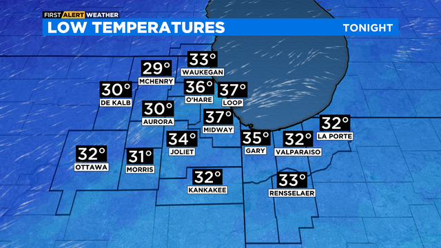
A strong south wind will increase temperatures and cloud cover overnight. Temperatures will go from low 30s at midnight, to mid-30s by sunrise.

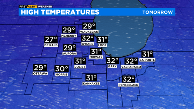
Behind the front, it will be cold this weekend with highs in the 30s.