Metro Detroit's weekend weather starts off gloomy on Friday, leads to warm-up and storms on Saturday

Metro Detroit is in for quite the ride as we head into the weekend.
If you've been waiting for a sign that spring is right around the corner, Saturday will deliver a noticeable warm-up, though you'll need an umbrella to fully enjoy it.
We are tracking a dynamic system moving into Southeast Michigan that will bring a mix of gray skies, showers, storms, and eventually, a beautiful end to the weekend.
Here is a closer look at what to expect across Metro Detroit over the next three days.
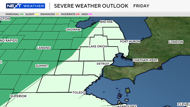
Friday: The gray setup
We will end the workweek on a quiet, albeit gloomy, note. Friday will be dominated by widespread cloud cover across the region, along with dense fog throughout the morning hours.
You'll want a heavier jacket heading out the door in the morning, with temperatures starting off at a chilly low of 36 degrees Fahrenheit. You'll be able to shed the heavier jacket by the afternoon as temperatures head for the 50s.
A severe weather risk to our west may have a chance to build some stronger storms by the late evening hours. If these storms can hold together, then we may see a strong storm risk after 9 p.m. on Friday.
Wind and hail are the primary concerns there, but it's a bit of a wait-and-see for storms to build strong enough out west first.
Saturday: Warm, breezy and wet
Saturday is the headline-maker of the weekend, and we'll need to start during the very early morning hours first.
A warm front will lift across Southeast Michigan, pulling unseasonably mild air into the region. We are forecasting highs to surge all the way up to the mid to upper 60s despite rain chances. However, this warm-up comes with a catch.
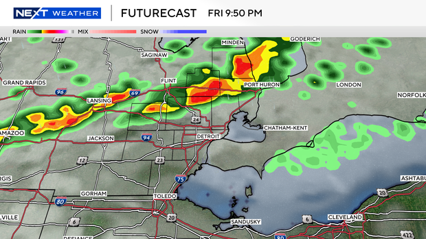
Early in the morning, showers and possibly some storms will roll through. An isolated severe storm is possible during this time.
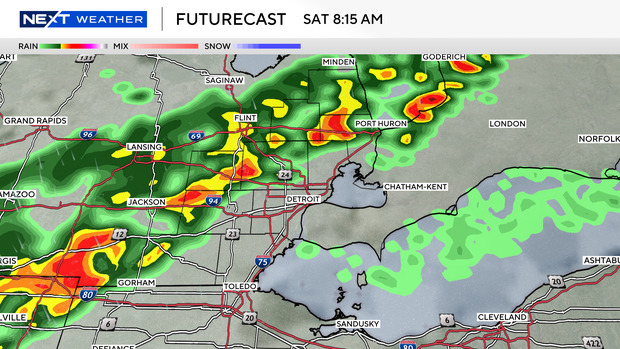
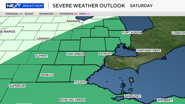
As temperatures rocket through the day, the air will have a chance to destabilize a bit. A cold front dives through in the afternoon and early evening, which gives us a better chance at severe storms in the afternoon.
We have a marginal risk for storms on Saturday (1 out of 5 category) as wind and hail are again the primary concerns for any storms that form.
One additional note is the wind. Saturday will be windy, whether it rains, storms, or stays dry, no matter what. Expect wind gusts to reach the 40 mph range before the front arrives to clear things out.
Sunday: The weekend payoff
The wet weather will clear out late Saturday night, leaving us with a spectacular finish to the weekend.
Sunday will feature clearing skies early on with sunshine for the remainder of the day.
Behind Saturday's system, slightly cooler air will filter back in, bringing our high temperatures down to the upper 50s.
Despite the slight drop, full sunshine and lighter winds will make Sunday the pick of the weekend for any outdoor activities, yard work, or simply taking a walk around the neighborhood.


