Winter Storm Warning Remains In Effect Until Midnight For Chicagoland
The National Weather Service issued a Winter Storm Warning on Saturday that remains in effect until midnight on Sunday night.
Watch CBS News
The National Weather Service issued a Winter Storm Warning on Saturday that remains in effect until midnight on Sunday night.

The National Weather Service issued a Winter Storm Warning for Cook, DuPage, Will, Lake, and Porter counties beginning 6 p.m. Saturday evening.

As temperatures begin to plummet outside, meteorologists inside the National Weather Center offices in Romeoville are beginning their predictions about what lies ahead.
The National Weather Service has issued a winter weather advisory for snow on Sunday.
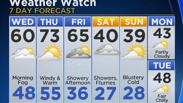
Summery weather isn't quite done with Chicago yet, and the city could set a record for warmth on Tuesday, with a high in the low 70s.

Far southwest suburban Braceville was overwhelmed by flooding on Sunday, after more than four inches of rain fell in less than two hours.

Residents in central Indiana were getting their first glimpses of crumpled buildings, scattered debris, and destroyed neighborhoods, after several tornaodes touched down on Wednesday.

Storms continue Thursday in the forecast, with threatening weather moving south.

With heavy rain expected to hit Monday afternoon and evening, a flash flood watch has been issued for some far southern suburbs and virtually all of northwest Indiana.

Chicago had its first tornado in a ten years on Tuesday, but it wasn't the kind of funnel cloud associated with a thunderstorm, and it didn't cause any major damage.

The Chicago area should get a good break from the storms to start the week, though, with lots of sunshine on Monday, and a high around 87.

With the heat index expected to climb into triple digits each of the next few days, people who work and play outside will need to take extra precautions to protect themselves from dangerous heat.

Monday was expected to be a pleasantly warm summer day, but temperatures will be dangerously hot by the end of the week across the entire state.

After a relatively comfortable weekend, hot and muggy conditions have returned to the Chicago area, and that heat could fuel a couple rounds of thunderstorms later this week.

Showers and storms could come and go most of this week, starting with the chance for thunderstorms early Wednesday morning.
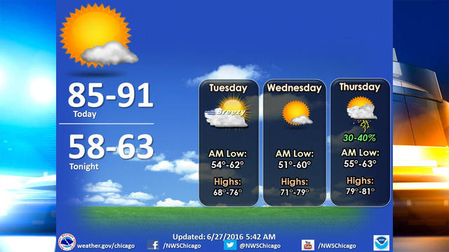
Chicago will see plenty of sunshine this week, and while Monday will be another hot one, milder conditions are on the way in the middle of the week.
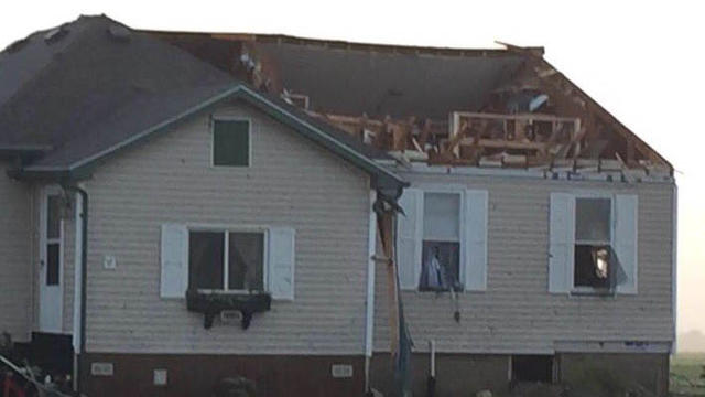
According to the National Weather Service, a tornado touched down near Paw Paw around 7:30 p.m., another touched down in Seneca around 9:15 p.m., a third touched down near Pontiac about 10:15 p.m., and a fourth touched down near Piper City shortly after 11 p.m.

Tuesday brings only a marginal risk of severe weather, but there is an enhanced risk of severe storms on Wednesday.

Showers and thunderstorms were headed to the Chicago area late Thursday morning, ahead of a hot and steamy weekend.

Spotty showers Monday afternoon could interrupt what otherwise looks to be a warm and sunny day, ahead of an unseasonably cool Tuesday.
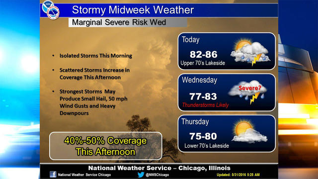
Showers and thunderstorms should ramp up across the Chicago area Tuesday afternoon, and scattered storms could continue on and off through Wednesday.

If you've got a barbecue or picnic planned for the Memorial Day weekend, the weather should be just what you were hoping for.

Showers and storms should fire up across the Chicago area Wednesday afternoon and evening, and rain will continue to be a threat through the next week.

It might have taken a while to get here, but we can finally begin to enjoy a nice long stretch of pleasantly warm weather.

Chicago could see a few spotty showers on Wednesday, but it should be mostly sunny and pleasant, and temperatures should gradually make their way to more summery conditions over the next week.