Eye On Weather: Harsh Winter's Impact On Gardening
Todd Gutner says the harsh winter may not have been as damaging to gardens as first thought.
Watch CBS News
Todd Gutner says the harsh winter may not have been as damaging to gardens as first thought.

Sandwiched between some mighty fine weather will be a super soaking tonight and early tomorrow morning. An area of low pressure with Gulf of Mexico origins is headed up the East Coast.

We are going on day three with this Nor'easter and these Spring Nor'easters are only slightly better than their Winter cousins. Cold, raw, rainy and now snowy and sleetie (is that even a word :-)) this pattern needs to change and soon.
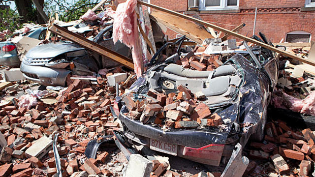
New England averages 8 tornadoes per year, 2 to 3 of those in the commonwealth.

The outlook for spring is not so great if you want to transition into a long stretch of warm days.
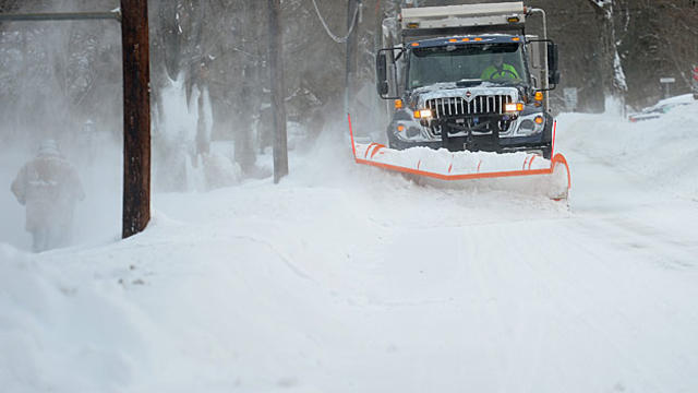
Eric Fisher looks back at what was one of the harshest winters in recent memory
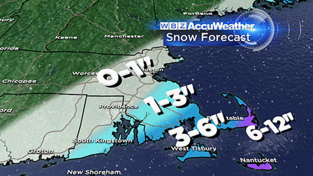
The snow has arrived on schedule, it is going to be a messy morning commute over southeastern Massachusetts, Cape Cod and the Islands.
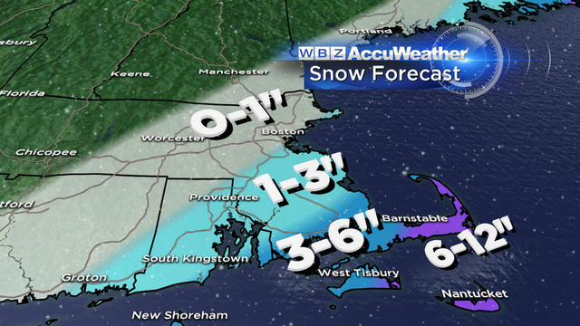
Here is what you should expect, inch-by-inch, hour-by-hour.

The calendar may say Spring but Winter is going strong. Temps these next few days will be very cold...average highs for this part of the month are in the upper 40s...our highs: Monday 29, Tuesday 35 and Wednesday 35. Along with the cold a large Nor'easter will develop off of Nantucket early Wednesday morning.
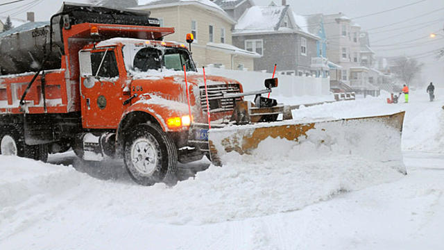
There is a storm in the works and it has the potential to be major, perhaps even historic, IF it is steered closer to New England Tuesday night into Wednesday.
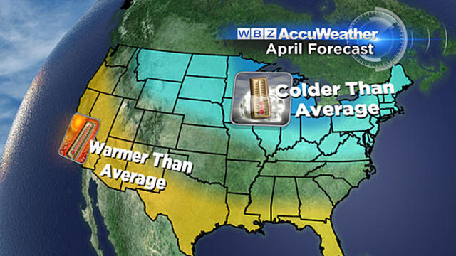
Ok, so enough is enough. when do we get warm?
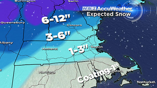
In just the next 24 hours, most of you will see rain, ice, snow, street flooding and strong winds. It sounds like a classic springtime storm in New England!
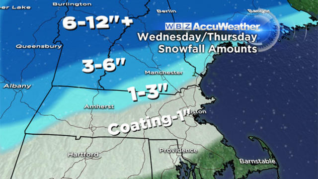
Mother Nature is about to serve up a classic taste of March in New England this week, complete with all the fixings - rain, snow, warmth and cold, all in the next few days.

This has been one long cold stretch and while it will stay pretty cold the next few days temps look to turn around over the weekend! If you are looking for warmer air you first need to look aloft...about 6000 feet up in fact. We look to this level of the atmosphere for clues on how warm or cold the air at the surface will be. Although the air 6000 feet up is still very cold, with some sunshine, mixing and the right wind direction, that air will sink down to the surface and as it does it gets compressed and therefore warms up...sometimes more than 30 degrees from that 6000 foot level.
Over the past 24 hours computer guidance has been suppressing the storm to our south minimizing the impact and lowering the snow amounts for Sunday night and Monday...that trend continues. What was once looking like a sizable snowstorm is now looking like no big deal.
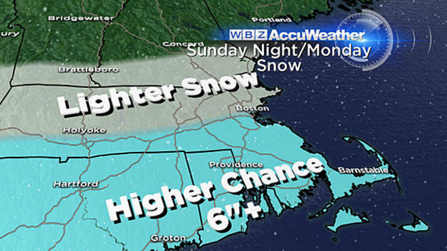
What I think is certain at this point is there will be a large swath of 6-to-10, perhaps up to 12 inches of snow somewhere in the vicinity of southern New England.
Intense snow showers called snow squalls raced through this afternoon leaving behind fresh coatings of snow and ushering in the coldest air mass of the month. It'll be a frigid Friday with morning lows in the single digits but adding salt on the wound will be the wind...wind chills will approach 20 below as you start you day.
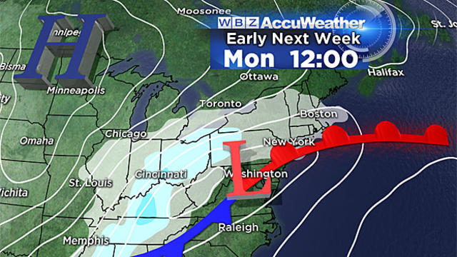
By now you have probably heard, there is a fairly good chance that Monday will be another snow day here in southern New England. While it is still a bit early for specifics, I think we can make some early assumptions.

We are in a holding pattern with nothing but cold through the weekend and occasional bouts of light snow or flurries.

The highs over the weekend were impressive...50 and 52...no that feel of Spring is gone as Winter comes roaring back this week with below normal temps and a couple of chances of snow. Most of this week temps will struggle to get out of the 30s...thanks to the return of the "Polar Vortex" (dah, dah, dah).
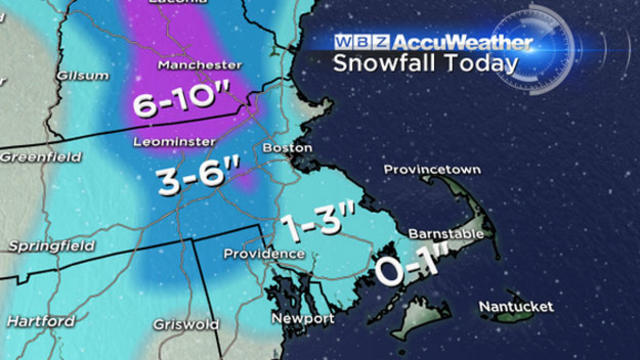
This should be our last significant snow accumulation for a while.

Another round of snow is moving in now. This won't be a big event but more of a nuisance for afternoon and evening commuters.
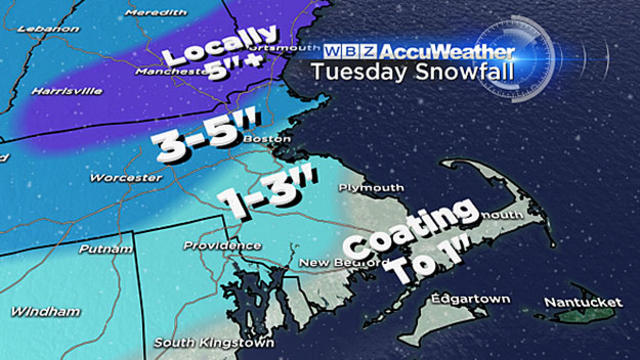
Another snow storm is coming, and while this one isn't very large, it will pack a quick little punch on Tuesday afternoon, hitting southern New England square in the face.

This will be a fast moving, intense burst of snow focused during Saturday night along our coastline, essentially, a 6-to-8 hour window where we will accumulate snow very rapidly.
As this storm wraps up, there is no resting around here...all eyes are on the next potential storm expected to impact us over the weekend. Here it is in the Midwest...not too bad...