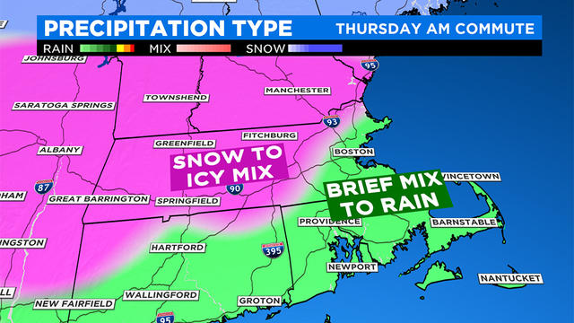
Snow, Rain, Sleet, Ice Mix Will Make Mess Of Thursday Morning Commute
This storm will be a long one, featuring several rounds of varying precipitation.
Watch CBS News
This storm will be a long one, featuring several rounds of varying precipitation.
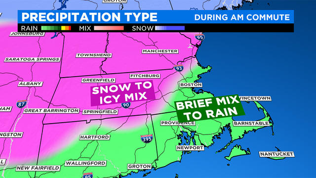
Any quick burst of snow is likely between 3 and 7 a.m. Thursday.
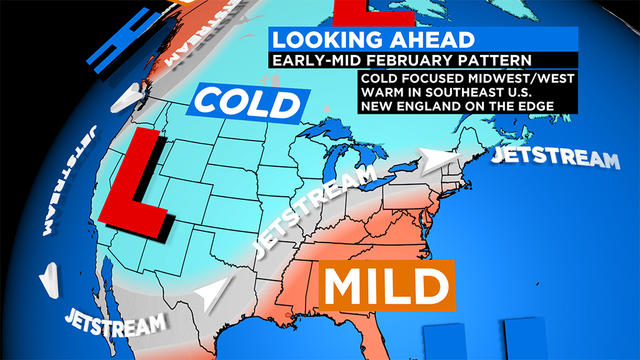
Winter in New England isn't done, but it's clearly on the ropes.
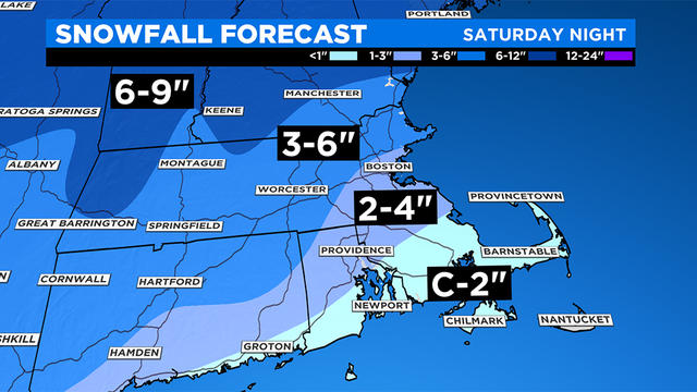
A plowable snowfall is on the way this weekend for most of southern New England.
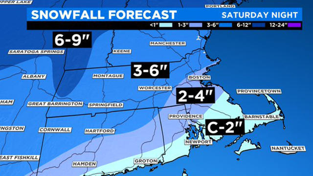
A Winter Storm Watch will go into effect Saturday afternoon in Worcester, Middlesex, and Essex counties through Sunday morning.
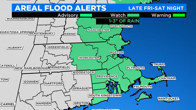
We have yet another anomalously strong and juiced up storm headed our way to start the weekend.
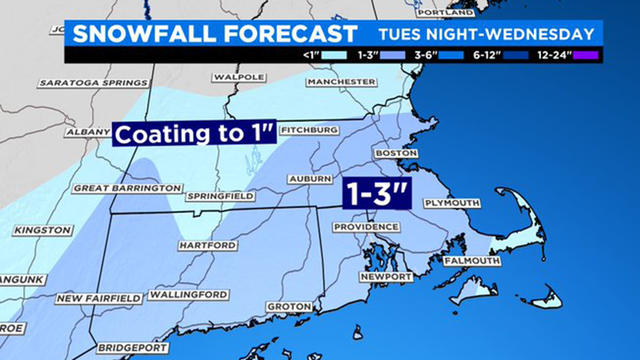
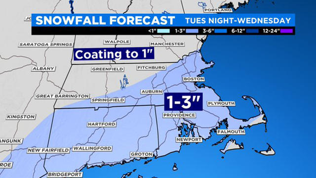
A few inches of snow are likely in Southern New England, impacting the Wednesday morning commute.
One week has made quite the difference. We've gone from days of snow to mild temperatures and rain.
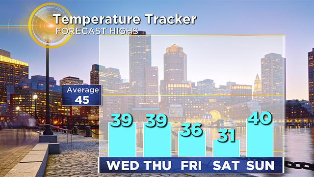
The snow isn't going anywhere any time soon! Temperatures the rest of this week will be well below average.
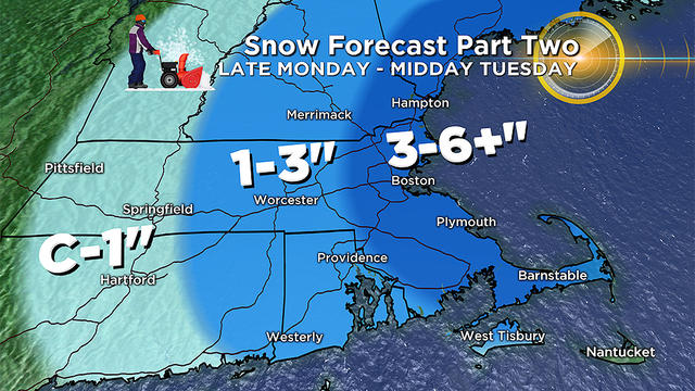
Part two of the storm should end around midday on Tuesday.
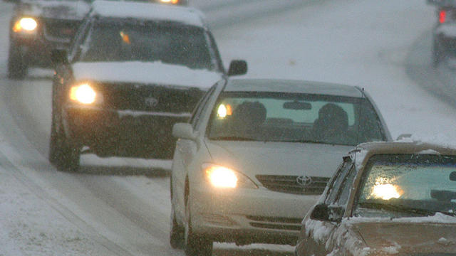
Expect snow, sleet, freezing rain and rain across southern New England during the day before the final wave of snow Monday night.
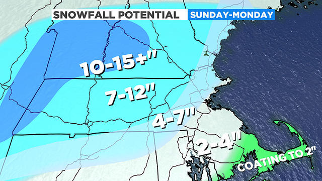
A very potent winter snow storm is set to arrive in southern New England Sunday afternoon.
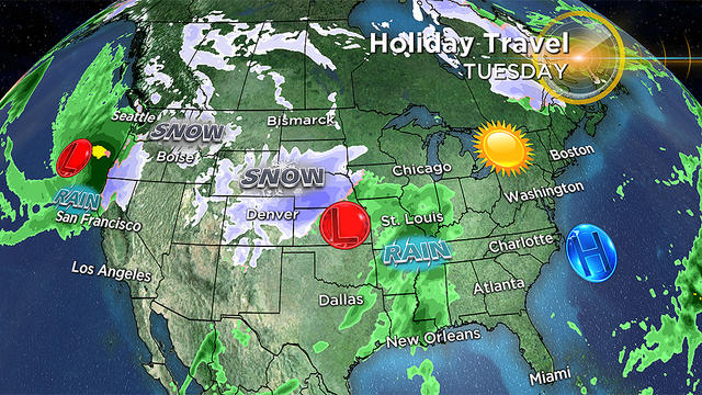
New England will largely be spared from any major weather headaches. But if your travels take you outside the Northeast, you need to beware.
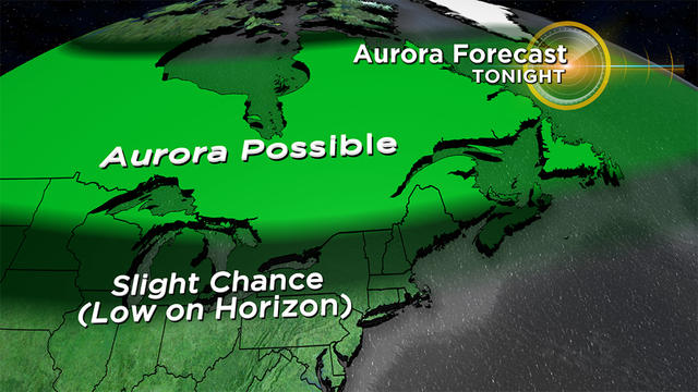
After a gloomy, damp several days, the skies will soon be clearing and just in time to give us a shot at seeing some fun astronomical happenings!
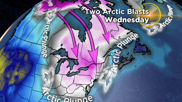
While earlier this week it appeared that an early season snow accumulation was possible in southern New England, it now seems that any significant snowfall will be confined to the mountains of Northern New England.
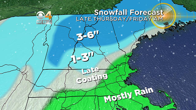
The track of the storm is key in determining rain versus snow.
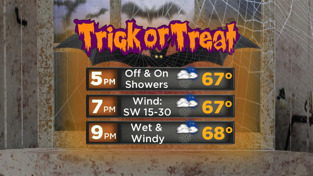
In this decade of Halloween storms, another howler is on the way for trick-or-treaters.
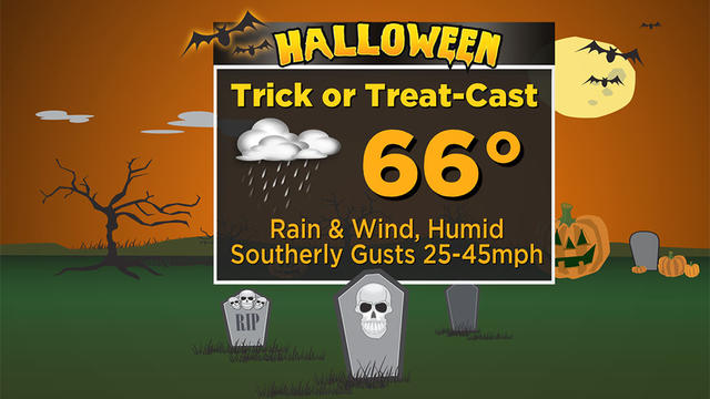
Some communities are postponing trick-or-treat due to a rainy and windy forecast for Halloween.
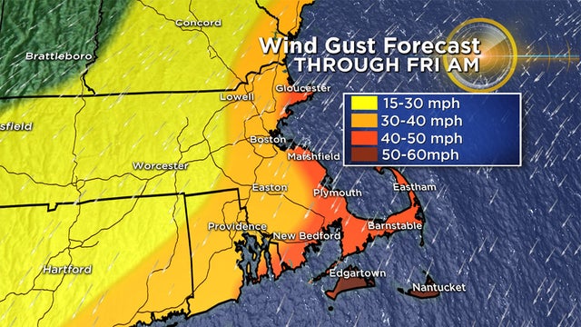
A wide range of weather conditions is expected throughout our area over the next 48 hours.
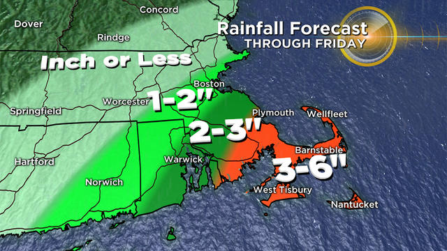
The brunt of the nor'easter will be somewhat long lasting.
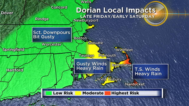
While it may seem like 150 miles is a long way away from our Coast, we will still receive a glancing blow late Friday night and early on Saturday from Dorian.
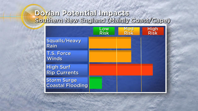
The Cape and Islands will get a taste of Hurricane Dorian's wrath on Saturday.
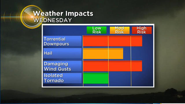
The main action and highest period of impact will be between 2 p.m. and 10 p.m.
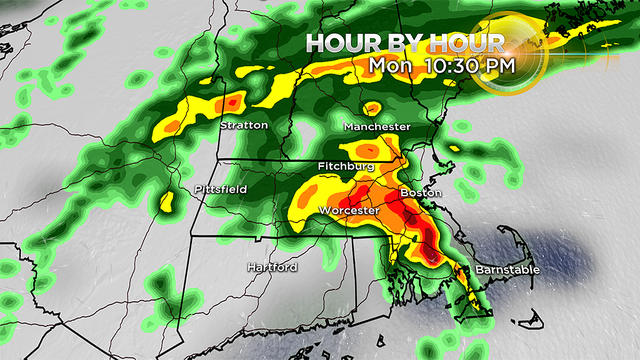
We are tracking multiple waves of heavy rain and possibly some severe weather Monday into Tuesday.
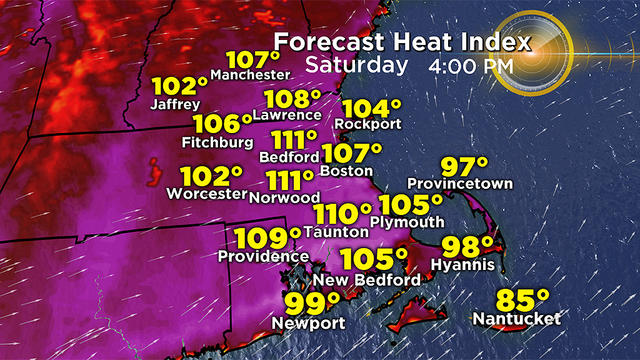
The heat is on. Temperatures on Friday rose above 90 in the afternoon, meaning the heatwave has officially begun.