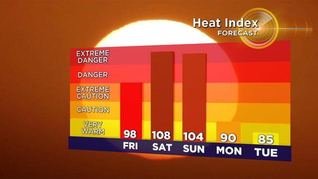
Weekend Scorcher: Heatwave Could Bring Record Temperatures To Boston Area
Ready to roast? It's gonna be a "scorchah" this weekend as the first heatwave of the season for many folks arrives on Friday.
Watch CBS News
Ready to roast? It's gonna be a "scorchah" this weekend as the first heatwave of the season for many folks arrives on Friday.
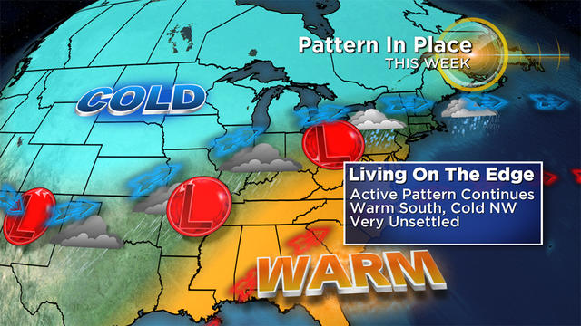
This year it seems we have taken the typical New England spring misery to a whole new level.
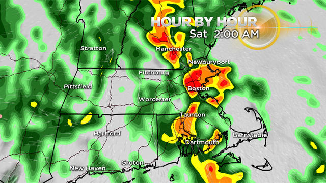
There will be periods of rain, downpours and embedded thunderstorms through the early morning hours of Saturday.
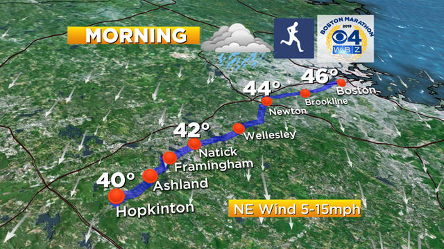
There are some reasons for optimism in the latest marathon forecast.
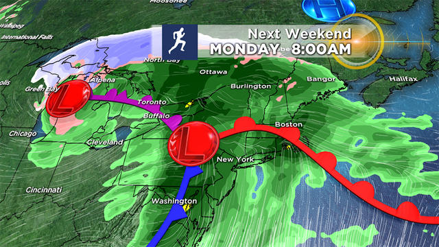
Odds are increasing that this year will be a very wet run in Boston.
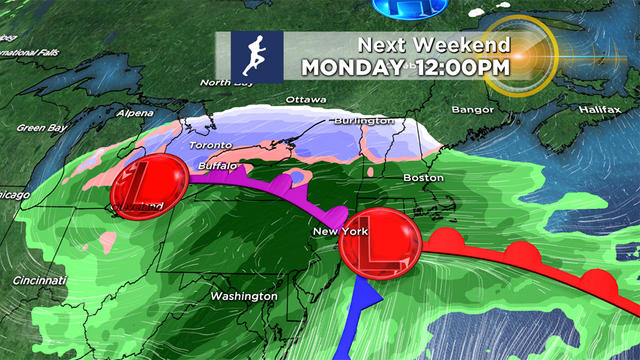
We could be in for a second straight wet, raw and cold Marathon Monday that may even include snow.
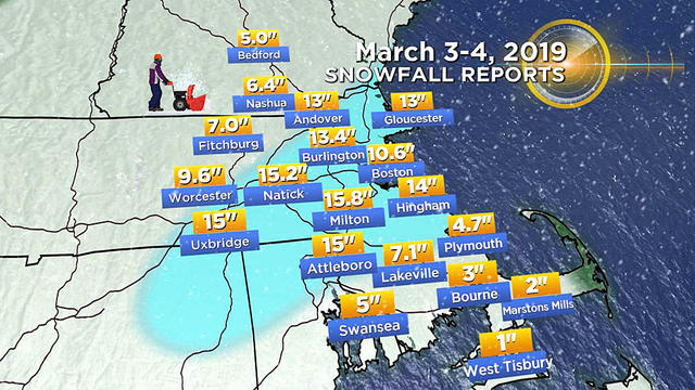
Suddenly March is becoming the new February.
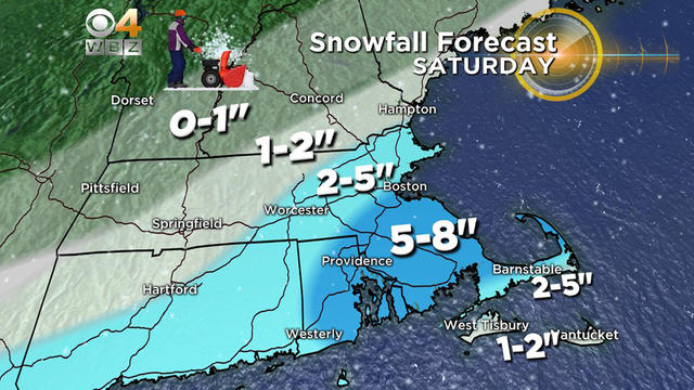
We're bracing for a one-two punch of winter this weekend.
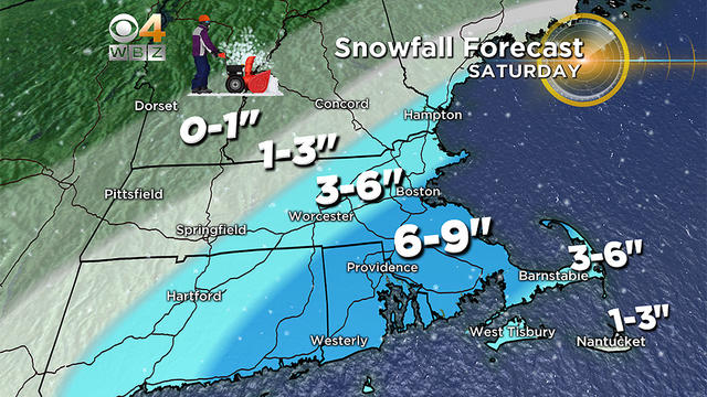
Get ready for two storms this weekend.
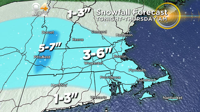
A widespread 2-to-4 inches for most of eastern Mass. with 4-to-6 inches in central and western Mass.

The next 7-10 days may end up being the most volatile period of the entire winter season.
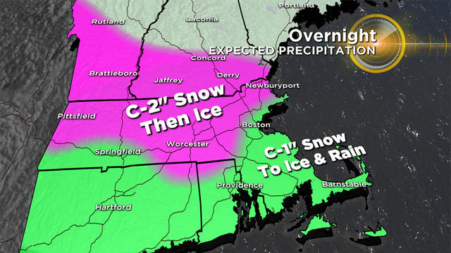
It will be a bit slippery in spots early Thursday morning, but by the afternoon, the ice and snow will be gobbled up by sunshine and 50 degree temperatures.
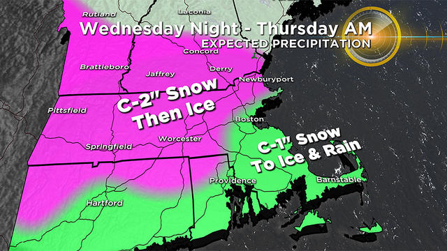
The initial band of snow will arrive between 7 p.m. and 10 p.m. from west to east.
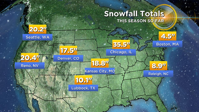
Any way you slice it, this year has been downright lame. Perhaps a dud of epic or record proportion.
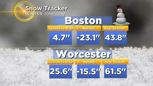
As expected, the snow came and went quickly with this storm, now it is onto the sleet, freezing rain and rain.
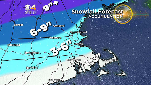
The biggest question is how much snow can we get on the front end before the change to ice and rain?
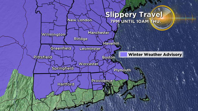
Freezing rain will make for some tricky travel late tonight and early on Thursday.
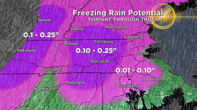
While we don't expect March and April to be anywhere near as brutal as last year, we do still anticipate some wintry weather in our near future. Look no further than Wednesday night.
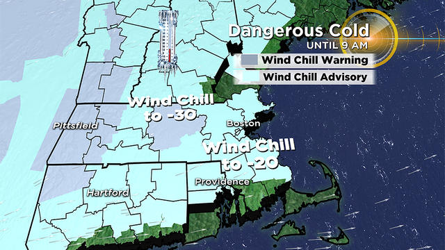
It is gonna get pretty darn cold here but we are only getting fringed by this Polar Vortex.
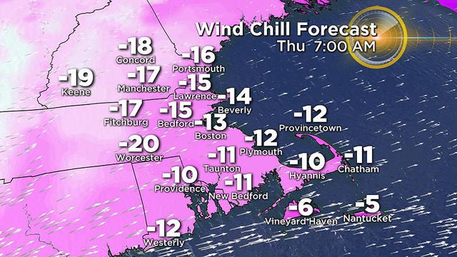
There will be difficult travelling Wednesday and then get ready for the bitter cold.
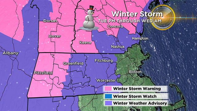
The dreaded and much hyped "Polar Vortex" is back. Rain and snow Tuesday night combined with the Arctic chill to follow makes for a busy week of weather ahead.
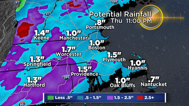
The heaviest rain falls from about 10 a.m. to 4 p.m. on Thursday.
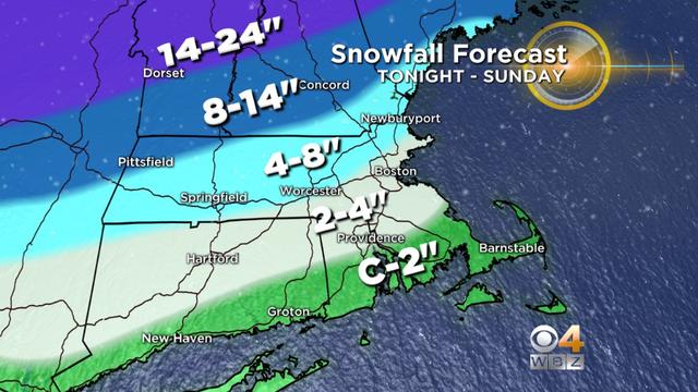
The snow threat is lowering as the ice and flooding rain threat is rising in this weekend's storm.
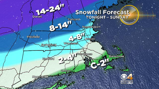
This storm may be remembered more for ice than snow.
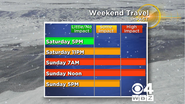
Real winter is about to arrive.