'Juiced Up' Storm Will Bring Heavy Rain, Localized Flooding
BOSTON (CBS) - It sure has been an active December in the weather department. From near record highs to blasts of cold, 3-day snowstorms and heavy rain...and the month is not even half over! If this is any indication of how our winter is going to go, hang on! We have yet another anomalously strong and juiced up storm headed our way to start the weekend.
TIMELINE:
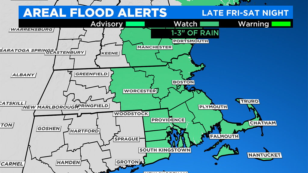
After Midnight, through Midday Saturday...The heaviest rain and meat of the storm occurs during this time frame. Icing concerns are just about over as temperatures slowly tick upwards overnight. Between 1-3" of rainfall is expected in this 12 hour period. This will undoubtedly cause areas of localized flooding, street and urban flooding and some small stream flooding. Strong, gusty ESE wind over the Cape and Islands, up to about 40-50 mph at times.
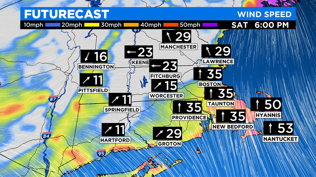
Midday Saturday through Saturday Evening...Rain becomes more scattered in nature, but still some downpours and perhaps even a few thunderstorms. Temperatures continue to creep up, into the 50s in eastern/southeastern MA and through the 40s well inland. Winds will be gusty out of the south-southwest over eastern and particularly southeastern MA. Gusts to 50mph possible.
Late night Saturday into Sunday...The rain ends late Saturday night and the entire region gets very windy by Sunday morning. Gusts out of the west 20-40mph, (isolated to 50mph) for a good portion of the day on Sunday. Skies will be partly sunny Sunday with temperatures in the 40s.
WHAT'S NEXT:
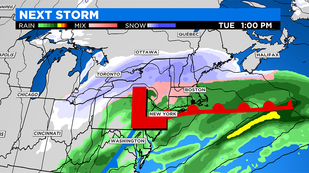
No rest for the weather weary...it looks like another storm is likely Monday night into Tuesday. This one could feature a messy mix of snow, ice and rain...more details to come!


