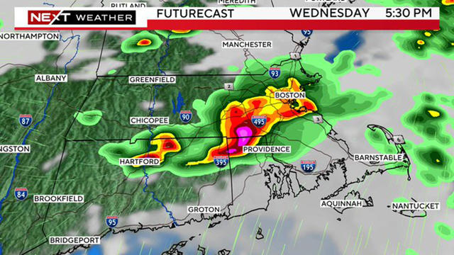
First severe thunderstorms of the season possible in Massachusetts
The WBZ Weather Team is issuing a NEXT Weather Alert for the risk of some thunderstorms on Wednesday in Massachusetts.
Watch CBS News
The WBZ Weather Team is issuing a NEXT Weather Alert for the risk of some thunderstorms on Wednesday in Massachusetts.
We have a great couple of days to start the week, but after that, the forecast for Massachusetts doesn't look good.
May is a month of significant weather gains in Massachusetts.

WBZ's Alyssa Andrews and Lexie O'Connor teamed up with "Keep Massachusetts Beautiful" to help volunteers at a beach pickup in Marlboro.

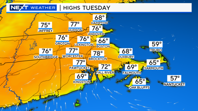
What could be more "April" than this in Boston. Freeze warnings and 80 degrees in the same 7-day forecast!
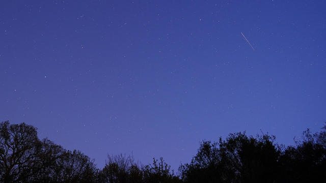
Keep an eye out for Lyrid meteor shower "leftovers," plus an International Space Station flyby over Massachusetts.
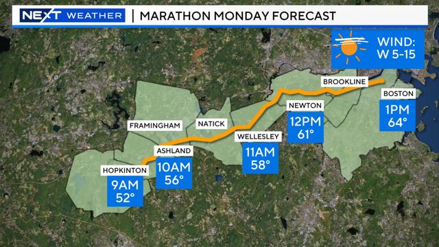
Monday is the 128th Boston Marathon and runners will have a mild, mostly clear day ahead of them.

A storm will bring heavy rain and gusty wind to Massachusetts Friday, with effects lingering into the weekend.

The heaviest rain looks to fall between Thursday night and during the day Friday.

The 2024 total solar eclipse is over. When will Massachusetts be in the path of totality for an eclipse?
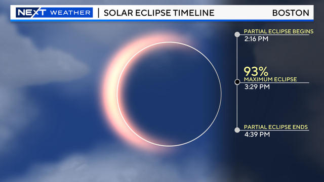
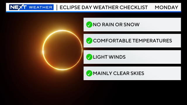
Massachusetts may not be in the path of totality, but the April 8, 2024 solar eclipse will be visible in the Boston area if the cloud forecast cooperates.
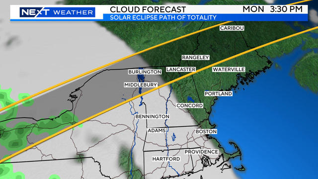
New England may end up being one of the few places in the path of totality in the United States with favorable viewing conditions!
For the last time for more than 50 years, this Monday, we will have the chance to see a total solar eclipse here in New England.
Massachusetts and New Hampshire are going to feel the lingering impacts of this storm for the next several days.
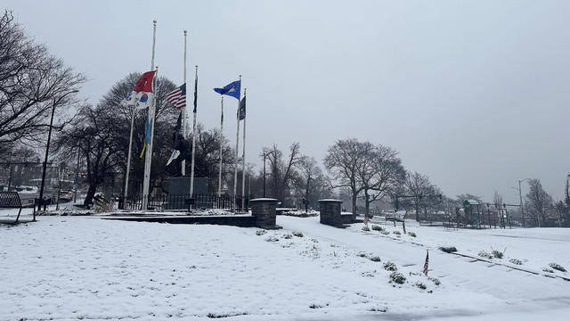
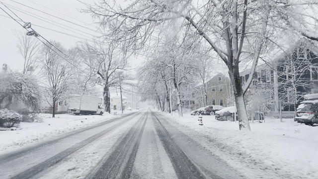
We've got an April storm mess across Massachusetts with a variety of snow, rain and wind hitting several cities and towns.