Snow, heavy rain and strong winds all hitting different parts of Massachusetts
BOSTON - We've got an April storm mess across Massachusetts with a variety of snow, rain and wind hitting several cities and towns.
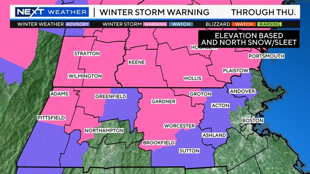
Winter Storm Warning
The National Weather Service has issued a winter storm warning for northern Worcester County and extreme northwestern Middlesex County. A winter weather advisory has been issued in parts of western Essex and Middlesex counties as well as southern Worcester County.
Storm timeline
Colder air came in early Thursday and changed the sleet over to snow north and west of Route 495 as far south as the Massachusetts Turnpike and the Worcester/Boston area.
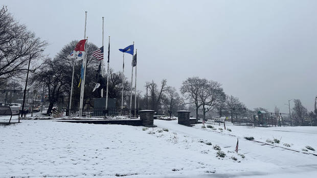
Many folks across northern Mass. and southern New Hampshire woke up to a fresh coating to a few inches of wet snow and school cancellations and delays.
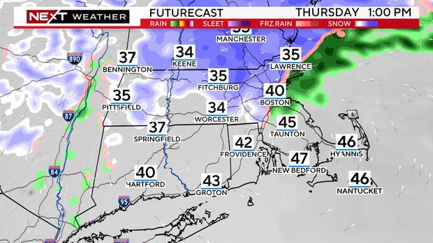
During the day on Thursday, there will be a dry slot developing across southeastern Massachusetts. Most of the precipitation will be located north of the Pike and in the form of snow.
We don't expect a lot of additional accumulation during the day on Thursday, perhaps just underneath some of the heavier bursts.
The snow will taper in most areas during the afternoon. By evening, we will be left with just some lighter flurries over northern Essex County and southern New Hampshire.
How much snow in Massachusetts and New Hampshire?
There have been stark differences in snow accumulation over very short distances. Even within one town that has variable elevation (hills and valleys) there could be several inches of variability in accumulation.
We do not expect any accumulation in the Boston area or inside the 128 belt. (Although there may be some wet snow in the air from time to time)
Pretty much all rain over southeastern Massachusetts and all areas south of the Pike as well.
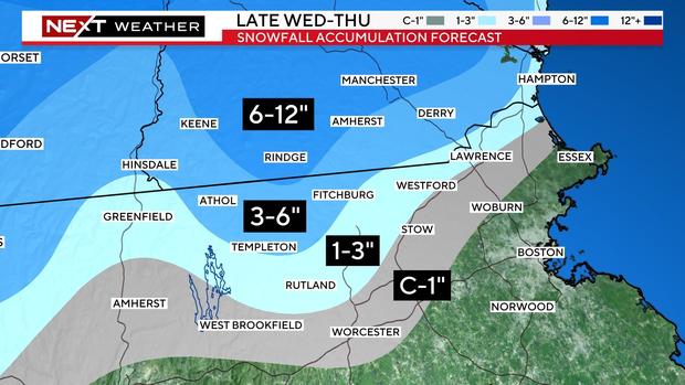
North and west of 128, through about 495, there should be some sticking to surfaces, perhaps enough for scattered coating up to an inch.
North and west of 495, including northern Middlesex and Essex counties, there may be as much as 1-3", again more so on grass than roads.
In the higher elevated areas of northern Worcester County and far northwestern Middlesex County, we are forecasting 3-6" of pasty, wet snow.
Some of the higher peaks extending into southwest New Hampshire could receive as much as 6-12".
Given the heaviness of the snow, any accumulation on tree limbs will be dangerous. Combine this with the strong wind forecast, and there have been numerous power outages in the higher snow areas.
High Wind Warning
We expect frequent easterly gusts between 30-50 mph across the entire region. Along the immediate coastline, the National Weather Service has issued a high wind warning for the potential of gusts as high as 60 mph.
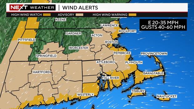
As the storm's center crosses over southern Mass. during the day Thursday, the winds will decrease significantly over southeastern Mass. but ramp up one final time over northeast MA and the New Hampshire and Maine coastlines.
Coastal Flooding
We are particularly concerned about the area from Cape Ann to Salisbury to Hampton, NH, locations that have been battered time and time again the last several months. In these areas, there may be flooding along with another round of beach erosion.
The major impacts from the storm will wind down Thursday evening but the storm itself will be very slow to pull away from the region.
Lots of clouds will remain on Friday, Saturday and even into early Sunday. There will also be some pop-up rain and snow showers during this time.


