Mild conditions through the weekend in Chicago
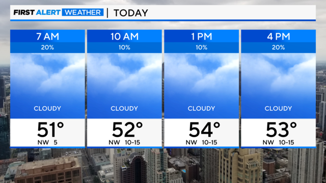
Shower chances decrease throughout the morning, giving way to a gloomy afternoon.
Watch CBS News

Shower chances decrease throughout the morning, giving way to a gloomy afternoon.
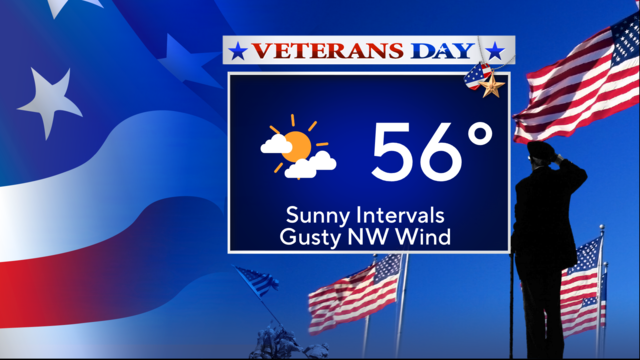
A cold front will cross the Chicago area on Veterans Day ushering in a gusty, northwest wind.
As the complex arrives today, our atmosphere is too dry to support rain making it to the ground.
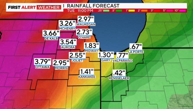
Heavy downpours are expected Monday night into Election Day.
Winds around the high-pressure ridge keep pulling warm air into the Chicago area.
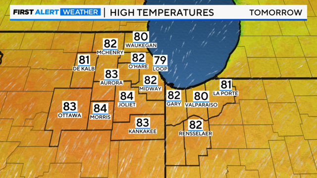
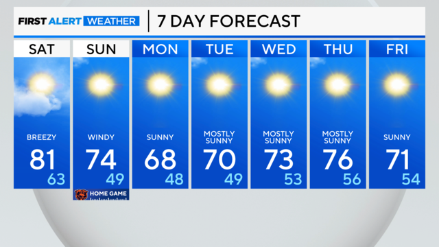
Saturday's high temperatures are expected to reach the low 70s, but the real story will be on Sunday, when highs actually flirt with 80 degrees.
Periods of rain are streaming into Chicago area off Lake Michigan as cold air sucks heat and moisture from the relatively warm water.
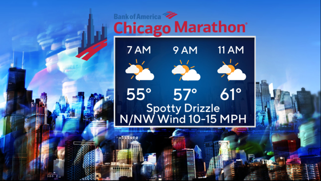
At the most, spotty drizzle may greet marathon runners at the start line.
The first of two cold fronts has already crossed our area, and you can feel the cool change.
Clouds move away, and a gusty west wind develops.
The first will cross our area overnight with a slim chance of a stray shower along it between midnight and 4 a.m.
Spotty stuff to the north will lead to some nice clearing later in the day.
Winds finally relax tonight as the remnants of Helene weaken and drift toward the eastern seaboard.
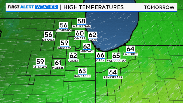
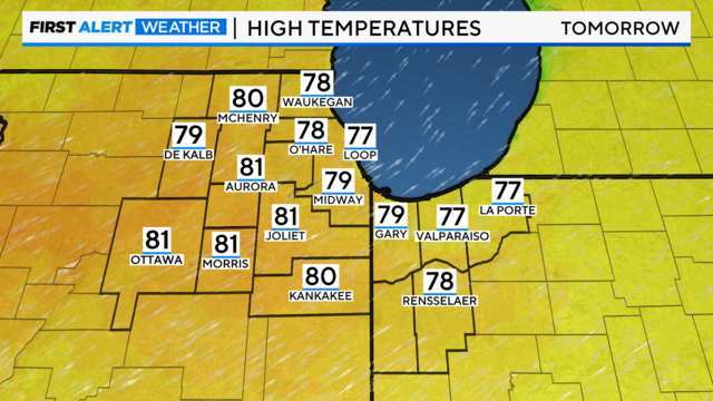
Sun returns on Monday with highs in the upper 70s.
The remnants of Helene are sitting to the south of the Chicago area, but we are close enough to keep the cloud shield and gusty winds.