Storms to arrive in Chicago area overnight, with flooding possible
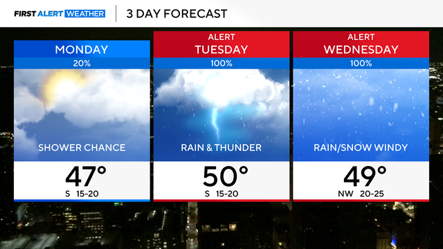
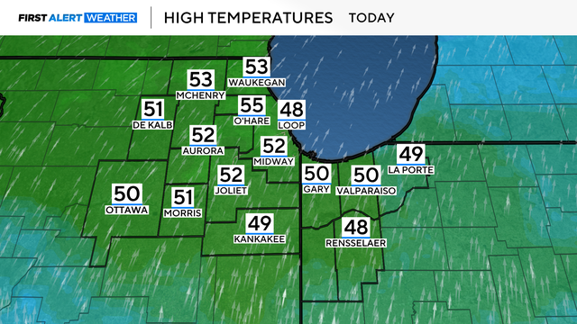
Highs will be near 50 degrees on Monday with chances for a stray shower and mostly sunny skies.
Watch CBS News

Highs will be near 50 degrees on Monday with chances for a stray shower and mostly sunny skies.
Rainfall totals could add up to more than 2 inches over the course of those 48 hours.
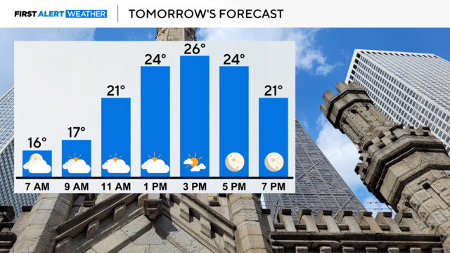
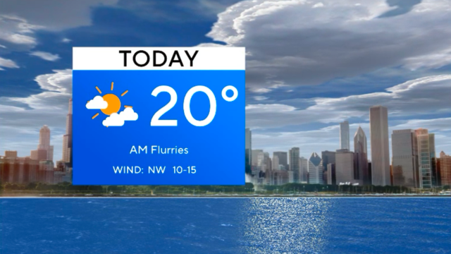
Any early morning flurries will move out of our area with increasing sunshine this afternoon.
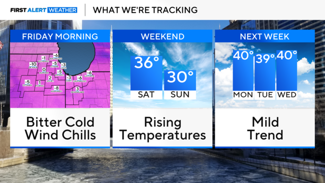
A Wind Advisory for Friday with gusts to 45 mph is in effect.

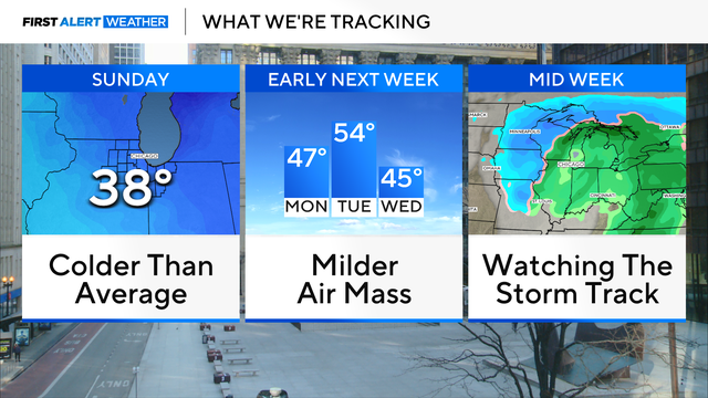
It will be slightly cooler on Thursday, but temperatures remain above the norm in the middle 40s.
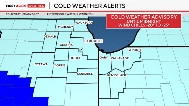
More snow is expected in the Chicago area ahead of dangerous cold.
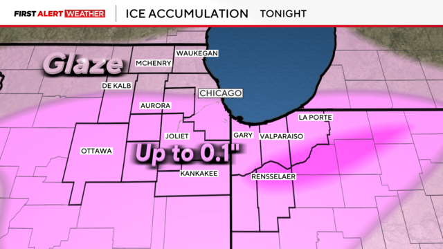
Widespread freezing rain and drizzle are causing untreated roads, sidewalks, and driveways to become icy and slick.
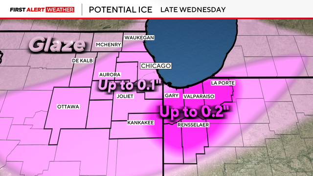
Light snow showers begin Wednesday morning, turning to a freezing rain threat by evening and into the night.
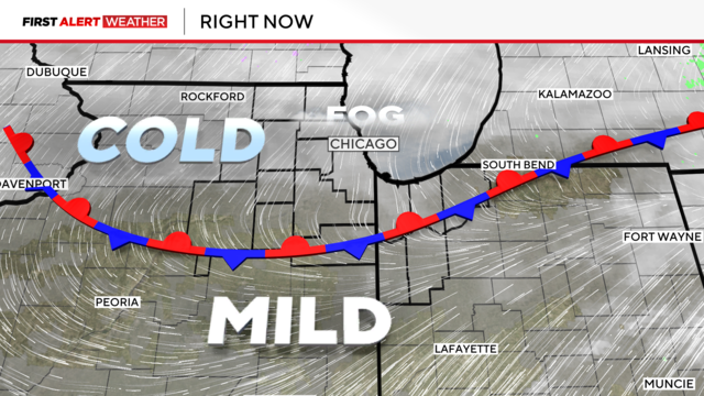
This front will inch southward this evening, and the fog will dissipate.
Highs will be near 55 degrees. The record of 55 degrees was set in 1988.
A few flurries are possible Saturday night, but the chance is minor.
A pair of cold fronts will bring chances for flurries tonight into Saturday morning and again Saturday evening and night.
Temps will continue to fall as the chilly northwest wind pulls in a colder air mass.
Some light morning snow is possible as the overnight snow system exits the area.
Another arctic cold day with single digits is ahead for the Chicago area.