Chicago First Alert Weather: Clear, calm conditions through Friday
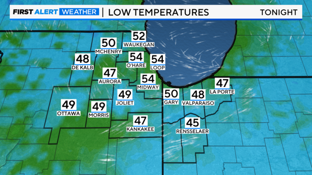
CBS 2 expects it to be cool Thursday night with lows in the mid-40s to mid-50s.
Watch CBS News

CBS 2 expects it to be cool Thursday night with lows in the mid-40s to mid-50s.
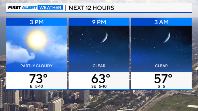
Cool temperatures are expected Wednesday night, with lakeside clouds possible Thursday morning, becoming mostly sunny by the afternoon.
According to CBS 2 Meteorologist Mary Kay Kleist, the next system moves our way overnight, increasing shower chances, especially after midnight.
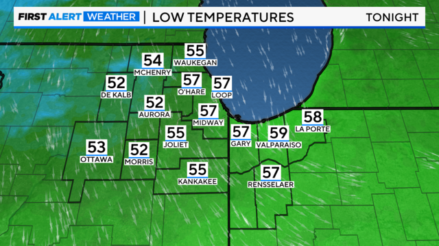
According to CBS 2 Meteorologist Mary Kay Kleist, some lakeside drizzle is possible Tuesday with cooler than average temperatures.
According to CBS 2 Meteorologist Mary Kay Kleist, dangerous waves up to seven feet high are expected.
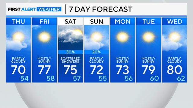
Another cold front will arrive by evening, bringing a brief shower chance.
A cooler trend will come behind the front to close the week and temperatures stay below average for a while.
There will be a better chance for storm activity on Wednesday as a cold front passes.
A second cool front moves across our area tonight bringing a slight shower/isolated storm chance.
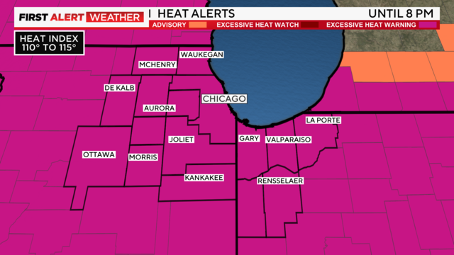
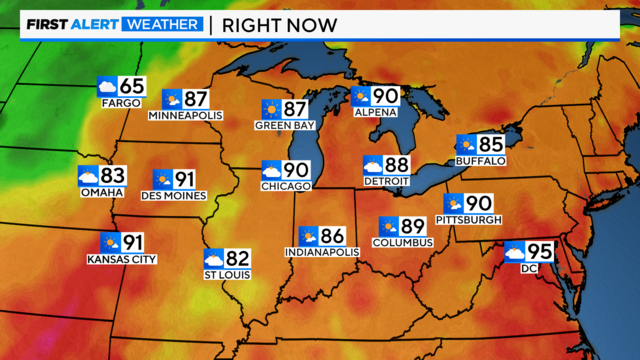
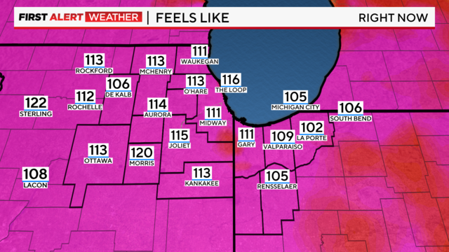
If you think it's never felt this hot in Chicago before, you're right.
A cold front will bring cool changes starting Friday.
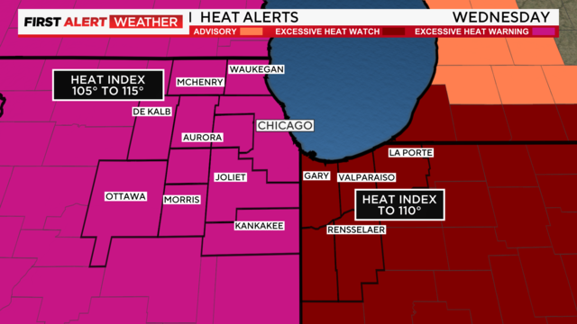
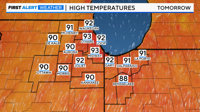
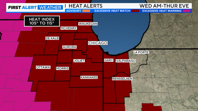
According to CBS 2 Meteorologist Mary Kay Kleist, Wednesday looks to be the hottest day, with heat index values up to 115 degrees.
The hottest day looks to be Wednesday as temperatures reach the upper 90s.
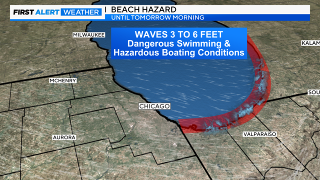
High waves and dangerous rip currents are likely.
According to CBS 2 Meteorologist Mary Kay Kleist, it will be breezy and wet along the boundary as it passes through our region.