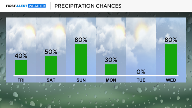
Rain chances through the weekend in Chicago
Rain showers pass through the morning and early afternoon.
Watch CBS News

Rain showers pass through the morning and early afternoon.
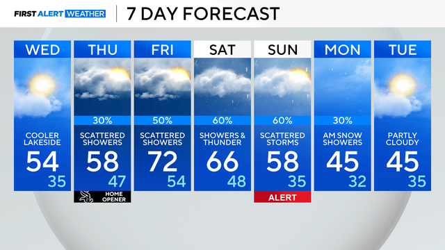
Showers are expected to return on Thursday, and this weekend could see the potential for strong thunderstorms.
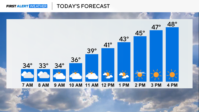
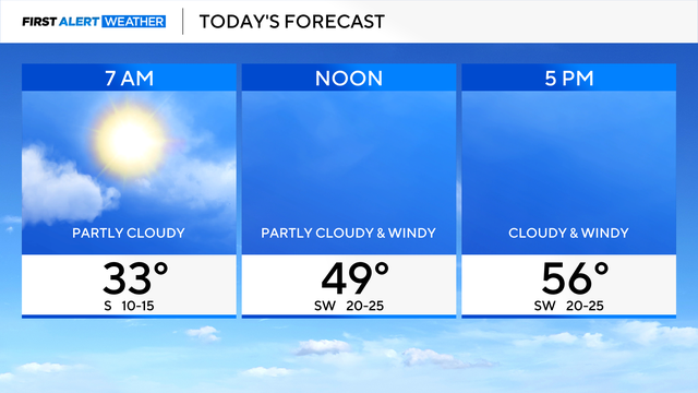
Cloudy skies eventually clear to sunshine, and highs reach the upper 40s. Gusty winds subside Monday night, and temperatures fall near freezing.
A calm and mild finish to the week.
A line of severe storms triggered multiple tornado warnings in the Chicago area Wednesday afternoon.
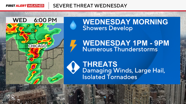
Strong to possibly severe storms move into the area on Wednesday evening.
Tuesday will be mostly cloudy, breezy and warmer.
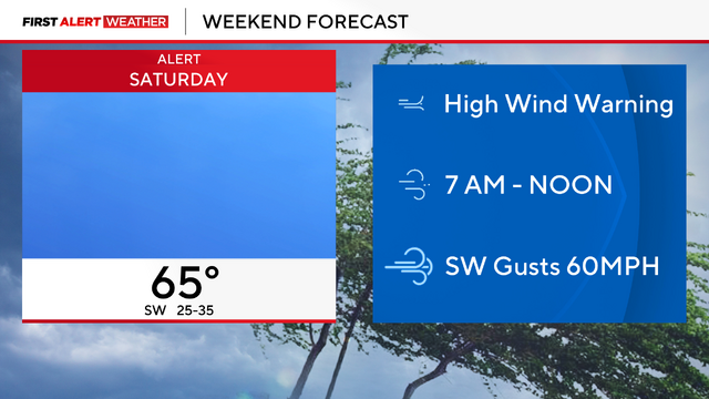
A high wind warning is in effect from 7 a.m. to noon on Saturday.
A sunny and milder day is ahead on Thursday with highs in the 60s.
From 8 p.m. Friday until 3 a.m. Saturday, expect the strongest to possibly severe storms to roll through.
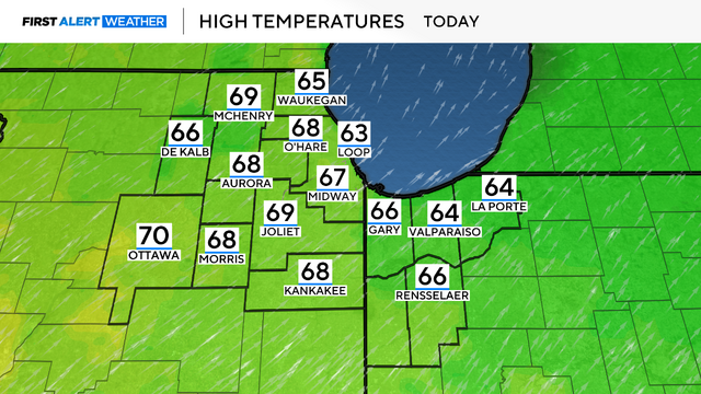
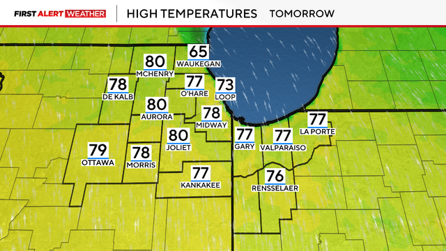
This week's highs will be in the 60s, and some areas may reach the 70s for the first time this year.

A warming trend begins this weekend.
Wet snow is likely Friday. With temperatures hovering in the middle 30s, rain showers may mix into the picture at times.

A Wind Advisory was in effect until midnight Wednesday night as winds have been gusting 40 to 50 mph.
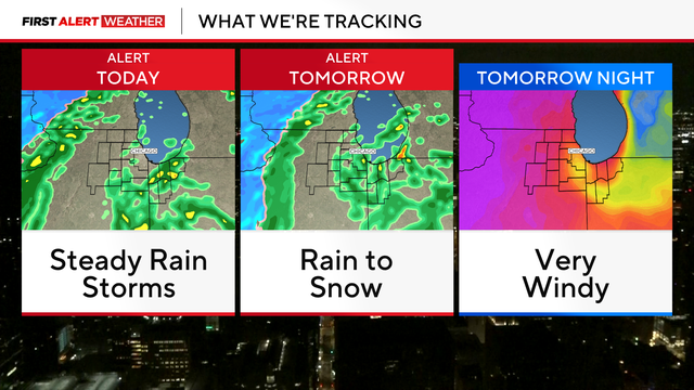
A large storm system will bring wind, rain, thunder, and snow to the Chicago area through Wednesday.