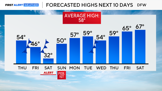
North Texas returns to the 50s on Thursday before temperatures drop again
A First Alert Weather Day is in effect for Saturday due to extreme cold, with wind chills ranging from -5 to 15.
Watch CBS News

A First Alert Weather Day is in effect for Saturday due to extreme cold, with wind chills ranging from -5 to 15.
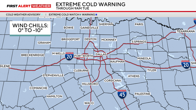
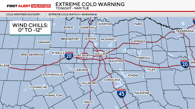
An extreme cold warning is in effect through Tuesday morning due to wind chills from 0 to -10 degrees covering the region.
Saturday began with rain, sleet and snow in parts of North Texas, with temperatures falling into the low 30s by 3 a.m.
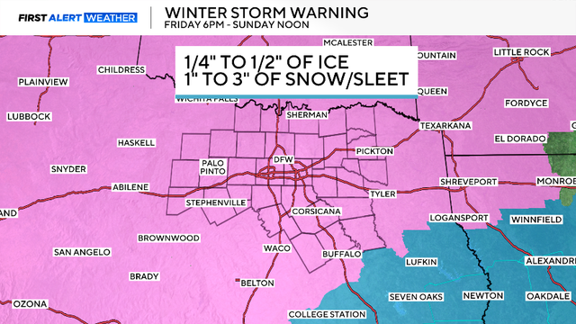
The National Weather Service has issued a winter storm warning for the entire region.
You'll need to grab a jacket heading out the door; temperatures will rebound in the afternoon, but most of the day will be chilly.

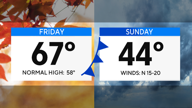
A cold front is set to arrive in North Texas on Friday, with highs back in the 40s on Saturday.

Temperatures on Friday will be 10 degrees cooler than Thursday, and drop even more by Saturday.

If you are wondering about New Year's Eve, it's not looking super cold, just very seasonal. It is also looking dry.

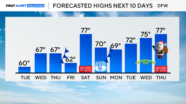
Christmas Day will likely be the second-warmest Christmas on record, with highs in the lower 80s, and a new record is likely for Friday.

A ridge of high pressure is dominating in the upper levels of the atmosphere, resulting in above-average highs.

Maybe grab a light jacket as you head out the door Monday morning, but you won't need it by the afternoon.
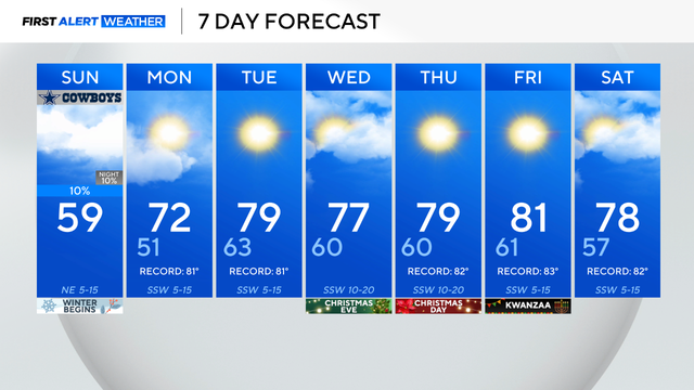
Sunday is the shortest day and longest night of the year.
North Texas temperatures Tuesday morning are above freezing with the help of cloud cover and southerly winds.

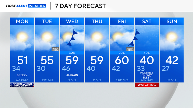
Coats, gloves and hats are needed if you head out to support your family or friends in the BMW Dallas Marathon on Sunday morning.
For the third day in a row, highs reached into the mid-60s Thursday, great winter weather. Friday should be a few degrees warmer.