
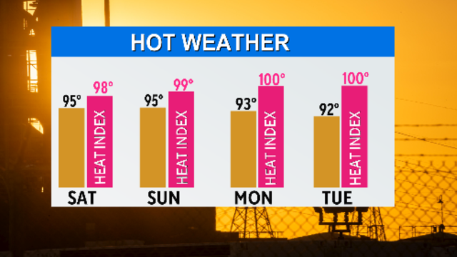
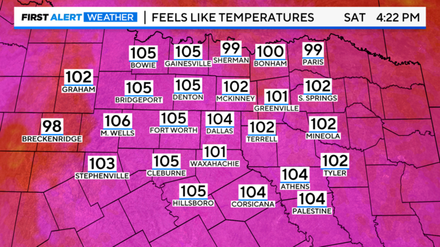
Excessive Heat Warning for North Texas extended through Saturday
The next 62 days are expected to be the hottest and driest days of the year as North Texas enters the "heat and drought" season.
Watch CBS News

The next 62 days are expected to be the hottest and driest days of the year as North Texas enters the "heat and drought" season.

There are rain chances over the next couple of days. Small chances.

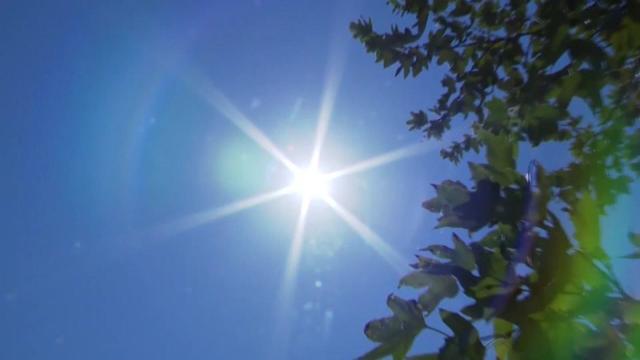
Four days into summer and our first heat wave of the season is upon us.

Alberto is packing winds around 40 mph. Tropical force winds extended out over 400 miles from the storm.
As a tropical system comes onshore in Mexico early Thursday morning, rain chances here peak Wednesday evening.

The best chance for rain will be Wednesday, on Juneteenth.
Deep tropical moisture is pouring into North Texas over the next 48 hours.

A storm system forming in the Bay of Campeche will pump tropical moisture into Texas.
Rain chances will return next week thanks to a tropical system developing in the Gulf of Mexico.

The best chance of rain and storms arrives on Tuesday.
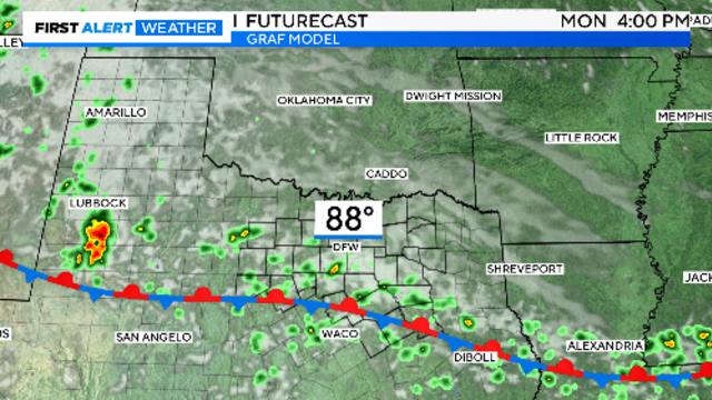
The severe weather threat is currently looking low for the Dallas-Fort Worth area.

More unsettled weather is expected across the week ahead.
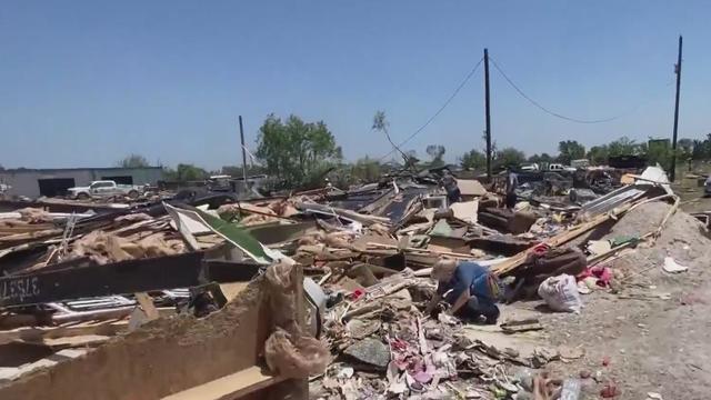
As of Monday, NWS Survey teams say four tornadoes hit North Texas Saturday night.
A tornado watch has been issued until 9 p.m. for counties west of the Dallas-Fort Worth Metroplex.

Large hail and damaging winds are the main threats with these storms. Later in the afternoon the dry line should fire up a line of strong storms.