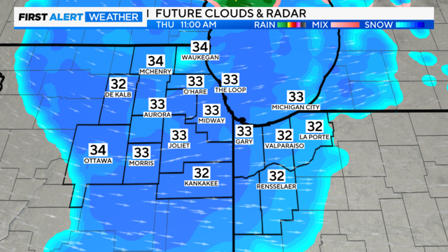
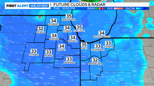
Scattered snow showers Wednesday night into Thursday in Chicago
A cooler and windy day is ahead in Chicago with the first snow of the season approaching.
Watch CBS News

A cooler and windy day is ahead in Chicago with the first snow of the season approaching.
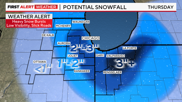
A strong burst of snow with heavy rates around 1 inch per hour is forecast beginning at 8 a.m.
Temperatures hover in the 40s all day Wednesday with gusty winds, light rain showers early, then some clearing midday.
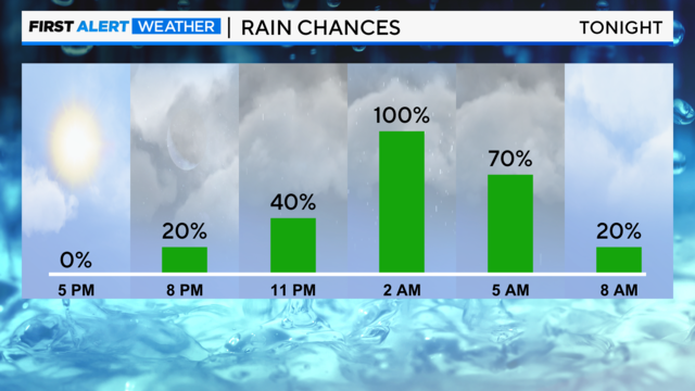
The second round of rain arriving overnight tonight.
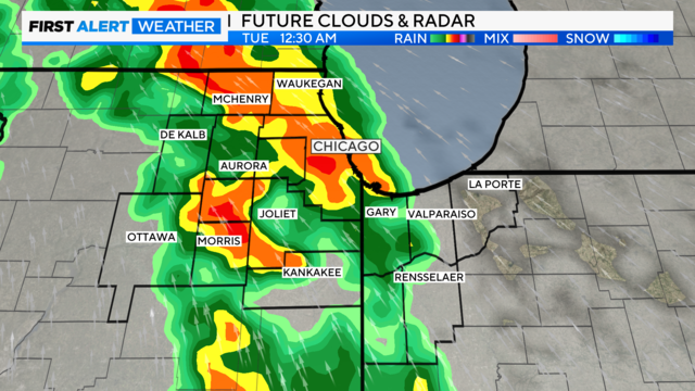
Next week, a round of soaking rain returns late Monday, then attention turns toward a cold snap beginning Wednesday.
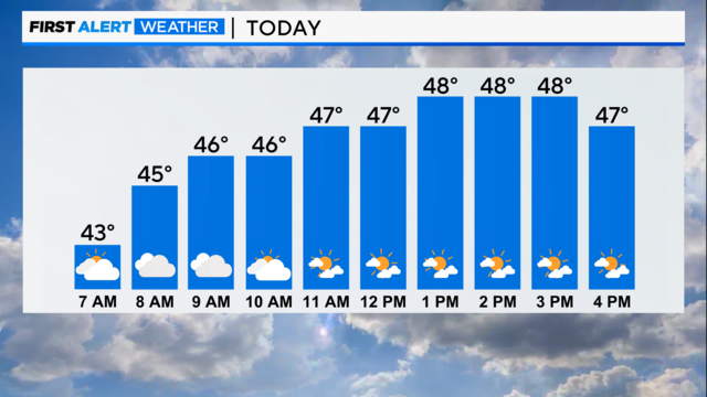
It's a brisk morning with chilly northwest winds.
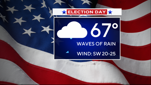
Grab your umbrella before heading to the polls on Election Day.
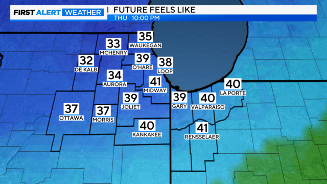
Wind chill temperatures fall into the 30s for late-evening trick-or-treat plans.
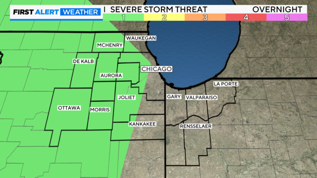
A Weather Alert goes into effect overnight and lasts through midday Thursday for widespread, inconvenient rain.
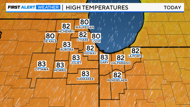
The forecast high today is 82, with the current high-temperature record being 78 degrees, set back in 1999.
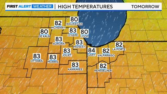
Tuesday night is expected to be the warmest night on record so late in the year.
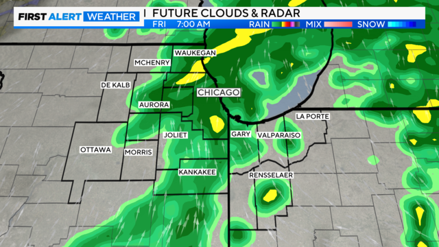
Some showers will linger into the Friday morning commute, so plan a little extra time on the roadways.
Expect a pleasant autumn day Thursday as we track our next storm system approaching from the Pacific Northwest.
A mix of clouds and sunshine is expected with highs in the low 70s.
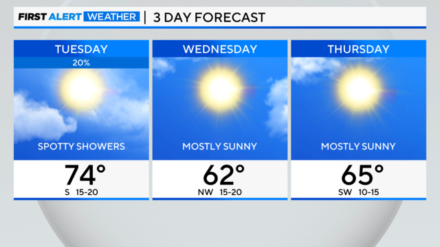
Friday's high will be near 70 degrees with sunny skies.