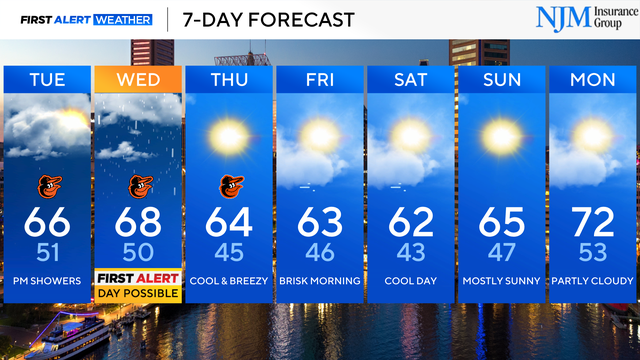
There are multiple chances of rain across Maryland this week
Wednesday appears to be the wettest day; a possible First Alert Weather Day.
Watch CBS News

Wednesday appears to be the wettest day; a possible First Alert Weather Day.
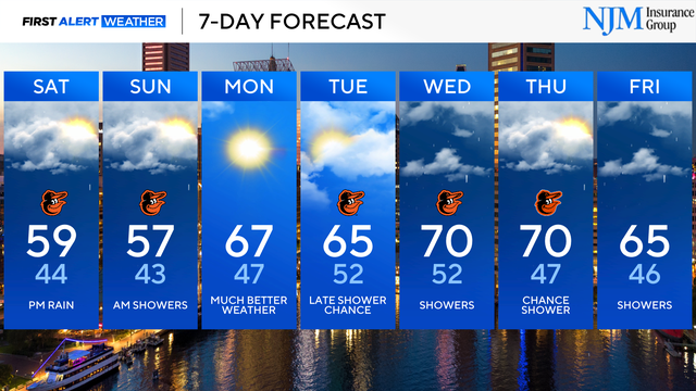
Much needed rain is on the way, but it won't break the drought.
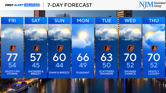
Saturday features the wettest weather.
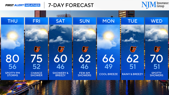
The chance of rain will be greatest on Saturday.
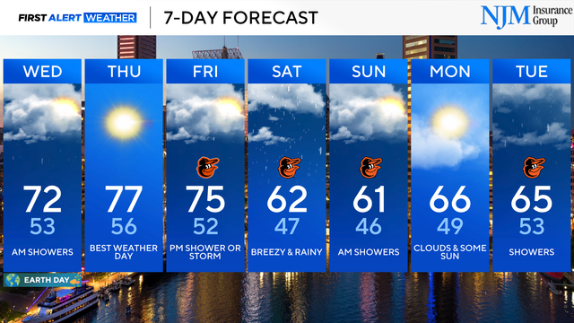
Additional chances of rain are in the forecast through the weekend.
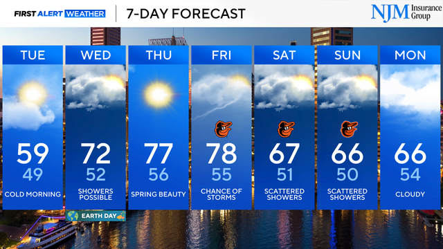
A freeze warning is in effect 2 a.m. until 10 a.m. Tuesday for most of Maryland for frost and freeze conditions.
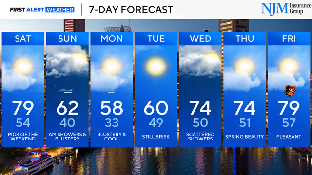
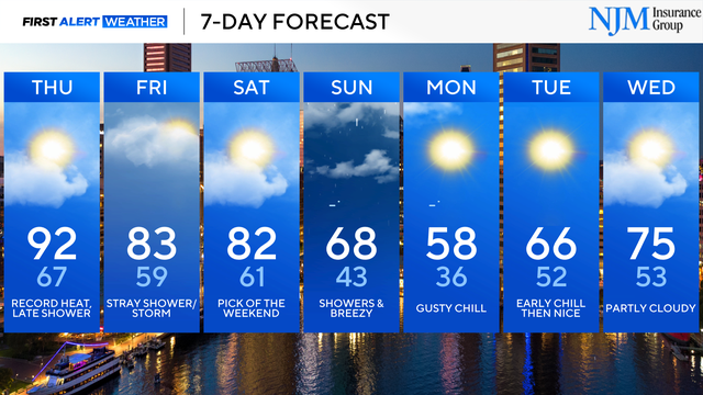
Saturday is the pick day of the weekend.
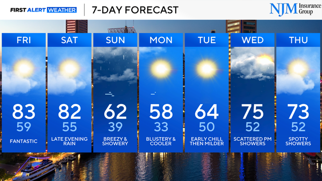
Temperatures trend a bit cooler as the weekend begins, then much cooler heading into next week.
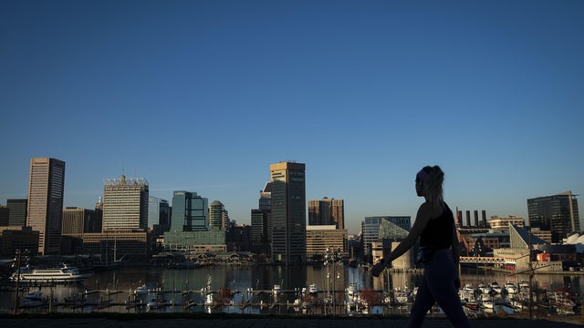
The Baltimore region broke its record high temperature again on Thursday as hot spring weather continued.
A record high temperature was set in Baltimore on Wednesday afternoon.
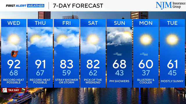
The weather will feel more like summer than spring through Thursday with some record highs possible.
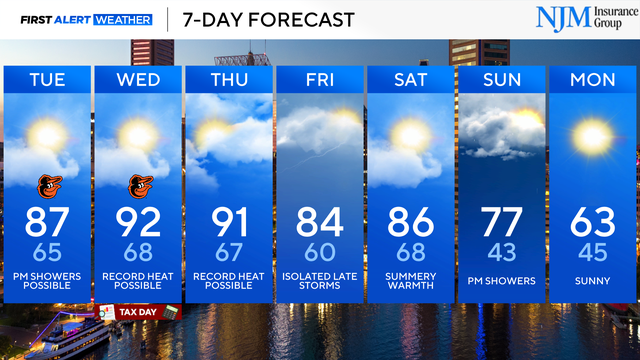
Record high temperatures are possible Wednesday and Thursday.
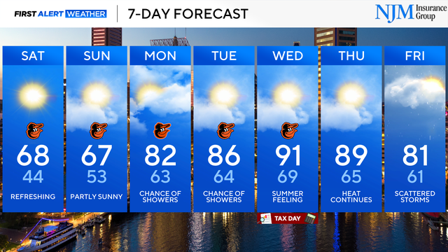
Near-record high temperatures are in the extended forecast.
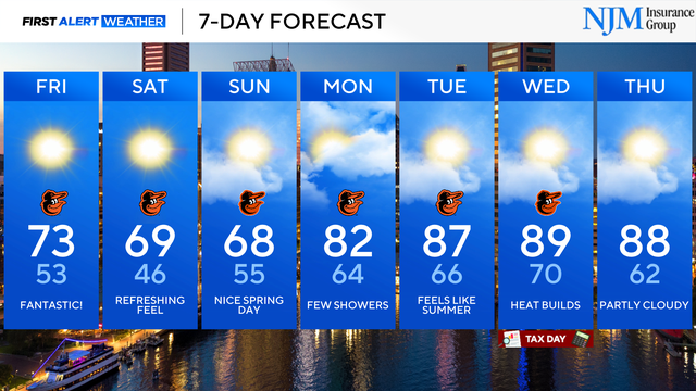
Temperatures will warm to near-record levels next week.
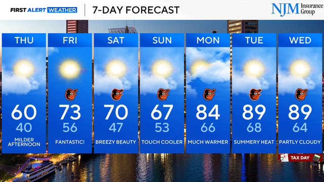
A warming trend begins on Thursday afternoon.