In The Calm
Calm weather is settling into New England. I think that most of us will be happy to hear this after 'Sandy' and last week's Nor'easter.
Watch CBS News
Calm weather is settling into New England. I think that most of us will be happy to hear this after 'Sandy' and last week's Nor'easter.
Get ready for temperatures to tumble! It's going to be a windy and rainy morning as a cold front sweeps across New England. In its wake, there will be a change of airmasses. The newer airmass will be considered Continental Polar, so cooler and drier.
We continue to celebrate and observe Veterans Day on this Monday. If you happen to have the day off, it's going to be lovely! Besides some patchy morning fog, skies will be mostly sunny and we are tapping into very warm temperatures...65-70F!
Shhhh! The dry stretch begins today. The weather is taking a turn in the right direction if you are wishing for sunshine and warmer temperatures.

With each and every snow event there is almost certain to be an area or areas where Mother Nature goes rogue and fouls up our nice and neat snowfall forecast map.
Thankfully, this Nor'easter is slowly exiting our region. However, secondary roadways are slushy and slick this morning, while main roads and highways are just wet this morning. Regardless, it's a morning that will be a 'slow-go'.

This will be more of a typical New England early winter-type storm - snow to the north and west and strong northeast winds at the coastline.
Outside of 495, there will be heavy, wet snow that may accumulate 1-to-3 inches.

If this trend continues and this nor'easter tracks well offshore this would be a good news-bad news situation.

The Nor'Easter will reach Cape Cod and the Islands around midday on Wednesday in the form of rain.
The Nor'easter will reach Cape Cod and the Islands around midday on Wednesday in the form of rain.

The peak of the storm will be overnight Wednesday into Thursday morning.
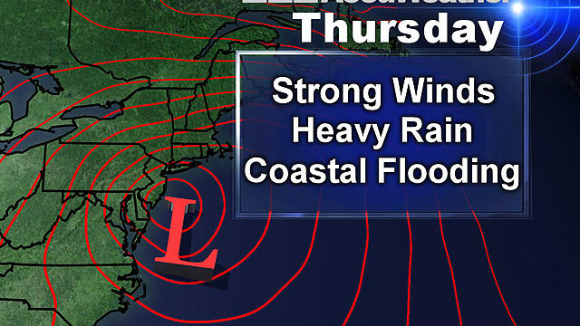
The latest thoughts are that the rainfall will tally up to 1-2 inches (isolated amounts of 3 inches) from Wednesday evening to Thursday night.
It's a tranquil start to your work and school week. Today will be partly sunny with a raindrop or two possible for the Cape and Nantucket. It's going to be chilly with highs in the middle 40s.

Another storm will be making a run at New England Wednesday, according to WBZ-TV meteorologist Joe Joyce.

There is likely to be some sort of storm off our coastline by the middle of next week. How close it comes and what its track and strength will be remains to be seen.
Today will be seasonable, but this weekend, the air will have a slight 'bite' to it.
Happy November! There will be a blanket of clouds around today, but there will also be some sunny breaks.
There will be showers around through this afternoon, but we should be dry for trick-or-treat this evening.
The worst is all said and done. We had thousands of reports of power outages, wind damage, and some coastal flooding.
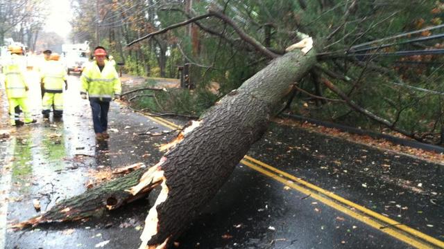
Here are the latest power outages in Massachusetts and New Hampshire from Hurricane Sandy.

The worst of Sandy has passed. Here is what we saw and what we could have seen.
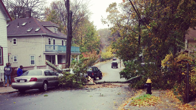
Sandy is hitting southern New England with Hurricane and Tropical Storm force wind gusts.

A severe high tide could rival that of Hurricane Bob back in 1991, and could be the most serious and severe blow from Hurricane Sandy when all is said and done.
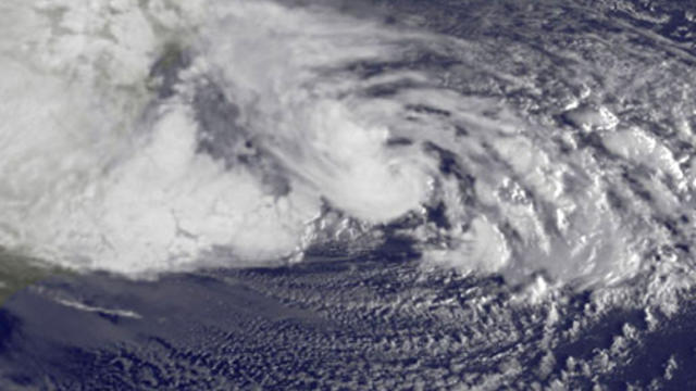
We are now approaching the peak of what Sandy has to offer for New England.