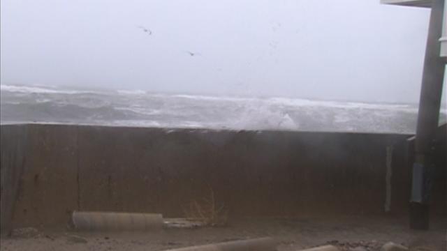
Several Communities Urging Residents To Evacuate
Voluntary evacuation recommendations have been issued in Scituate, Lynn, New Bedford and Plum Island.
Watch CBS News
Voluntary evacuation recommendations have been issued in Scituate, Lynn, New Bedford and Plum Island.

The peak of Sandy for southern New England will come between noon and 8 p.m. Monday.
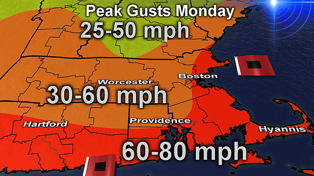
Hurricane Sandy is bearing down on the East Coast with maximum sustained winds at 85 mph Monday morning.

Per the 5am NHC update, Sandy is cranking out maximum sutained winds have increased to 85mph. The pressure has also decreased to 946mb, which signifies some strengthening.

We've been talking about Sandy for a week now, and it's arrival is Monday.

Boston Public Schools will be closed Monday and all non-essential city employees have been advised to stay home.
The National Hurricane Center says this could be the largest tropical storm ever in the Atlantic Ocean.

As Sandy continues her path up the coast, Massachusetts Emergency Management is preparing state residents for power outages.

President Barack Obama has spent months trying to balance his re-election bid with running the government.

Massachusetts officials have opened the state emergency operations center in Framingham to get ready for Hurricane Sandy.
Clouds will dominate today as Sandy gets closer and closer. The storm spans a mere 1000 mi in terms of the cloud shield.

Confidence continues to increase for the track and severity of Sandy this morning. Nearly all weather models forecast a landfall in Central New Jersey Monday night.

A list of storm-related closings.
A calm Saturday did not reflect what Sandy has in store for the coming days.

This is going to be a powerful and damaging event but likely not be a catastrophic event.
It looks like Sandy is going to hit New England no matter what its track is at this point.
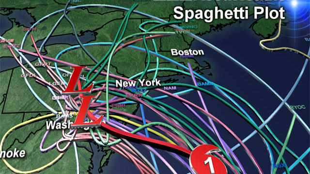
If we take a direct hit Sandy would go down in New England weather history joining some of the more memorable storms like the Blizzard of '78 and the Perfect Storm.

Our midday and afternoon models are pouring in and forecasting some significant changes in the ultimate track of Hurricane Sandy.
The one sure thing is that this is going to be a beautiful Friday! Some inland neighborhoods will top off at 70F this afternoon.
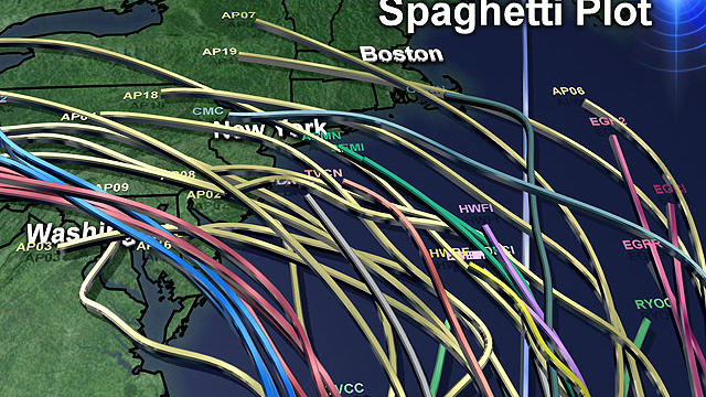
Some major developments in the past 24 hours with regards to Hurricane Sandy and its eventual track up the Coast…First of all, Sandy strengthened overnight into a category 2 hurricane.
All is quiet at home today with a changeable sky and highs returning to the lower 60s.

The likelihood of New England feeling some effects from Sandy is increasing.
Today will be another quiet day. Clouds will continue to thin out as the morning transitions into the afternoon.
The quiet weather will prevail today.
Sunday turned out to be a beauty. So, if you liked yesterday, you're in luck today!