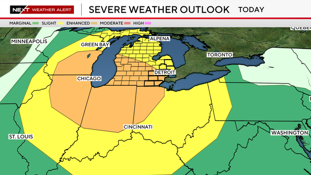
Severe weather is possible Monday for Southeast Michigan
Monday is a NEXT Weather Alert Day in Southeast Michigan as CBS News Detroit tracks a low-pressure system moving across the northern Great Lakes.
Watch CBS News

Monday is a NEXT Weather Alert Day in Southeast Michigan as CBS News Detroit tracks a low-pressure system moving across the northern Great Lakes.
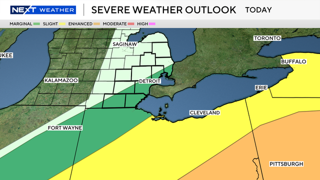
Clearer air is forecast for Metro Detroit on Tuesday, but the change in weather includes a chance of scattered showers and thunderstorms.
A line of storms will move through the Great Lakes region, approaching Metro Detroit overnight Monday into early Tuesday.

"This is pretty unprecedented," Ali Abazeed, Detroit's chief public health officer, said about the air quality due to wildfire smoke.

The air was so bad on Thursday in Michigan that Detroit was listed as having the world's worst air quality in the IQAir database.
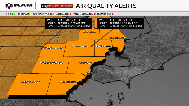
Southeast Michigan residents face two weather hazards on Wednesday, with an air quality alert issued due to wildfires and a continuing heat advisory.

Cooling centers are open, and some events are canceled, on Tuesday in Metro Detroit in response to a heat wave.
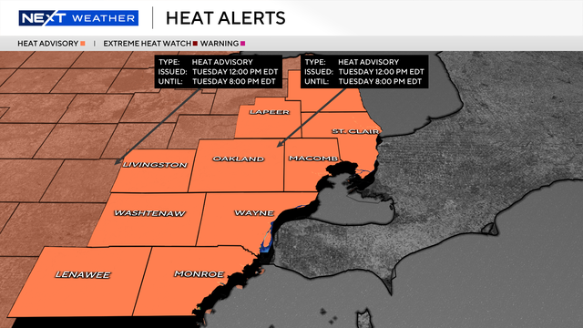
Extreme heat will move into southeast Michigan this week, with temperatures climbing into the 90s and humidity making it feel even hotter.
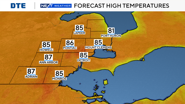
Afternoon highs are expected to warm into the mid-80s on Tuesday and upper 80s by Wednesday, with increasing humidity making it feel even warmer.
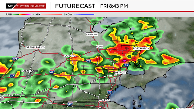
Any storms that do occur would have a risk of heavy rainfall, strong winds and larger hail.
An extreme heat warning for Metro Detroit will continue through Friday evening. Here's the forecast, along with the latest announcements from Southeast Michigan communities.
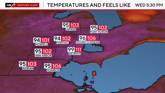
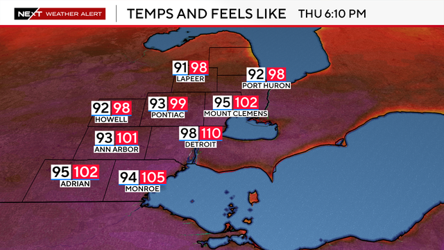
An extreme heat warning remains in effect on Wednesday for southeast Michigan, with dangerously high temperatures and heat index values of 105 to 110.
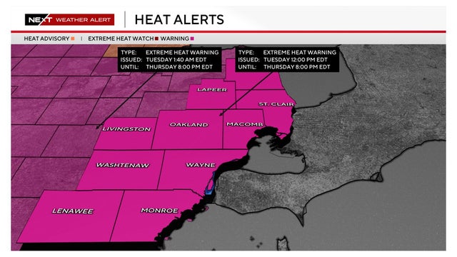
An extreme heat warning for Southeast Michigan takes effect at noon today. Here's what you need to know about dealing with such conditions.
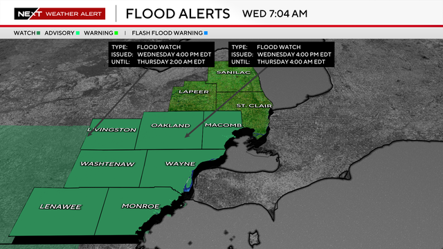
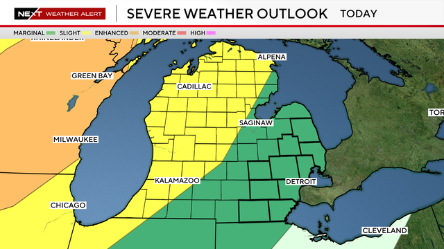
Thunderstorms could produce 1 to 2 inches of rainfall across Metro Detroit on Wednesday, with localized amounts approaching 3 inches.
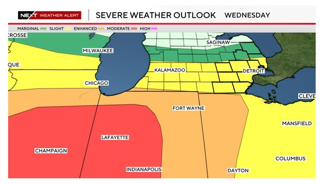
Metro Detroit is considered to be at a slight risk for severe weather on Wednesday. Here's a look at the forecast.