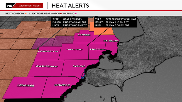
Strong storms moving through Southeast Michigan Friday evening as heat remains


Temperatures remain hot on Friday in Southeast Michigan, with storms expected in the evening to finally cool us down.
The Storm Prediction Center has us in a 2 out of 5 risk category for strong-to-severe storms in our southern counties. Friday afternoon and evening are the main windows for storms to try to pop.
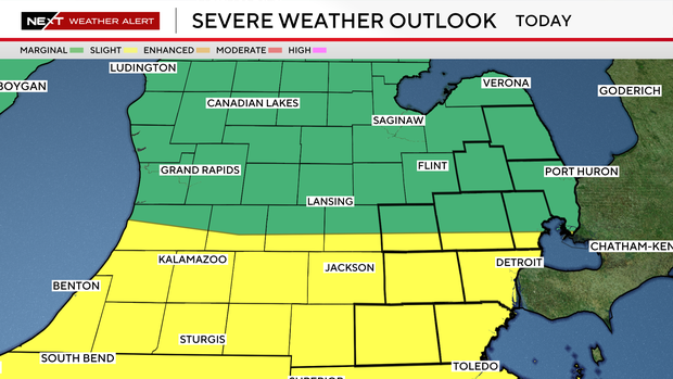
The strongest storms on Friday afternoon and evening could produce damaging wind gusts, large hail, torrential rainfall, and localized flooding.
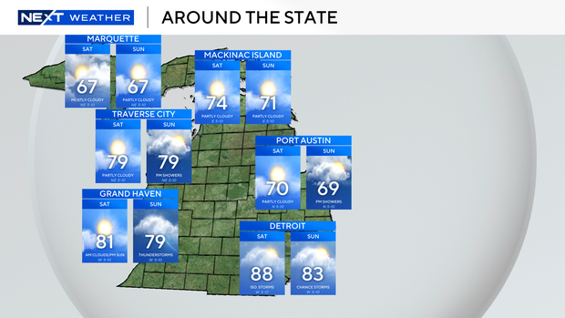
Looking ahead to the holiday weekend, the extreme heat will ease somewhat, with highs settling into the 80s, but daily chances for showers and thunderstorms remain in the forecast through Saturday and Sunday. While the holiday won't be a washout, anyone with outdoor plans should stay weather-aware and be prepared to adjust activities if thunderstorms develop.
If you are traveling, there are a few things to keep in mind.
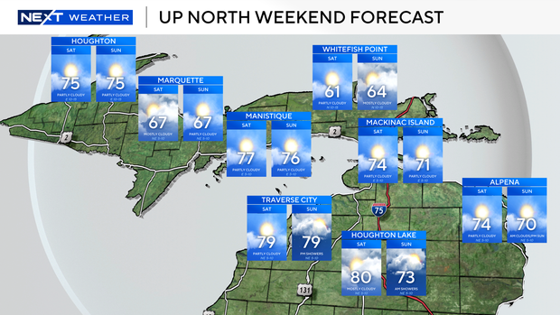
Temperatures remain warm throughout the state. Cooler conditions build in for the Upper Peninsula this weekend after they also roasted throughout the week.
Watch for temperatures in the 60s toward Lake Superior and the 70s on the southern shore.
Both Saturday and Sunday also continue to hold rain chances across the Mitten, with a larger focus to the south at first, and some more in northern Michigan possible.

The Upper Peninsula will largely remain dry after experiencing severe weather for several days this week.
Enjoy your holiday weekend and the cooler air returning.