South Florida braces for possible showers, storms Wednesday afternoon
The wet weather pattern in South Florida is expected to continue into the Fourth of July holiday weekend.
Watch CBS News

The wet weather pattern in South Florida is expected to continue into the Fourth of July holiday weekend.
South Florida is facing multiple weather hazards this week as dangerous heat continues, heavy rain raises the risk of flooding and wildfire smoke impacts air quality.
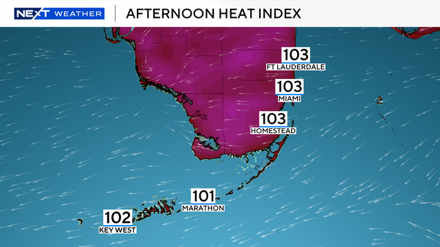
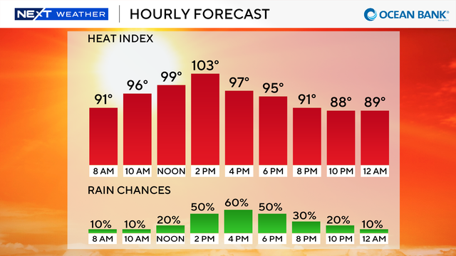
The "feels-like" temperatures are again expected to get into the triple-digits across much of the region on Monday.
The NEXT Weather Team is also monitoring tropical developments for next week.
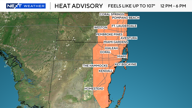
People in South Florida are being urged to stay hydrated and to wear light colors and loose-fitting clothing due to the dangerous heat.

A heat advisory will be in effect from 11 a.m. until 3 p.m. Monday for metro Broward and Miami-Dade counties.
The "feels-like" temperatures will peak closer to 100 degrees in South Florida for both Monday and Tuesday afternoons.
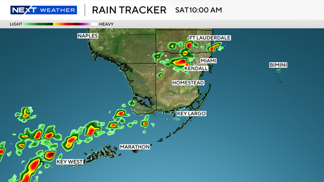
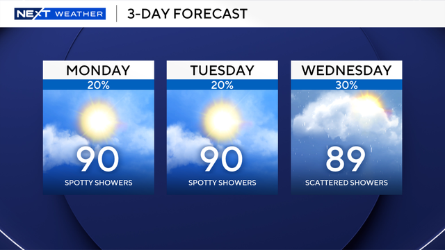
There's a chance of seeing scattered showers and thunderstorms in South Florida today, but the higher risk will be found in the Keys.
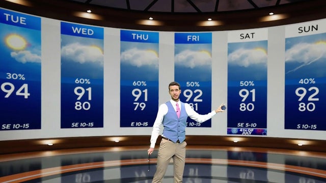
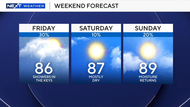
Drier air starts to arrive in South Florida on Friday and continues to move in for the weekend. Rain chances will also drop significantly.
Scattered to widespread rain chances linger in the forecast for the rest of the workweek and will lower for the upcoming weekend.

FPL says its ongoing grid-hardening efforts, including burying power lines underground and reinforcing critical infrastructure, are helping reduce storm-related outages.
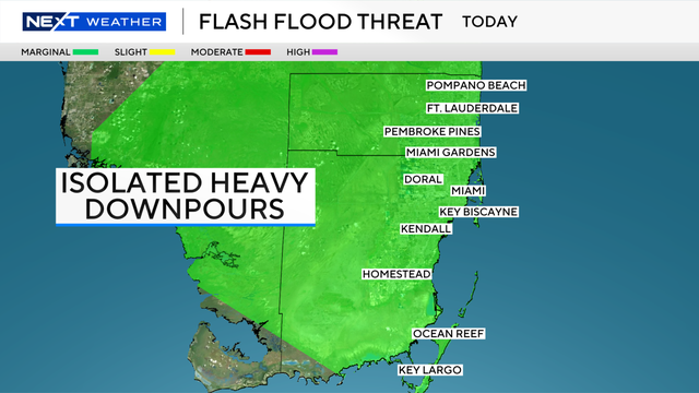
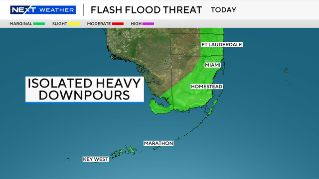
All of Broward, most of Miami-Dade, and the Upper Keys are under a marginal risk for isolated flash flooding on Thursday.
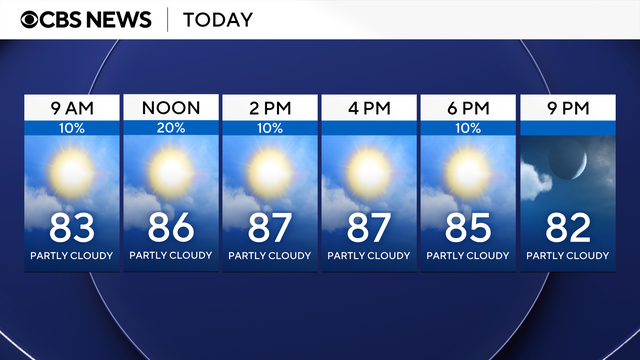
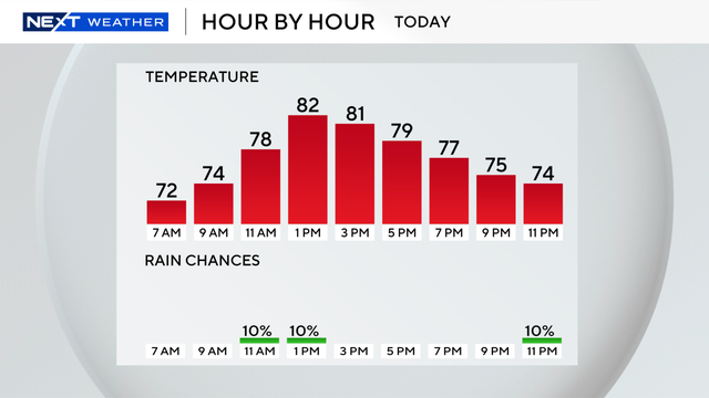
High temperatures are expected to hover in the upper 80s to lower 90s each day for the rest of the week.
A high rip current risk will continue at our Broward and Miami-Dade beaches.
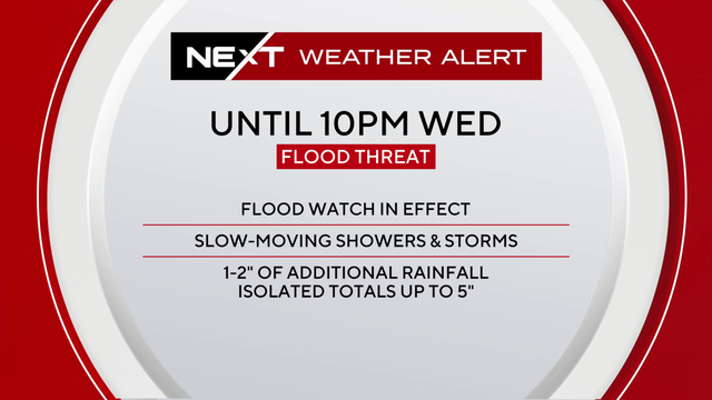
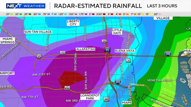
Eastern Broward and Miami-Dade are under a flood watch until 10 p.m., and a level two out of four flood risk on Wednesday.