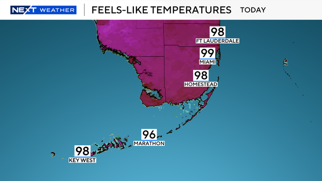
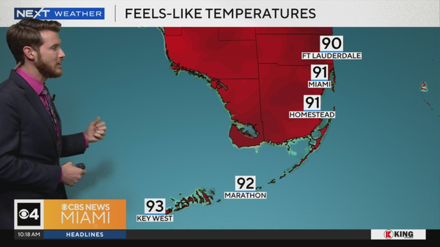
Muggy start as South Florida sees "feels-like" temps close to 100
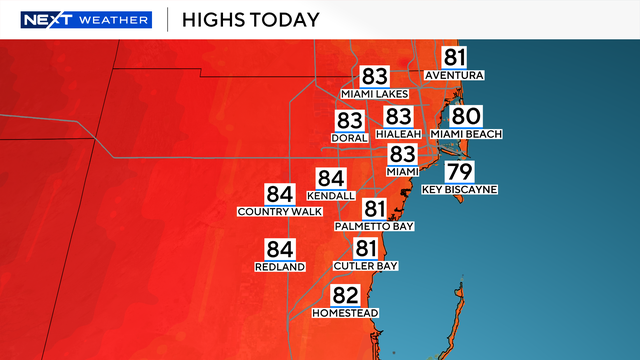
NEXT Weather Meteorologist Shane Hinton said these showers will be hit-or-miss through the morning as temperatures begin in the lower 80s.
Watch CBS News

NEXT Weather Meteorologist Shane Hinton said these showers will be hit-or-miss through the morning as temperatures begin in the lower 80s.

Scattered showers and dangerous heat are in the forecast for South Florida this week, with rain chances increasing into the weekend.
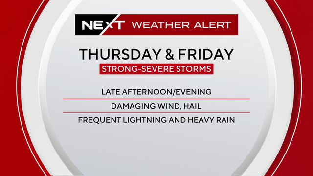
South Florida faces a new storm threat Saturday with damaging winds and hail possible in Broward and Miami-Dade.
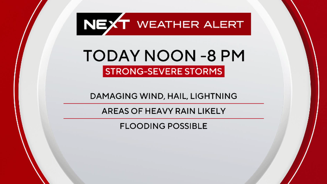
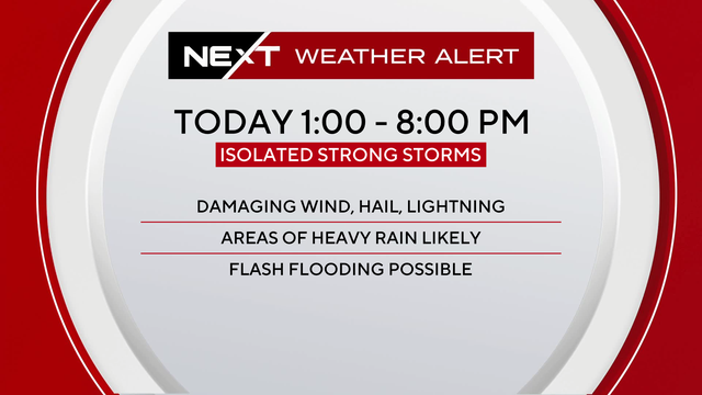
The most active period for storm activity will be from noon through 8 p.m.
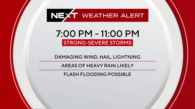
The main threats will be storms capable of producing damaging wind gusts and hail.
The main threats will be storms capable of producing damaging wind gusts and hail.
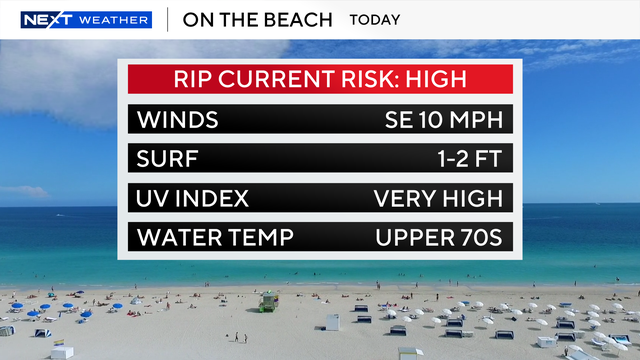
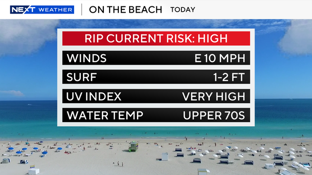
If you're trying to beat the heat at the beach, the rip current risk is low, but the UV Index is extreme.
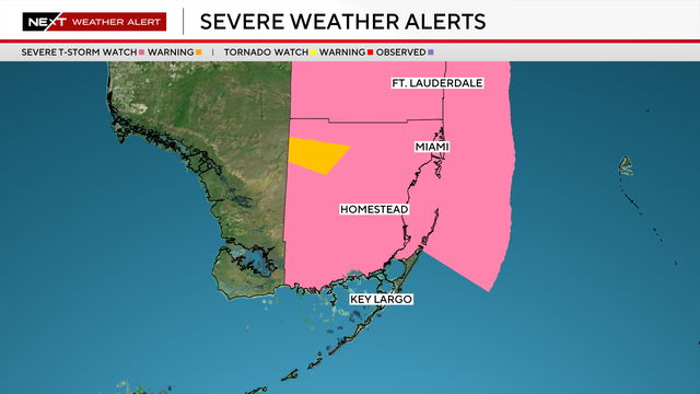
Broward and Miami-Dade counties were under a Severe Thunderstorm Watch until 9 p.m. Monday
A few scattered showers have already bubbled up this morning and our chances for storms will peak in the afternoon.
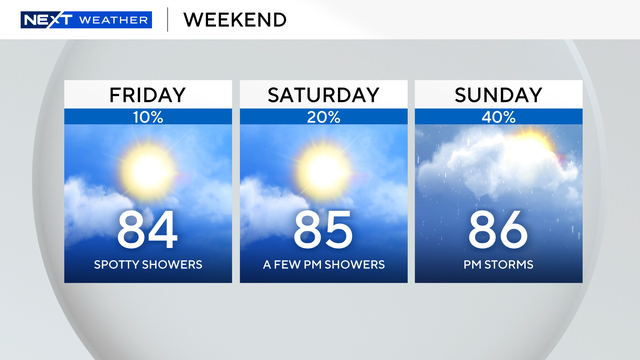
On Friday, a few spotty, light showers will lead to a warm afternoon with temperatures in the mid 80s.
Expect warmer and wetter weather over the weekend and into the beginning of next week.
There are no marine alerts for boaters in the Atlantic Waters and Florida Keys.

A few brief isolated showers are possible.

Breezy conditions linger not only throughout the day, but into the beginning of the upcoming work week
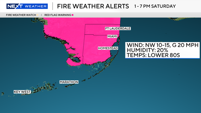
Critical fire weather conditions from 1-7 p.m. Saturday.