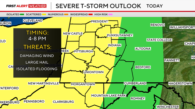
Afternoon strong storms possible in Pittsburgh | KDKA First Alert Weather
Saturday is a First Alert Weather day due to the chance for severe storms after 4 p.m.
Watch CBS News

Saturday is a First Alert Weather day due to the chance for severe storms after 4 p.m.
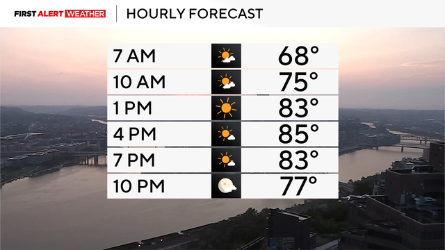
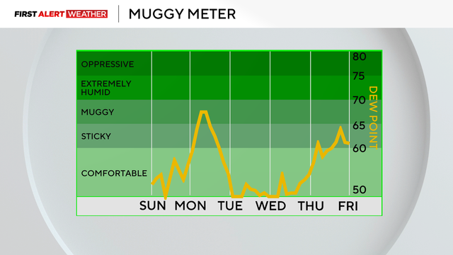
Sunday will be hot with lower humidity, but storms are on the horizon on Monday.
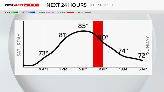
While there will be patches of dry time this weekend, more rain and thunderstorms are on the horizon in Pittsburgh.
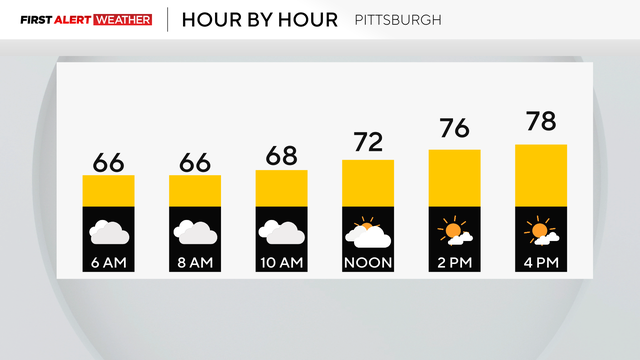
High temperatures are expected to be near 80 degrees.
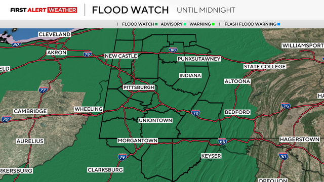
Most of the area is under a Flood Watch for most of the day on Sunday, as rain will be persistent.
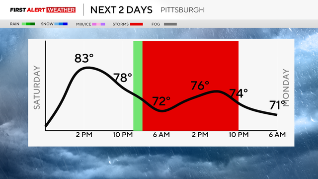
While there may be some quick drizzle, Saturday will be mostly dry, but on Sunday, rain and storms are possible.
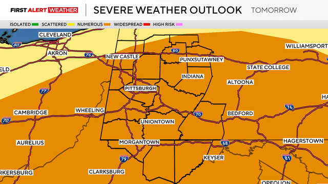
Damaging winds, flash flooding, small hail, and even possible tornadoes will be possible.
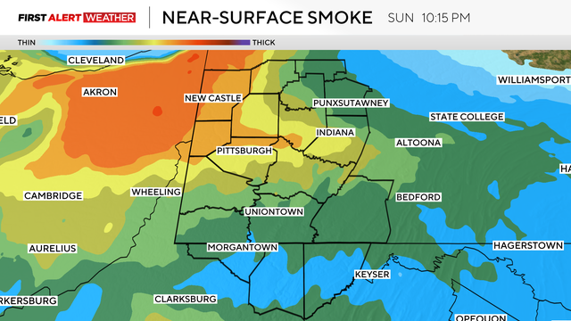
While some of the wildfire smoke will be back on Sunday, it will also be warm and sunny.
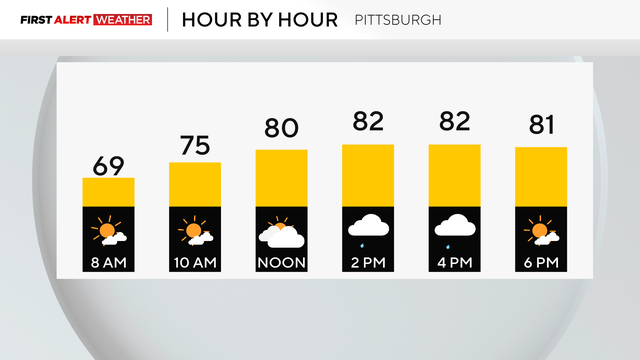
While we can't rule out an afternoon shower, it will be mostly sunny today in Pittsburgh.
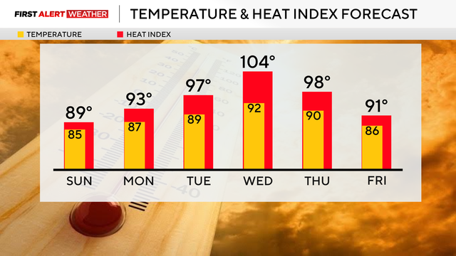
Saturday will have some scattered thunderstorms before the heat cranks back up next week.
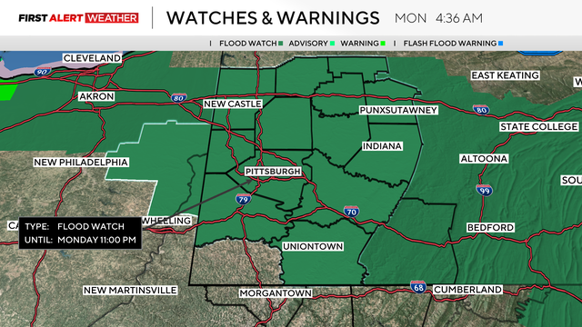
The National Weather Service said flash flooding is possible throughout the region because of excessive rainfall.
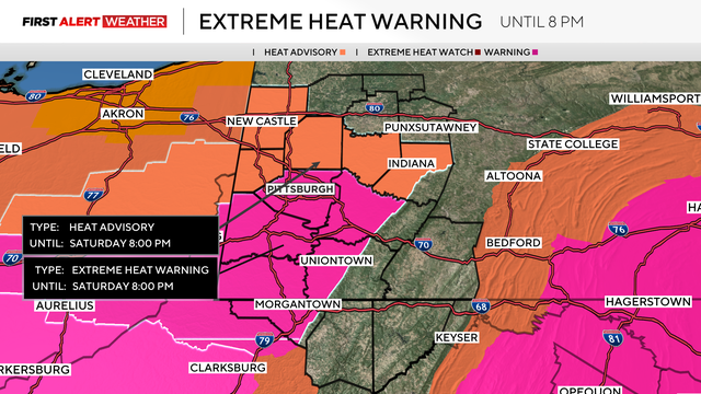
It will be the fifth day of temperatures in the 90s, but relief is on the horizon.
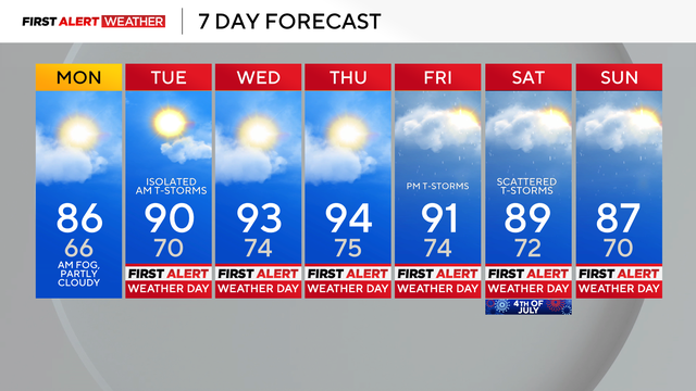
The hottest daytime temperatures of the week are expected on Wednesday and Thursday.
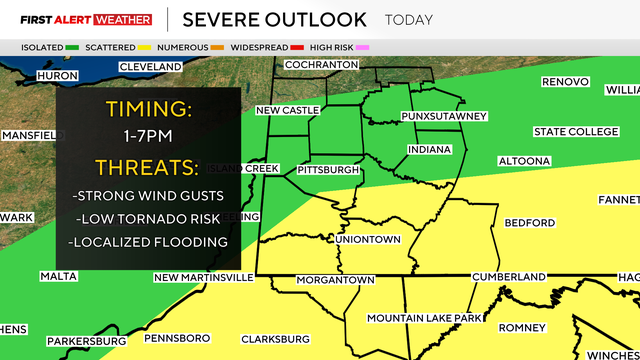
Isolated heavy downpours could lead to localized flooding, and some gusty thunderstorms could cause power outages and other damage.
Summer began just after 4 a.m. in Pittsburgh, and the first official day will be cloudy with some late rain showers.