Warmer temps in Chicago ahead of next storm system
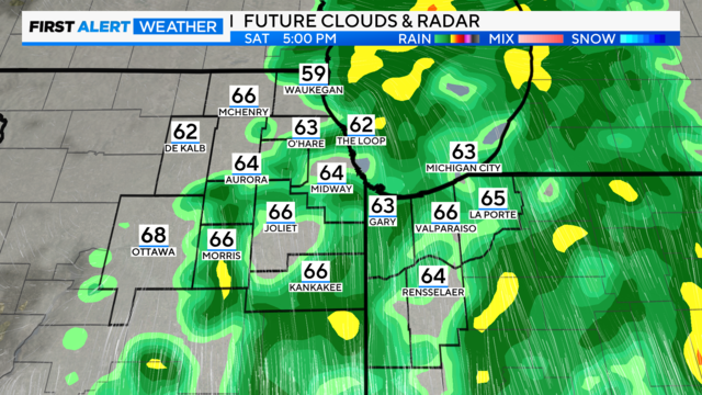
The system's forward speed has slowed slightly, meaning dry weather early Saturday morning through daybreak, with rain increasing mid-morning and peaking in the afternoon.
Watch CBS News

The system's forward speed has slowed slightly, meaning dry weather early Saturday morning through daybreak, with rain increasing mid-morning and peaking in the afternoon.
After the sun sets on Thursday, clear skies will be the order of the evening, but it will be brisk, with lows in the lower 50s.
By 6 p.m., storm activity had died down. It was expected to diminish even more after sundown.
The first wave arrives in the 7 a.m. hour along Interstate 39 and drives eastward to the city by 11 a.m. and then to Northwest Indiana.
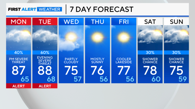
Heat and humidity will increase, and temperatures will rise into the upper 80s.
A few spotty showers are possible after midnight Saturday in the Chicago area as a weak cold front crosses the area.
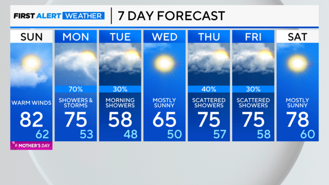
Warm winds gusting up to 30 mph will warm temperatures in the Chicago area into the 80s for this Mother's Day.
Waves of thunderstorms could move into the area between 1 a.m. and 5 a.m.
Chances for isolated pop-up storms heading into this evening. The highest rain chance is tonight.
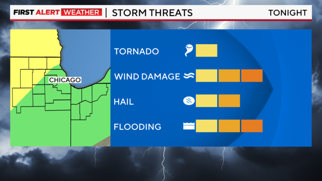
Brief tornadoes are possible, with favorable timing around 2 a.m. to 6 a.m.
Winds will be with us from the southwest all day, possibly gusting to 35 mph.

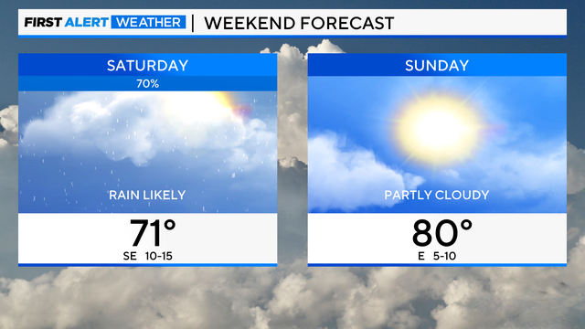
One more dry day on Thursday until a storm complex heads our way for the weekend.
Sunday was the warmest day of the year so far for Chicago as the area reached 80 degrees for the first time this year.
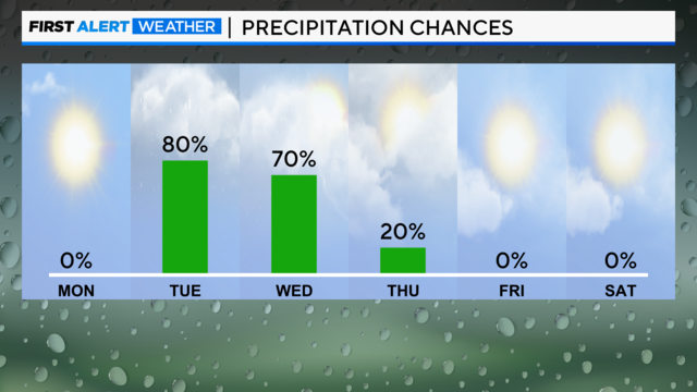
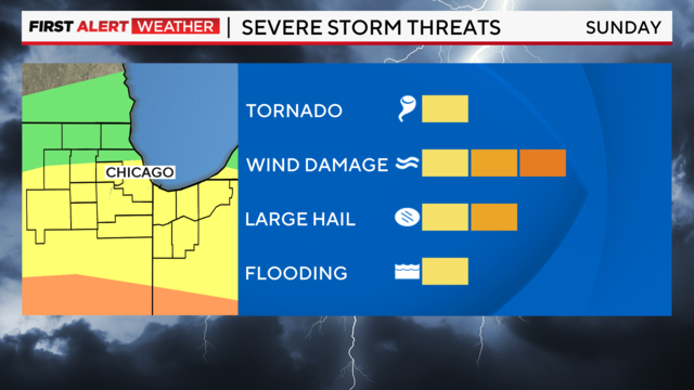
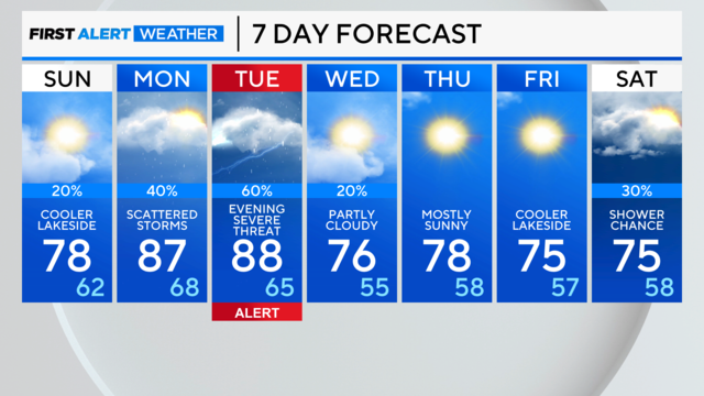
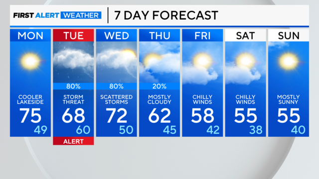
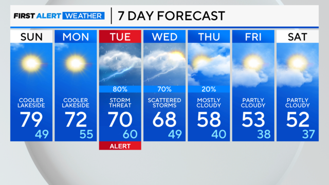
A severe storm threat arrives Tuesday afternoon and evening, and storms could linger into the Wednesday morning rush.
Later in the day, a lake-enhanced cold front will turn the winds off the chilly lake, and temperatures will drop.