Steamy heat, severe storm threat move into Chicago area

CHICAGO (CBS) -- Cool winds off Lake Michigan have kept stable air in place in the Chicago area Sunday. The front is stalled well to the south for the night.
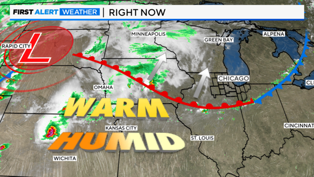
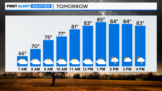
On Monday, it will lift north as a warm front and open the door for steamy heat to move into the area for the next two days. This unstable air mass will fuel storm threats over the next two days.
As the warm front lifts north on Monday morning, heat and humidity will increase, and temperatures will rise into the upper 80s.
Storm Timeline
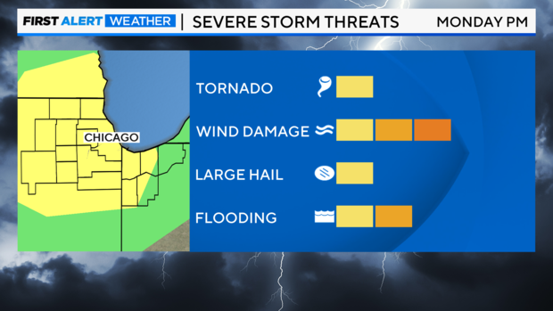
MONDAY AFTERNOON 2 P.M. - 8 P.M.: Severe threat for damaging winds and hail. Also, the slow forward motion of the storms will create localized flooding at times.
TUESDAY MORNING: Gusty showers and thunderstorms. Do not expect severe weather at this time.
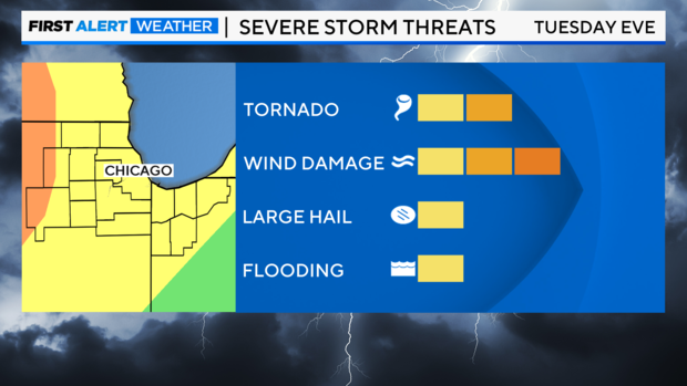
TUESDAY SUNSET TO MIDNIGHT: Severe threat for damaging winds and brief tornadoes.
WEDNESDAY: Storm complex departs by Wednesday, leaving dry and quiet pattern through the rest of the workweek.
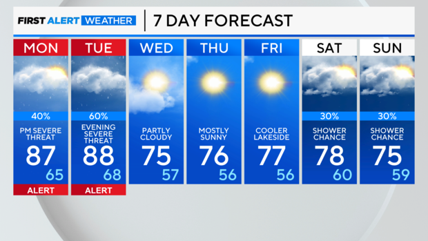
Forecast
SUNDAY NIGHT: Clouds increase. LOW: 60
MONDAY: Very warm and humid. Afternoon strong/severe storms possible. HIGH: 87
TUESDAY: Morning showers and thunderstorms. Then warm winds carry temperatures. Severe storm threat sunset to midnight. HIGH: 88