
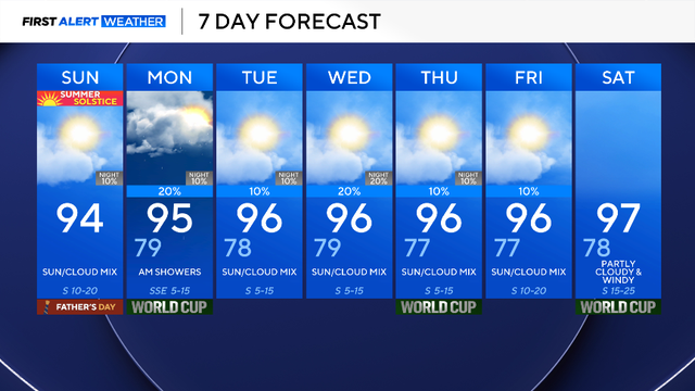
Hot weather across North Texas for Sunday
The hot, humid, and windy weather will continue through the end of the month.
Watch CBS News

The hot, humid, and windy weather will continue through the end of the month.
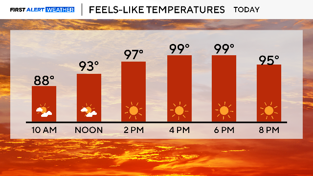
The heat index will be in the triple digits for Saturday.
Sunday overnight, a complex of storms, some severe, will cross the Red River around 4 a.m. and will cross I-20 around 6 a.m.
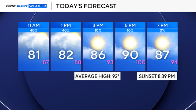
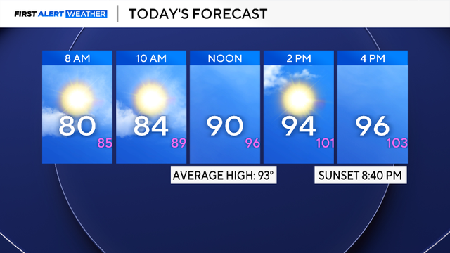
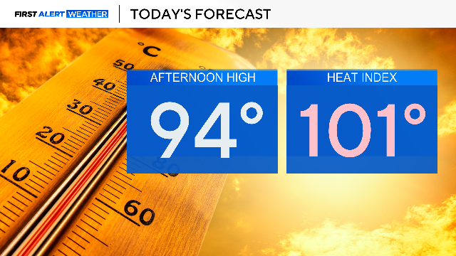
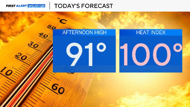
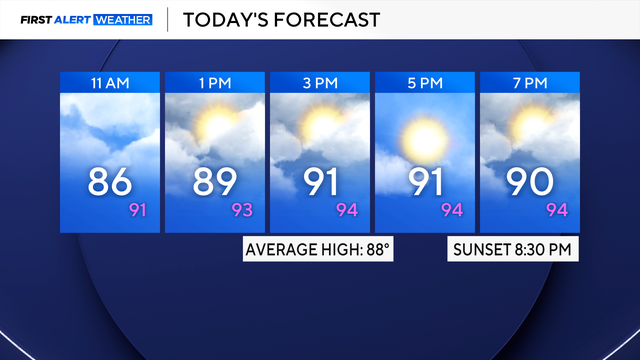
High temperatures will be in the 90s, with a heat index over 100 degrees.

Areas along and south of I-20 will see rain in the late morning and afternoon due to a stalled front and a disturbance

More scattered storms are anticipated across the Metroplex in the late morning and afternoon.

Sunday is a First Alert Weather Day due to the chance of severe weather.
The First Alert Weather Team is monitoring a potential First Alert Weather Day on Thursday, with an expected heat index of around 105 degrees.
Drink plenty of water and take frequent breaks in the A/C.
On Sunday, Dallas-Fort Worth International Airport recorded 3.55 inches of rainfall, which broke the daily rainfall record.

Grounds are already saturated, leading to flooding in low-lying areas across parts of North Texas.
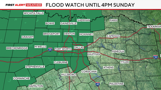
A Flood Watch is in effect until 4 p.m. on Sunday.

For those attending the Charles Schwab Challenge, be sure to wear sunscreen and drink plenty of water.
Don't rule out a pop-up shower for some western counties on Saturday.

Temperatures will reach into the mid-80s in the late afternoon and cool into the 70s after sunset.