Saturday starts cool after cold front; weekend to stay pleasant for North Texas
Expect mostly sunny skies and winds from the north gusting up to 20 mph throughout Saturday.
Watch CBS News
Expect mostly sunny skies and winds from the north gusting up to 20 mph throughout Saturday.
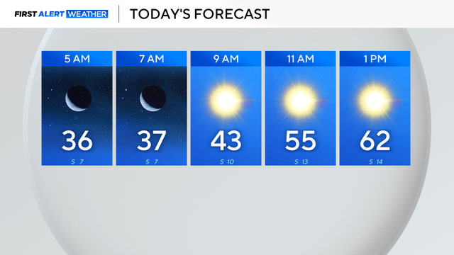
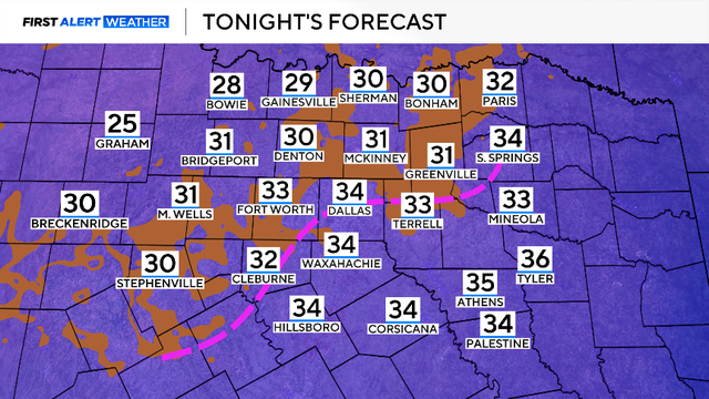
Temperatures across the area dropped below freezing in the 30s and 20s, and winds from the northwest at 5-10 mph made it feel like the 20s and teens.
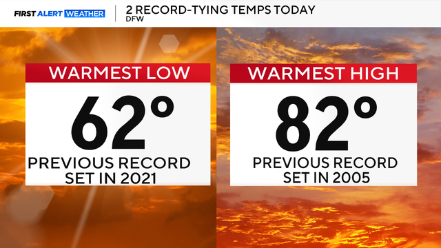
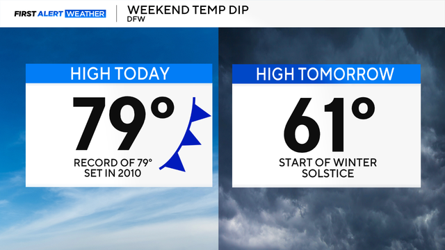
It was another record warm day across DFW Saturday.
North Texas reached a record high of 86 degrees the day after Christmas.

A ridge of high pressure is dominating in the upper levels of the atmosphere, resulting in above-average highs.

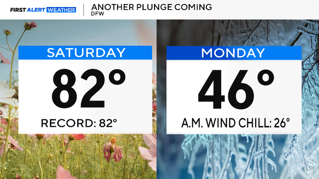
Maybe grab a light jacket as you head out the door Monday morning, but you won't need it by the afternoon.
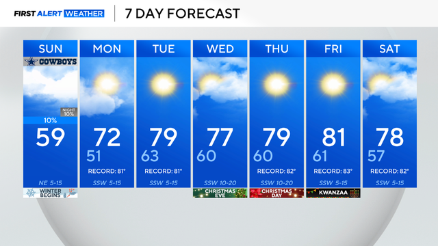
Sunday is the shortest day and longest night of the year.
Highs are expected to flirt near 80 degrees across North Texas Saturday, which will potentially break the record for the daily high temperatures on this date.

Wednesday in North Texas is starting out more mild compared to yesterday morning as most wake up to temperatures in the 40s.
Tuesday morning started off chilly in North Texas with temperatures in the 30s.
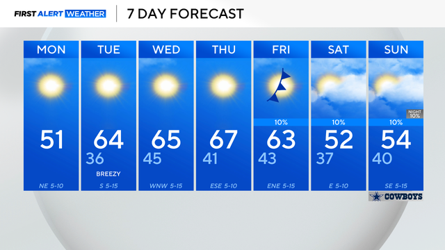
Monday's temperatures will reach the low to mid-50s, a few degrees below the average high of 59 degrees.
A cold front is moving across the area Sunday morning, bringing a cool and gusty northerly wind.
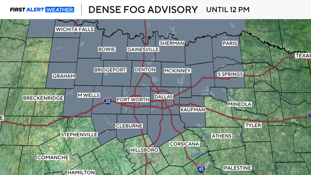
The fog will begin to lift once the sun rises and mixing occurs in the atmosphere.
Monday is the first day of meteorological winter and it sure felt like it this morning with temperatures in the 30s.
Cold weather is expected all day.