
Another chilly morning, warm day in North Texas
DFW Airport reached 53 degrees Wednesday morning – the coldest since May 4.
Watch CBS News

DFW Airport reached 53 degrees Wednesday morning – the coldest since May 4.

A cold front moved across North Texas this morning, which brought cooler temperatures, a dry airmass and windy conditions.

Winds could reach up to 40 mph in some parts of North Texas.

Expect sunny skies, low humidity, a high in the 70s and a slight breeze from the north with gusts up to 20 mph. It will be a fabulous day to enjoy the outdoors.

Prediction models are showing scattered storms in DFW between noon and 4 p.m. Saturday.
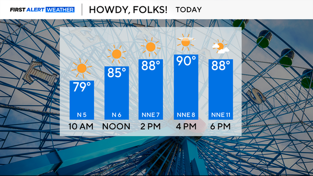
Winds will remain light today, with sunny skies, and highs in the upper 80s.

There is elevated fire danger on Sunday for counties along and west of the I-35 corridor due to the relative humidity being around 20 to 30%, with winds gusting up to 25 mph.
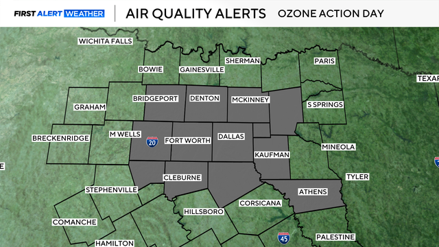
There is an air quality alert Saturday for higher-than-normal ozone levels.
It has been an abnormally warm and dry first week of October.

Though most of the area will remain dry, there is a slight chance of an isolated shower for areas to the east.

This month has started dry and will likely continue to stay dry through mid-October.

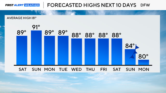
The hot and dry streak continues this weekend.

September ended with 21 days recorded above normal, resulting in the average high temperature topping out at 92.1 degrees.

It is a hot end to the month of September. Most days have been above average temperature-wise and that trend is looking to continue starting in October.

The high for Dallas-Fort Worth is expected to top out around 87 degrees and cloud cover will be increasing with dry conditions expected.