Another frigid morning before a warming trend in Chicago
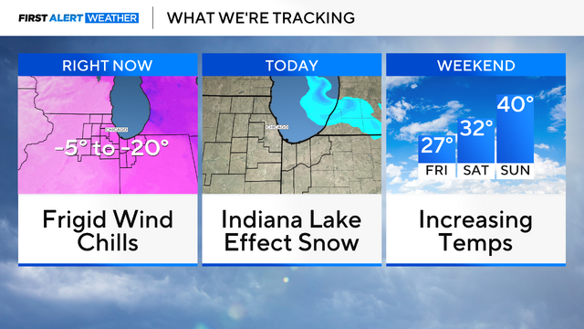
On Thursday morning, wind chills drop as low as -15 degrees.
Watch CBS News

On Thursday morning, wind chills drop as low as -15 degrees.
By next week, high temperatures rise to the mid-40s in Chicago for the first time in more than three weeks.

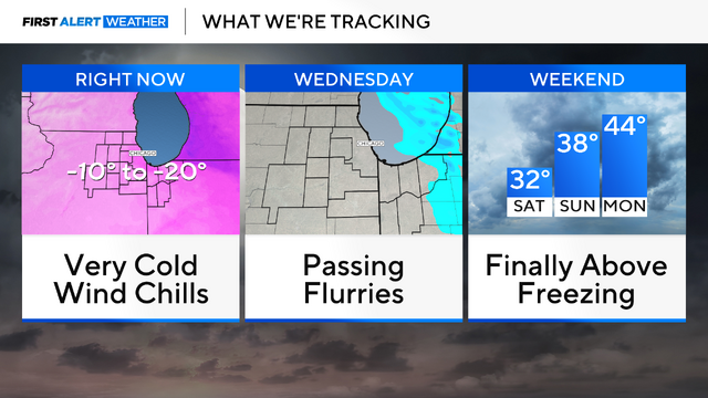
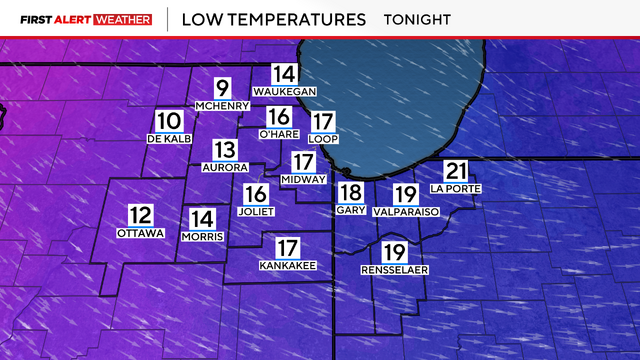
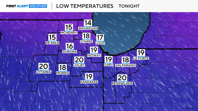
Bitterly cold conditions are in place again Tuesday morning.
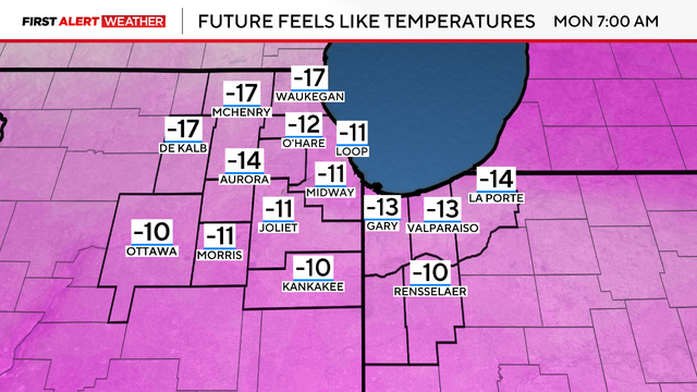
A cold weather advisory is in effect until 11 a.m. for wind chills of minus 15 to minus 25 degrees Monday morning.
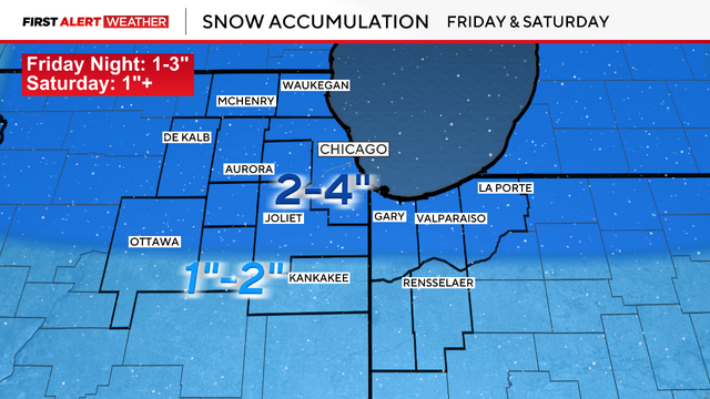
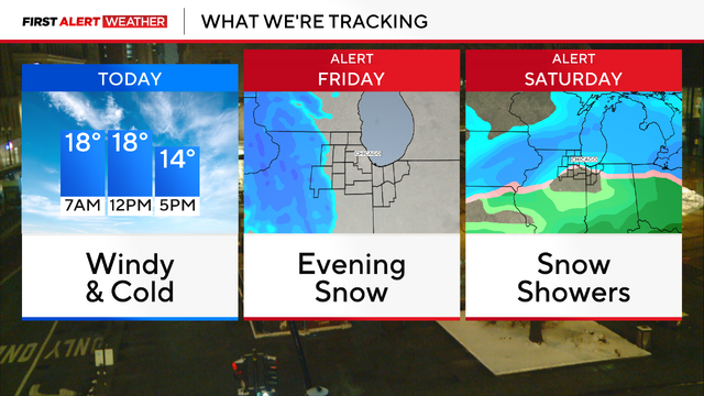
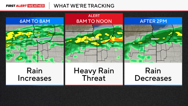
Snow increases by 6 p.m., with widespread snow of 1-3" accumulation and messy travel conditions for the evening commute.
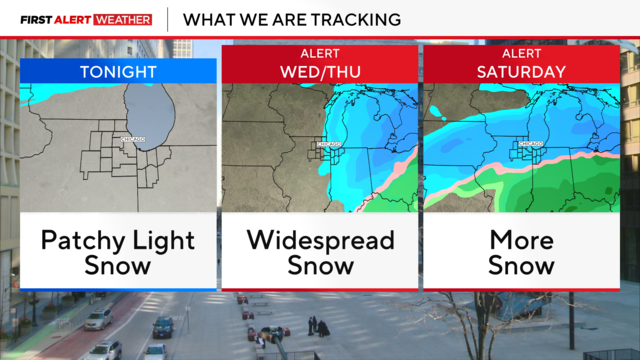
The impact of Wednesday's storm will still be felt during the early Thursday morning commute as crews continue to clean up the snow.
Snowfall reports as of 9 p.m. range from 1.5" to 4".
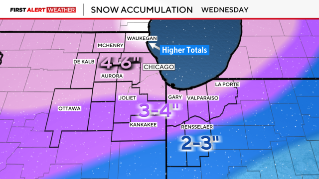
Widespread snowfall totaling 4 to 6 inches is expected through Wednesday, with isolated higher amounts along the North Shore.
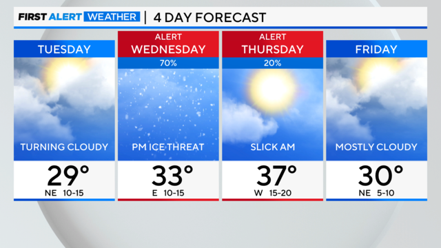
Our next winter storm approaches Chicago on Wednesday.
We are in for messy weather ranging from drizzle to icing to some snow to the north.
Friday morning will be breezy as wind chills start in the single digits.
Sunshine returns, as well as blustery breezes with gusts topping near 40 mph.
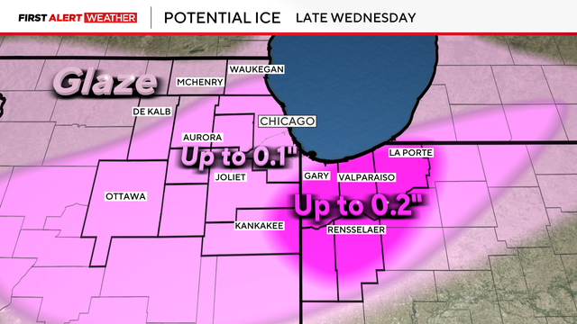
Light snow showers begin Wednesday morning, turning to a freezing rain threat by evening and into the night.
Monday's highs will reach close to 50 degrees.
A dense fog advisory is in effect until 9 a.m. Commuters can expect decreased visibility.