Wintry weather ending Saturday night in Chicago area; colder but quiet finish to weekend

CHICAGO (CBS) — Lingering freezing drizzle on Saturday afternoon and evening may keep conditions icy in the Chicago area, especially on elevated and untreated surfaces.
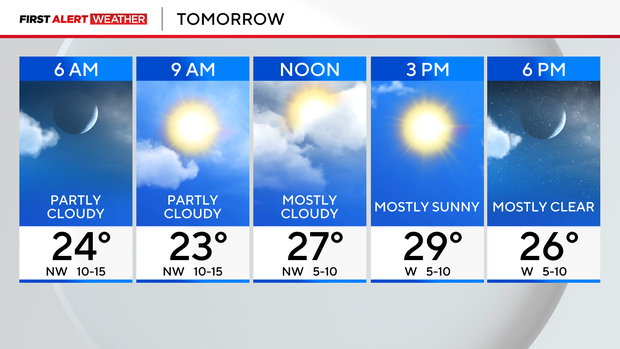
Conditions will improve overnight into Sunday as clouds break. The sun returns on Sunday, with colder highs in the upper 20s. Cold northwest breezes will keep wind chills in the teens for the day.
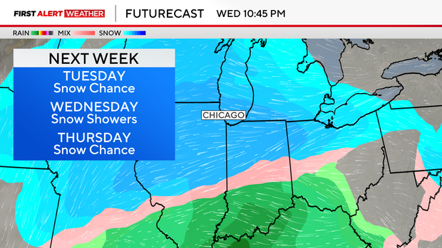
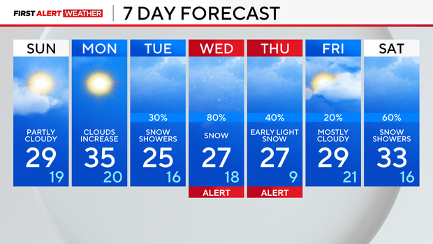
More sunshine leading into Monday and highs in the middle 30s. Clouds increase late in the day and night as the first of many snow chances develops for the week with potential travel impacts.
Light snow is possible Monday night into Tuesday and again Wednesday into early Thursday. This second round could be the more meaningful punch for snow. Still too early to talk about totals, but it's a system to watch closely. We've issued Weather Alerts during this time period for potential travel impacts, especially for early Thursday.
Snow is possible again for next weekend, mainly on Saturday. Stay tuned throughout the week!
Temperatures are expected to dip into the 20s for highs on Tuesday. It'll stay on the colder side of things through the weekend.
Forecast at a glance
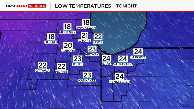
Tonight: Evening freezing drizzle/snow ending; clouds break; low: 22
Tomorrow: Partly cloudy with cold breezes; high: 29
Tomorrow night: Mostly clear and quite cold; low: 19


