Sub-zero wind chills in Chicago on Tuesday; improving temps later this week


The cold Arctic blast lasts about 48 hours longer for the Chicago area, then a warming trend starts.
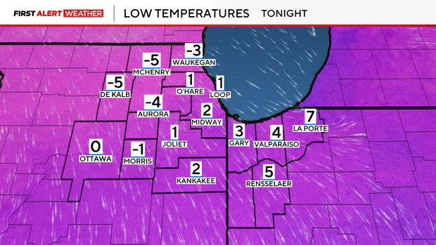
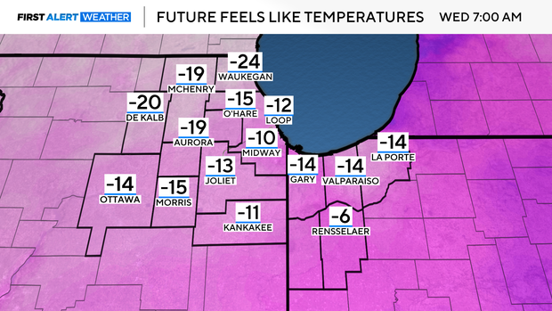
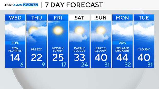
Tuesday morning's temperatures remained cold, with overnight lows falling near zero. The brisk wind will send wind chill values towards -10° to -20° late Tuesday night and through early Wednesday.
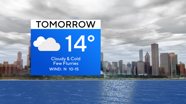
Clouds linger overnight, lasting through Wednesday, and a 20% chance of snow returns to the forecast. A few light snow flurries will be possible across Illinois, but in Indiana there is a better chance of snow showers due to Lake Effect.
More sunshine and drier conditions return for the end of the week and the upcoming weekend.
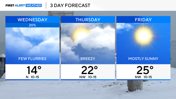
By Thursday and Friday, temperatures are back in the 20s. Highs climb towards freezing on Saturday, then we jump into the 40s on Sunday through the early start next week.
School closures Tuesday
Some Chicago area schools have announced delays and closures due to the frigid conditions.
Joliet Public Schools District No. 86, River Forest School Corporation and City of Hobart Schools are among the districts moving to e-learning.
The Emergency Closing Center reports closures and delays for several area schools, businesses, daycare centers, and other organizations.


