Winter storm moves out of Chicago; 4 inches fall in some areas


CHICAGO (CBS) — Snow was moving out of the Chicago area Wednesday night, leaving us with some lingering flurries overnight into early Thursday morning.
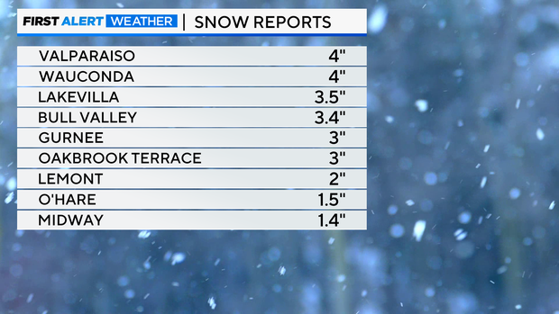
Snowfall reports as of 9 p.m. range from 1.5" to 4".
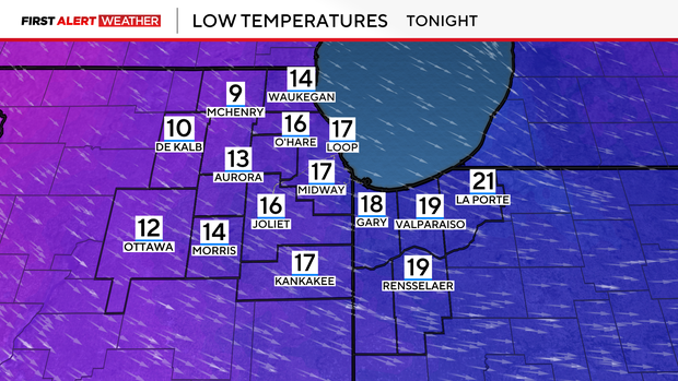
Lows Wednesday night, lows will be in the teens, with wind chills near zero degrees in many spots.
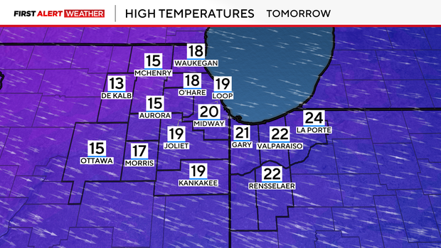
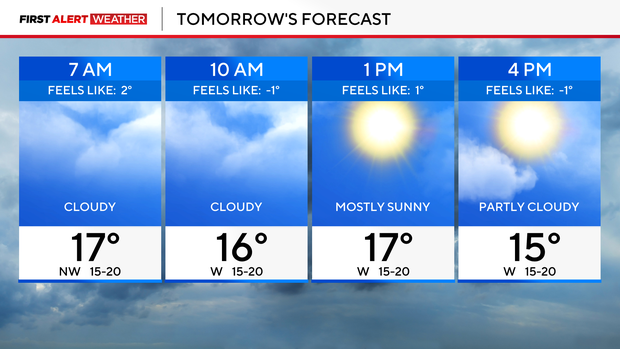
For Thursday, morning clouds will give way to a partly cloudy sky in the afternoon and highs in the upper teens.
Slick and snow-covered roads will create dangerous travel overnight into Thursday morning, especially on untreated roadways.
Our next winter storm arrives Friday afternoon, with travel impacts likely for parts of the afternoon and evening commute. Heavy snow is in the forecast late Friday, with the potential for several more inches of snowfall possible.
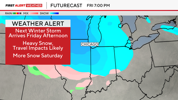
Additional snow chances will be with us on Saturday.
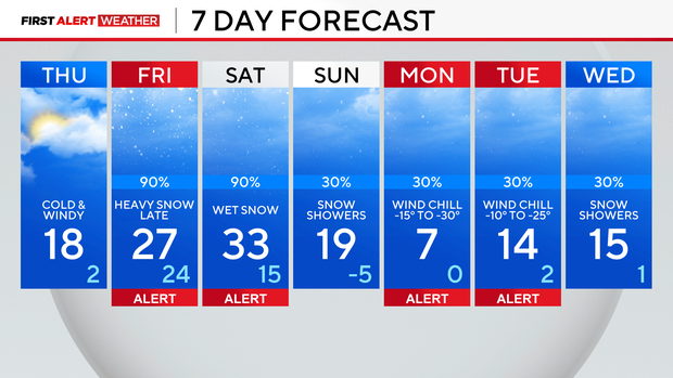
Weather Alerts continue into next week due to dangerous cold. Wind chills on Monday morning could be as cold as -30 degrees in the far western suburbs, and -25-degree wind chills are expected on Tuesday morning.


