Cold weather advisory for much of Chicago area overnight Sunday into Monday
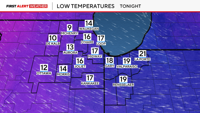
Lows were dropping toward zero degrees, and factoring in the brisk winds will make it feel like -15 to -25 degrees outside.
Watch CBS News

Lows were dropping toward zero degrees, and factoring in the brisk winds will make it feel like -15 to -25 degrees outside.
Monday and Tuesday will be the coldest days, with dangerously cold wind chill readings in the -15 to -25 degree range.
Snowfall reports as of 9 p.m. range from 1.5" to 4".
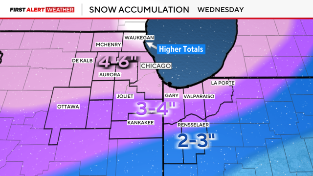
Widespread snowfall totaling 4 to 6 inches is expected through Wednesday, with isolated higher amounts along the North Shore.
A snowstorm Wednesday into Thursday looks to have a lot of moisture associated with it, meaning at least a few inches of accumulating snow right now is looking more likely.
By midday, ice will thaw as temperatures rise to around 40 degrees.
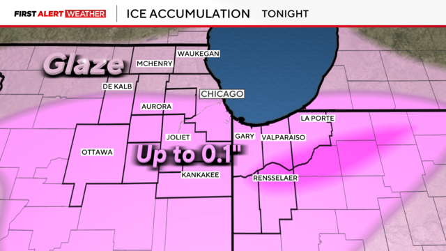
Widespread freezing rain and drizzle are causing untreated roads, sidewalks, and driveways to become icy and slick.
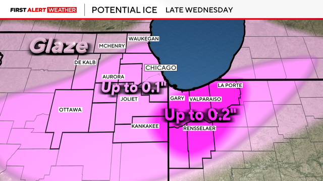
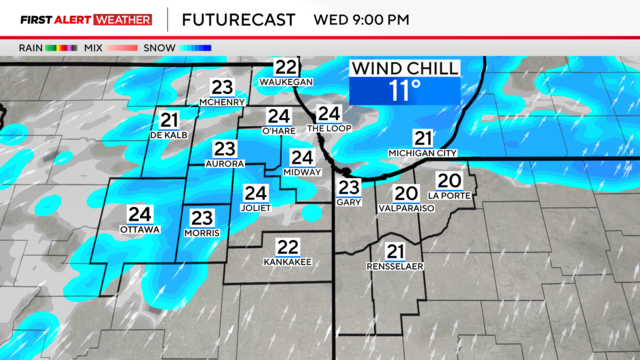
Light snow showers begin Wednesday morning, turning to a freezing rain threat by evening and into the night.
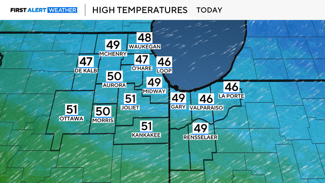
Monday's highs will reach close to 50 degrees.
By late morning, the fog should start to mix out, but we will be left with mainly cloudy skies for this Groundhog Day.
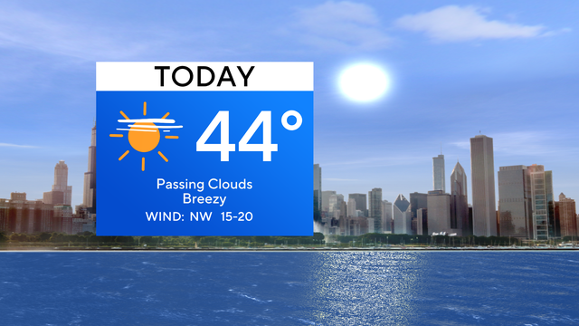
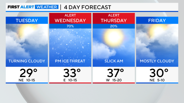
Highs are expected to be in the lower 40s on Wednesday with breezy conditions.
Winds will stay breezy through Wednesday with gusts near 30 mph.
Highs will top out near 30 degrees, but since it'll be breezy, feels-like temperatures throughout the afternoon will primarily be in the teens.
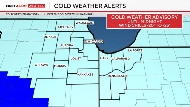
Feels like conditions are ranging from 10 to 20 degrees below zero.
Another arctic cold day with single digits is ahead for the Chicago area.