Rain in North Texas leaves behind cooler temperatures
After a rainy Monday in North Texas, it will finally feel like fall.
Watch CBS News

After a rainy Monday in North Texas, it will finally feel like fall.
Highs soared to 86 degrees in Dallas-Fort Worth on Tuesday, breaking the current record of 83 degrees.

North Texas has tied for the record high temperature on Monday. Another record high is expected on Tuesday.
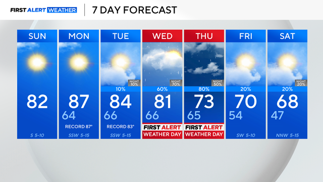
Due to a ridge of high pressure, the above-average temperatures are here to stay over the next few days.

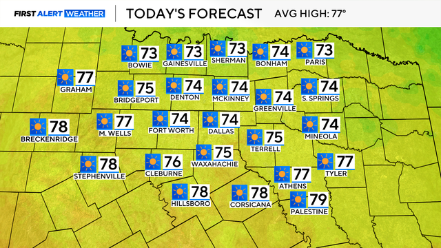
The typical high temperature for this time of year is 67 degrees, but the high on Saturday hit a record 89 degrees.

A cold front will come to North Texas in the middle of next week, bringing chances of rain to the forecast.

A ridge of high pressure will bring clear skies and above-average temperatures to North Texas all week long.

High temperatures Thursday afternoon will reach the mid-60s, and winds will be much lighter than they were on Wednesday.

Wind is coming down this evening but the chill sticks around across the weekend. Some rain chances on Saturday.

This shower activity will carry a much lower severe threat, however, we do have a 1-out-of-5 risk for strong to severe thunderstorms where these cells do develop.
Expect sunny skies, low humidity, a high in the 70s and a slight breeze from the north with gusts up to 20 mph. It will be a fabulous day to enjoy the outdoors.

The First Alert Weather team continues to monitor the cold front arriving in North Texas on Saturday.
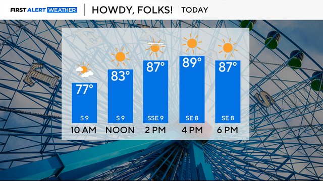
Plan for lots of sunshine and temperatures in the upper 80s on Monday.
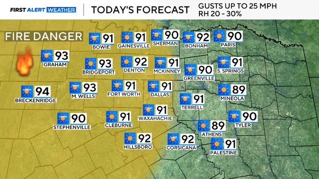
There is elevated fire danger on Sunday for counties along and west of the I-35 corridor due to the relative humidity being around 20 to 30%, with winds gusting up to 25 mph.
A remarkable run of warm and dry weather continues into this weekend.