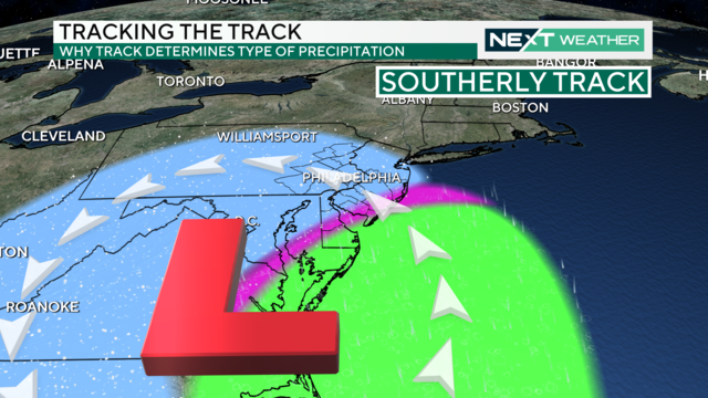
Philadelphia weather: Who will get the most snow this weekend? The details are uncertain
The first significant winter storm of the season could bring the first notable snow accumulation to the Philadelphia area in almost two years.
Watch CBS News

The first significant winter storm of the season could bring the first notable snow accumulation to the Philadelphia area in almost two years.
A strong storm system expected to arrive during the first weekend of 2024 shows the possibility of being a significant winter weather event.
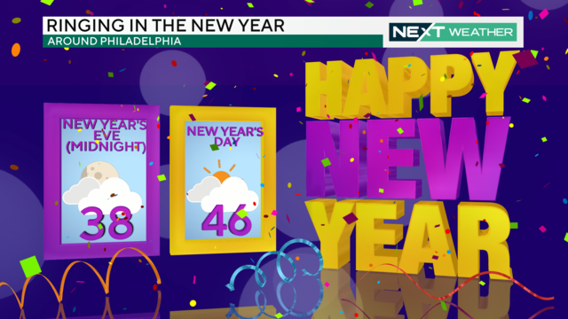
Partly sunny skies and seasonable temperatures spread across the region for the last day of 2023. A chance for isolated sprinkles or flurries moves in late and continues through Monday.
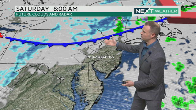
Saturday, Dec. 30 is cloudy with a chance of a light sprinkle in the Philadelphia region.
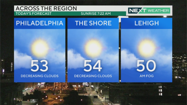
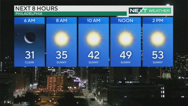
High temperatures will reach the 50s in the Philadelphia region on Friday, Dec. 29, 2023.
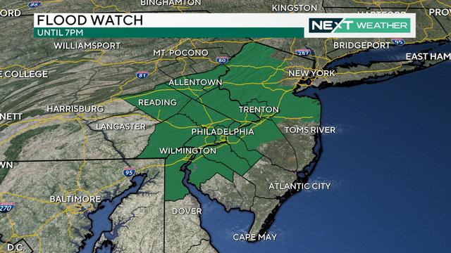
The Schuylkill River is forecast to crest around 1 p.m., which could lead to flooding and road closures along Kelly Drive and MLK Drive. A Flood Watch remains in effect until 7 p.m.
The Philadelphia region can expect rain for most of the day Wednesday, with heaviest showers late in the day and into the night.
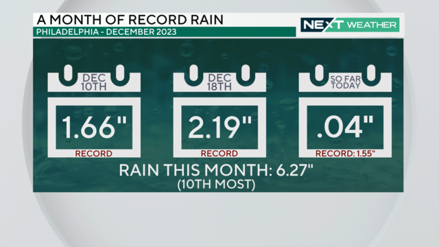
For the third time in December 2023, a daily rainfall record is expected to be broken in Philadelphia.
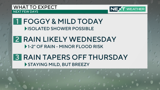
High temperatures will be in the 50s Tuesday afternoon despite generally cloudy and humid conditions. Widespread rain and possibly heavy downpours move in Wednesday, which could result in some minor flooding.
The heaviest of the rain has ended across the Philadelphia area, but light to moderate showers will be possible through midday before some drier air begins to move in.
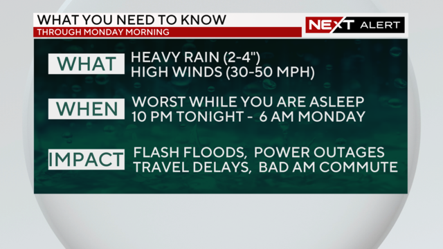
Temperatures return to the 50s Saturday before another strong storm system arrives Sunday into Monday

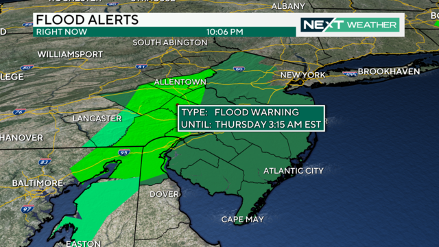
Heavy rain, gusty winds and possible flooding will impact the entire Delaware Valley region, and a Flood Watch is in effect from 1 p.m. Sunday through 4 p.m. Monday.

Showers and even some snowflakes are possible Wednesday, but don't expect any accumulation.

Dress for colder weather through the middle of the week! Wind chills on Wednesday will make it feel like barely above freezing.

Snow flurries started falling after 8 a.m. across the Philadelphia region after a blast of arctic air hit us.