Philadelphia forecast: Light rain continues Monday, winds strong throughout the day


PHILADELPHIA (CBS) -- A NEXT Weather Alert continues through Monday, as a strong coastal storm moves northeast and residual impacts continue through the remainder of the day.
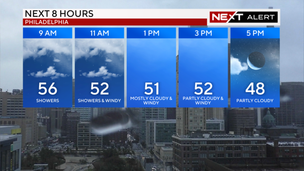
The heaviest of the rain has ended across the Philadelphia area, but light to moderate showers will be possible through midday before some drier air begins to move in.
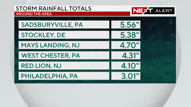
Rainfall totals have been quite impressive for the second weekend in a row, which has contributed to widespread flooding issues across the region. Rainfall totals have generally ranged from 2-3 inches, but some places have received more than 5 inches of rain in less than 24 hours.
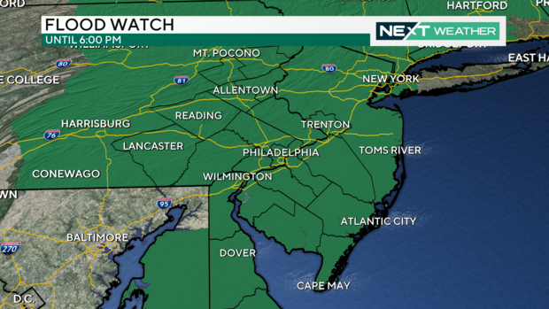
The heavy rainfall combined with the already saturated ground has resulted in several Flood Warnings across the area that will continue through the afternoon. Even though the rain will taper off, locations may still experience flooding as the water continues to run off into lower-laying areas. A Flood Watch for the entire area will remain in effect until 6 pm.
The Philadelphia International Airport has received at least 2.20 inches of rain so far Monday, which breaks the daily rainfall record for Dec.18 in Philadelphia, which used to be 1.72 inches set in 1977.
Since the rain started Sunday, Philadelphia has received at least 3.01 inches of rain for the entire storm.
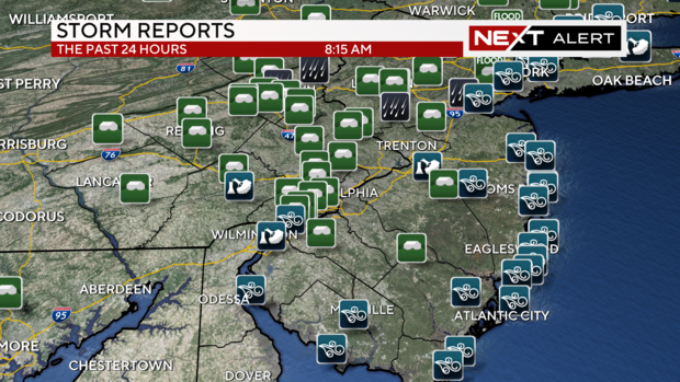
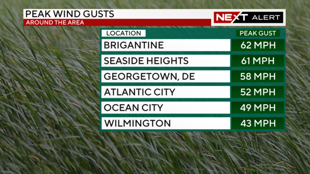
In addition to the rain, the wind has been a factor that has resulted in some damage and power outages. There have been several reports of trees down across the region as a result of the gusty winds that came through overnight and will continue at times through Monday and Tuesday.
Wind gusts were highest along the coast in excess of 60 mph, but there have been several reports of gusts well inland that have ranged from 30-40 mph. Winds died down a bit around sunrise Monday morning, but will increase again Monday afternoon with gusts peaking between 30-40 mph once again as colder air really begins to rush in from the northwest.
The high temperature Monday of 63 degrees already occurred around 4:30 a.m. Since then, cooler air has started to push into the area, which will keep temperatures in the low and middle 50s for the remainder of the day.
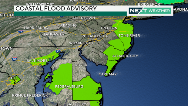
Along the shore, a Coastal Flood Advisory for New Jersey shore points and back bays will be in effect through 4 p.m. Monday. Some minor-moderate coastal flooding has been reported and will remain a threat through the midday high tide cycle. After the peak of high tide into early Monday afternoon, the threat for coastal flooding will diminish into this evening.
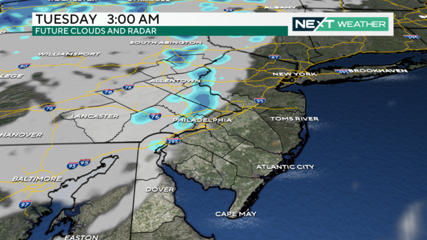
The good news? After we clear out late Monday, we have a relatively dry and quiet forecast heading into the last full week and weekend before Christmas. That said, it'll remain breezy through Tuesday afternoon and with high temperatures only in the low 40s, it'll feel like the 30s all day long with the wind chill.
There could also be a few rain or snow showers early Tuesday morning as an upper level disturbance sweeps through, trailing behind the larger low pressure system that moved through Monday. Any snow accumulations are not expected to be more than a light dusting, if anything at all.
Temperatures will then remain seasonably with highs in the low 40s and lows in the upper 20s and low 30s through the remain of the week. While overnight temperatures remain chilly, there will be a slight warm-up with daytime highs into Christmas with high temperatures Christmas Day expected to be near 50 degrees.


