Philadelphia weather: Quiet end to 2023, isolated sprinkles and flurries heading into the new year


PHILADELPHIA (CBS) -- Cloud cover will remain through Sunday, but all-in-all it won't be a bad last day of 2023.
At times the steady stream of clouds over the region will thin out and give a glimpse of the sun, but overall skies will be partly sunny as temperatures make their way into the mid-upper 40s this afternoon.
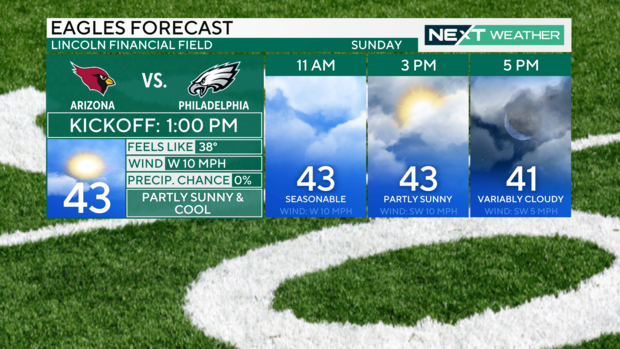
This coincides with the Eagles game, with kickoff at 1 p.m. Morning temperatures leading up to the game will be in the 30s to nearly 40 degrees by 11 a.m.. Game-time temps stay in the low to mid-40s with west winds around 10 mph. This will make those low 40s feel more like the upper 30s through the game.
New Year's Eve forecast
If your plans take you into the evening, expect skies to become mostly cloudy to overcast as a system approaches from the west. That will help keep those low 40s around, even into the 8-10 p.m. hours.
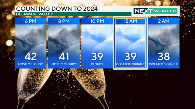
By the time we usher in 2024, temperatures will be in the upper 30s with overcast skies and even a few sprinkles possible.
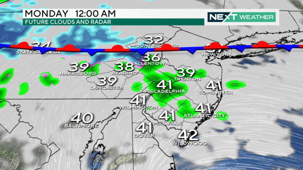
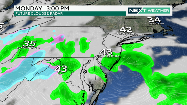
The quick-moving clipper system will continue to deliver early-morning sprinkles and a shower or two to the Philadelphia, New Jersey, and Delaware areas and a few snow showers just north into the Lehigh Valley. Little to no accumulation is expected.
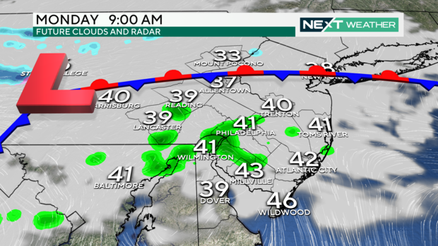
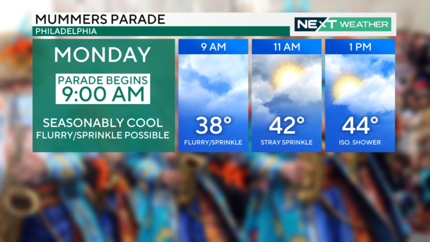
This means anyone heading into Center City for the Mummers parade which begins at 9am could see a few light sprinkles and even a brief snow flake mixing in. Temperatures for the start of the parade will be in the upper 30s and then warm into the low-middle 40s by the afternoon. While the chance of precipitation is not zero and rain/snow will be light and relatively short-lived
From there, dryer air will move into the region for Tuesday allowing for more sunshine and continued seasonable temperatures through mid-week. By Thursday a coastal low pressure system will merge with a cold front from the west to bring the area its next chance for rain.
In the wake of this next system colder air will settle into the region Friday and Saturday which will set the stage for another storm system into Sunday. Right now it is too early to discuss details, but the setup is one that has the potential to be the first snow-maker of the season for some parts of the region.
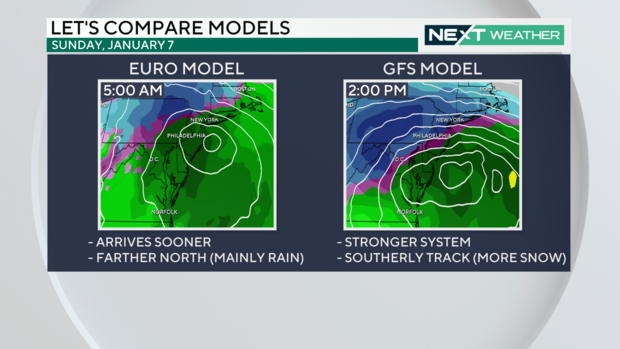
The Next Weather Team will continue to monitor the development of this forecast. Until then, be happy, be safe, and be healthy!
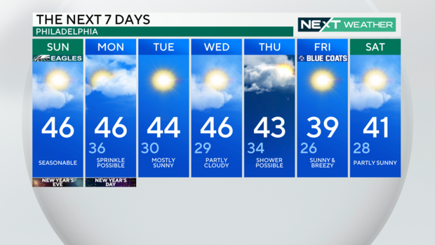
Here's your 7-day forecast:
Today: Partly sunny. High of 46, seasonable temps
Tonight: Low of 36. Mostly cloudy. Isolated sprinkle possible.
Monday: High of 46, low of 36, sprinkle possible
Tuesday: High of 44, low of 30, mostly sunny
Wednesday: High of 46, low of 29, partly cloudy
Thursday: High of 43, low of 34, shower possible
Friday: High of 39, low of 26, sunny and breeze
Saturday: High of 41, low of 28, partly sunny


