Philadelphia weather: Who will get the most snow this weekend? The details are uncertain

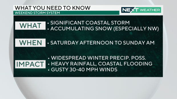
PHILADELPHIA (CBS) -- A strong low-pressure system is forecast to track into the Northeast this weekend and bring a widespread area of gusty winds, rain, the threat for flooding and, yes, snow.
The specifics of the storm are still uncertain, but the forecast becomes a little more clear with each passing hour.
Where we stand now
The area of low pressure set to arrive this weekend is currently tracking to the southeast across the Desert Southwest. Now that the system has moved ashore from the Pacific Ocean, the network of weather balloons across the United States will be able to gather more data about the system than what has been available up to this point.
This additional data will be fed into the forecast models, which will begin to produce much more consistent and accurate solutions for how the storm will evolve as it approaches the region.
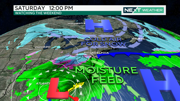
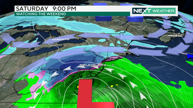
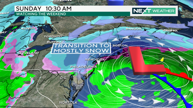
The storm system will track northeast out of the southern states and begin to spread precipitation across the area Saturday evening through Sunday morning.
Cold air in place ahead of the system will likely be cold enough for the initial precipitation across the Lehigh Valley to fall all snow.
Slightly warmer conditions across the I-95 corridor will likely keep the precipitation from initially being all snow, with a good mix of rain, sleet and snow possible. Southeasterly winds off the Atlantic Ocean ahead of the storm will then likely be too warm for anything but rain along the shore for most of the event.
In areas that see any combination of a rain/snow mix to all rain will be at risk for flooding due to the saturated ground after the recent rainfall over the last few weeks.
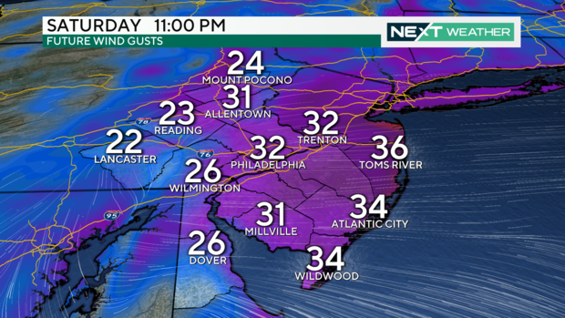
In addition to the variety of precipitation types and issues associated with them, gusty winds will also be a factor associated with this storm. Wind gusts around the area could reach 30 to 35 mph with stronger gusts up to 45 mph possible along the coast.
Holiday decorations, along with other loose items, could easily blow away during these windy conditions.
Furthermore, the saturated ground from the recent rain and expected precipitation could also make it easy for trees to come down or simply limbs and branches to fall as well. Power outages will be possible.
What could change
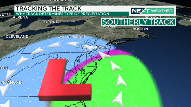
There remains a fair amount of uncertainty in exactly where the center of the storm will track, which will ultimately dictate what areas get snow, a rain/snow mix, or just all rain. The storm track will also determine how much precipitation will fall in general.
The trend, as of Wednesday, has been for the center of the storm to track off the coast of Virginia and pass just to the southeast of New Jersey. This scenario would bring all snow to the Lehigh Valley into the Poconos, which is where the greatest snowfall totals will likely be.
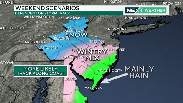
The Delaware Valley and I-95 corridor would likely deal with a mix of rain and snow through Saturday night with a transition to snow Sunday morning as the system begins to clear out. This would allow for some snow accumulation on grassy and elevated surfaces and more of a slush on roadways.
The coast would most likely see a cold rain through the majority of the event, but potentially a brief period of snow toward the very end of the precipitation into Sunday afternoon.
If the storm tracks a little farther to the south and offshore that would allow colder air to push more into the region, which would allow the area for snow to also shift farther to the south into more of the Philadelphia area and South Jersey.
On the other hand, if the storm system tracks farther north than the area of snow would also be pushed farther north and rain would be a dominating feature across a larger part of the area.
Bottom line: How much snow this weekend?
The entire CBS Philadelphia area will receive impacts from the storm system this weekend, beginning Saturday evening through Sunday. While areas across the Lehigh Valley and Poconos will likely see decent snow accumulations, more uncertainly exists across the Philadelphia area about how much of the precipitation will be snow as opposed to rain.
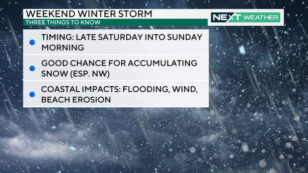
Everyone should be prepared for the potential for flooding due to the recent rain over the last month and the threat for gusty winds and flooding along the coast.
While this storm system doesn't appear to be a blockbuster of a winter storm, it will bring the area its first decent chance for snow in almost two years. The NEXT Weather Team will continue to monitor the latest data and make sure to pass along the latest forecast and details as it becomes available.


