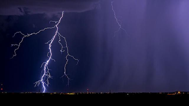
Severe thunderstorm warnings issued in Northern Illinois, Northwest Indiana
Warnings have been issued for Lake and McHenry counties in Illinois and Lake and Porter counties in Indiana.
Watch CBS News

Warnings have been issued for Lake and McHenry counties in Illinois and Lake and Porter counties in Indiana.
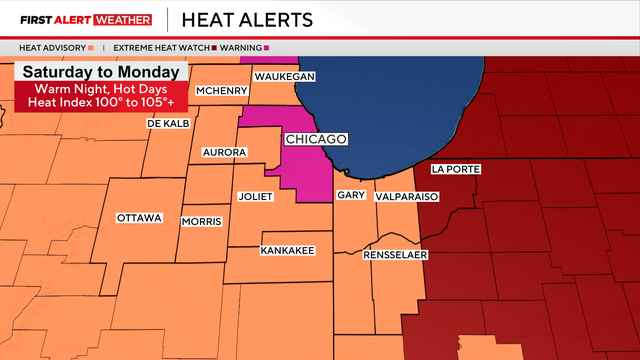
Cook County and Chicago are under an Extreme Heat Warning starting Saturday morning, a Heat Advisory has been issued for the entire rest of the Chicago area, and an Extreme Heat Watch in parts of Northwest Indiana.
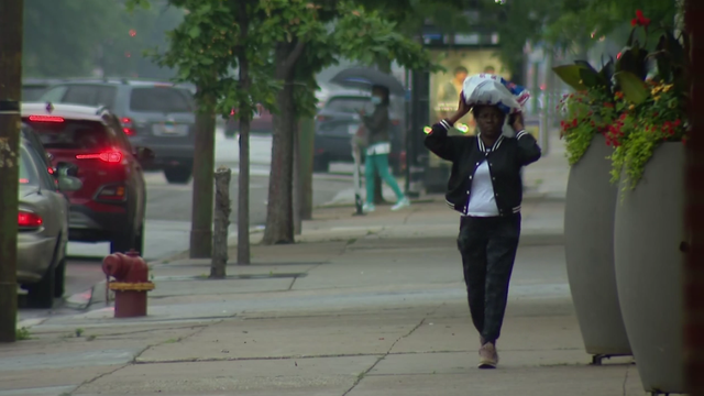
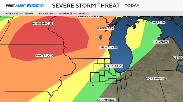
A line of strong thunderstorms brought a tornado watch, flood watch and heavy downpours to the Chicago area Wednesday afternoon.
An Air Quality Alert is in effect as Canadian wildfire smoke has been blown in behind a slow-moving rain system and cold front.
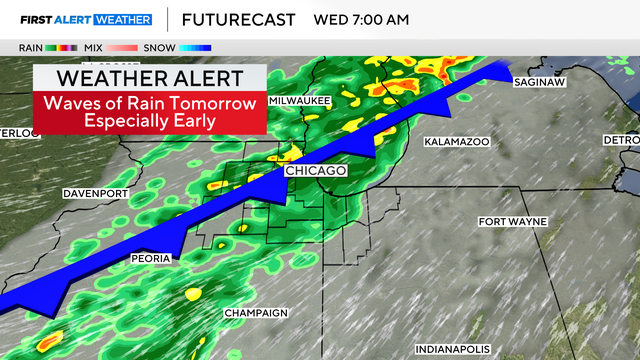
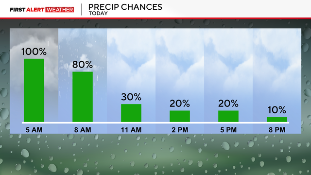
There is the possibility of some ponding and flooding on low-lying roads as waves of steady rain come through the area Tuesday night into Wednesday morning.

Summer is Chicago's wettest season and a time when severe storms and tornadoes are most common. There are two reasons why 2025 may be worse than normal.
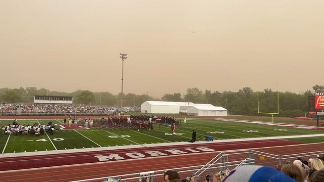
The National Weather Service said it was only the second time its Chicago office ever issued a dust storm warning.
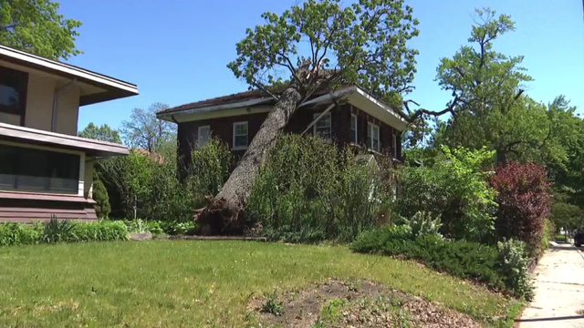
Downed trees were scattered across roads and thousands were without power after a line of destructive storms hit the city.
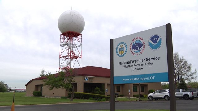
Many NWS offices are now short-staffed, following recent Department of Government Efficiency-ordered staff cuts and voluntary early retirements.
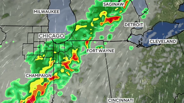
Heavy rain that started overnight continues Thursday, bringing a risk of flooding before a round possible thunderstorms moves in.
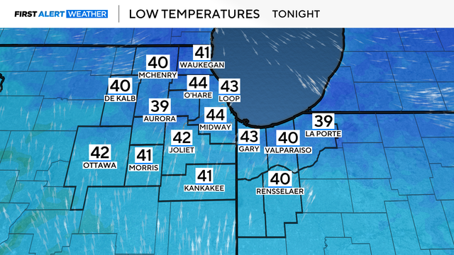
Mostly cloudy and calm Friday night with lows in the upper 30s.
The chance of severe storms hitting the Chicago area Monday night has lessened.
Clouds increase tonight with showers, possibly by daybreak.
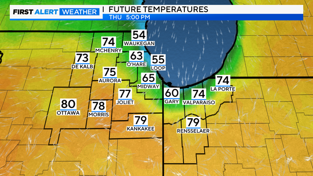
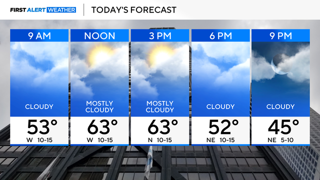
While the far southwestern suburbs hover around 80 degrees, Chicago's temperatures fall into the 50s by late afternoon.
A chance for showers and storms on Tuesday with highs in the upper 60s and low 70s.