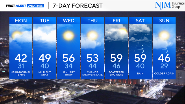
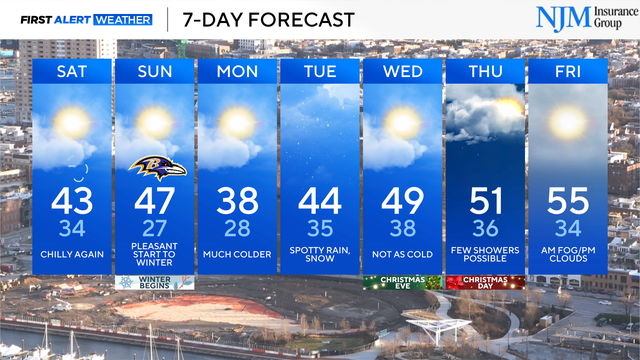
Much warmer weather returns to Maryland later this week
Afternoon temperatures could warm past 60° before the next strong cold front arrives.
Watch CBS News

Afternoon temperatures could warm past 60° before the next strong cold front arrives.
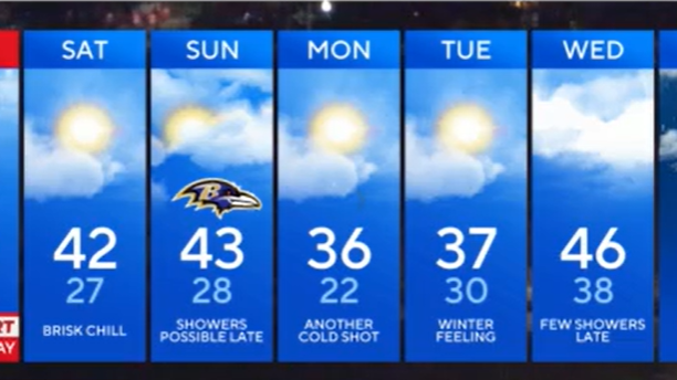
Scattered flurries are possible Saturday evening, into early Sunday morning.
While no major weather impacts are expected, it won't be the prettiest weekend in Maryland.
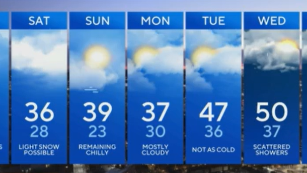
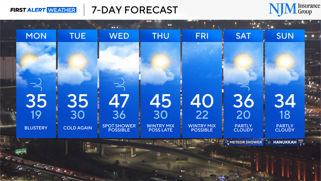
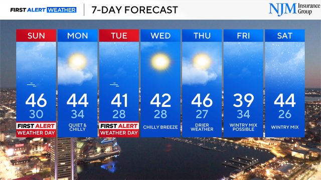
There is another opportunity for light snow in Maryland as we head into the first weekend of the new year.
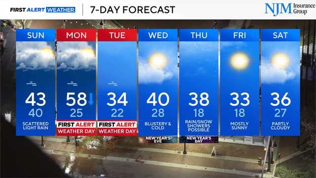
There will be more clouds than sun through the weekend, ahead of a blast of much colder weather.
Multiple storm systems will impact parts of Maryland through the holiday weekend into next week, bringing a chance for wet weather and a possible wintry mix.
Temperatures will be in the upper teens and 20s across the Baltimore region early Monday morning.

The chance of a white Christmas in Baltimore, central Maryland, and the Eastern Shore remains very low.
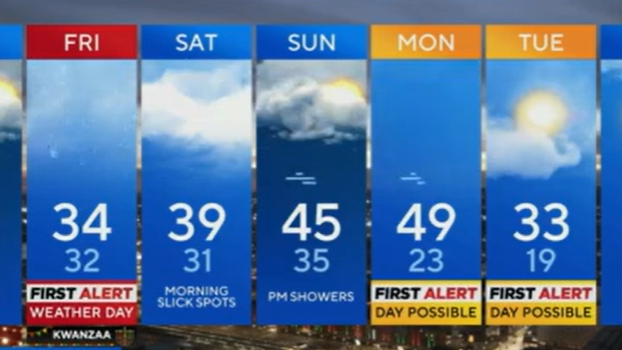
Bundle up for Friday night, Saturday morning plans.
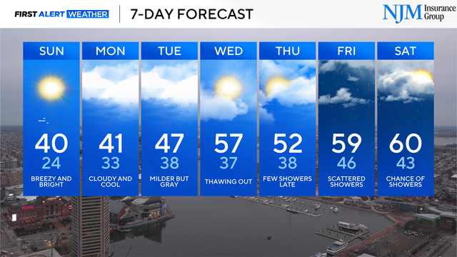
A strong cold front moves through late Sunday night, into early Monday morning.
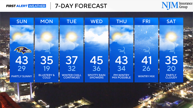
Chilly weather continues through the Ravens home game, ahead of another drop in temperature.

The first accumulating snow of the season is winding down in the Baltimore area. Leftover flurries, freezing drizzle and slick spots continue.
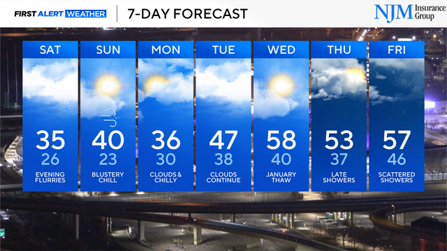
Cold remains locked in-place, with an occasional chance of wintry weather.
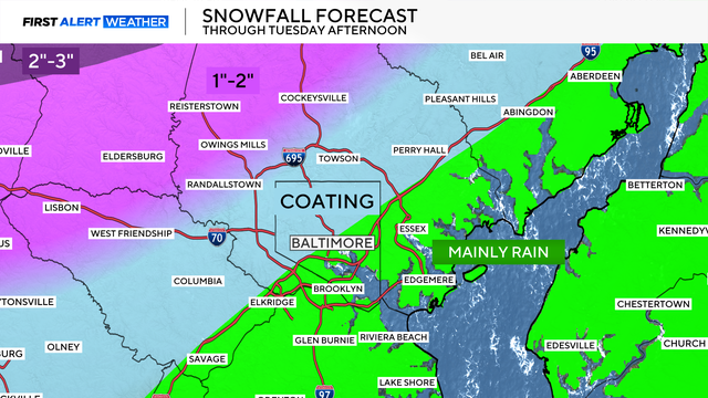
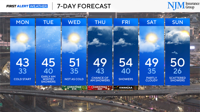
Accumulating snow and ice are likely Tuesday across Maryland before a changeover to rain. Travel delays are likely.
Additional storm systems will impact Maryland within the next seven days.