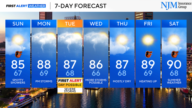
Muggier, stormier weather returns to Maryland this-coming week
Tuesday is a possible First Alert Weather Day.
Watch CBS News

Tuesday is a possible First Alert Weather Day.
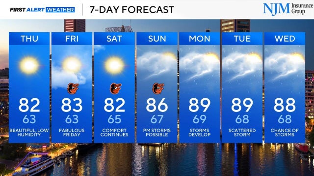
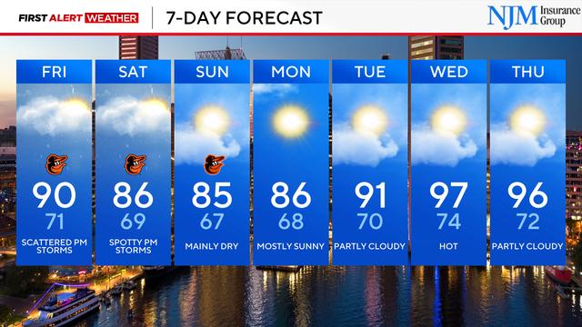
The forecast trends cooler and drier heading into late week.
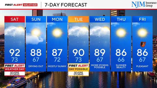
Some more storms are expected on Wednesday but the severe weather risk will be much lower

The risk of severe storms and heavy rain have prompted a First Alert Weather Day on Tuesday.
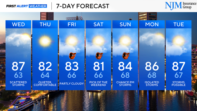
Sunday brings drier weather.
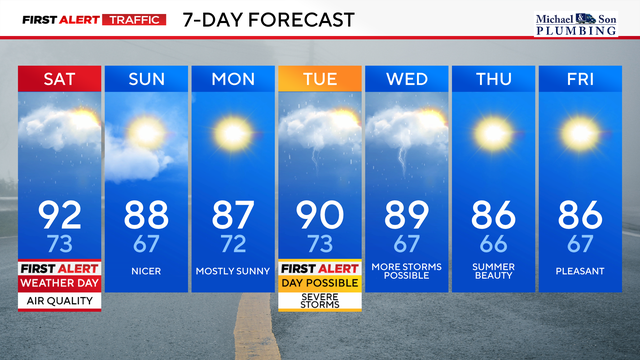
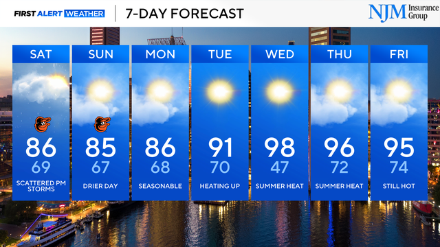
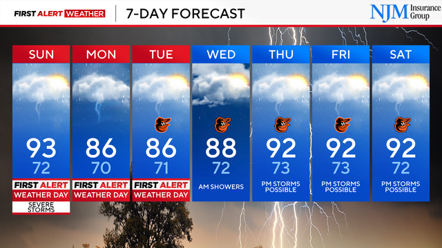
Friday and Saturday are First Alert Weather Days due to poor air quality from thick wildfire smoke, followed by scattered severe storms.
It's going to heat up across Maryland this week. First Alert Weather Days are possible on Wednesday and Thursday.
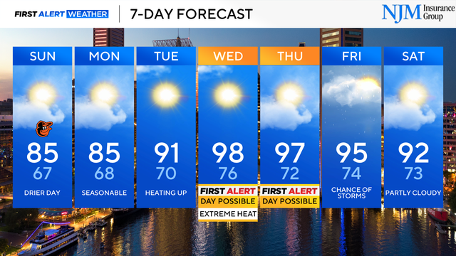
Sunday is the 'pick day' of the weekend.
More scattered storms expected on Saturday, ahead of drier weather.
Showers and storms with heavy rain, lightning and gusty winds have moved out of the WJZ viewing area. A few showers are still possible overnight.

Storms may impact the Thursday evening commute and routine.
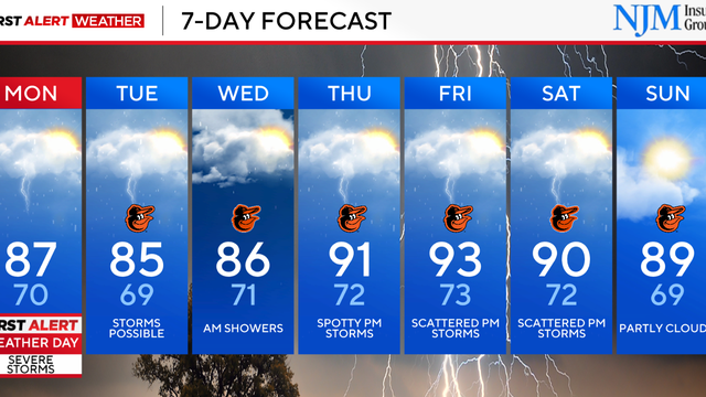
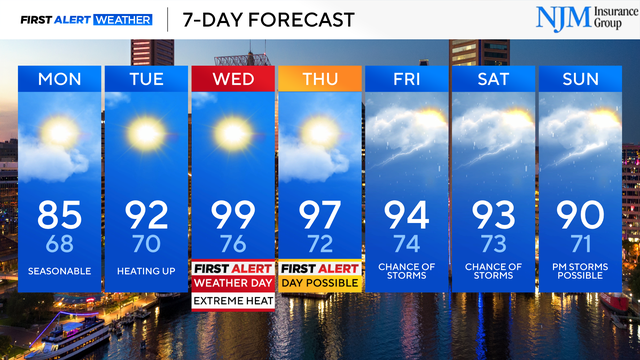
Monday is another First Alert Weather Day, due to impacts from more heavy rain and strong storms.
The risk of severe weather is dropping across the Baltimore metro.
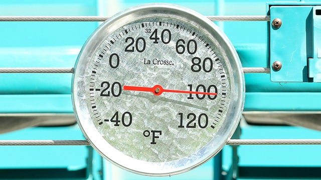
A dangerous heat wave is set to impact Maryland starting Wednesday.
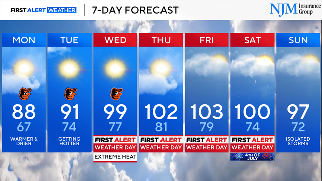
A heat wave is set to arrive in Maryland Wednesday and temperatures will likely be above 100 degrees.