Chicago First Alert Weather: Clear and colder Friday night
A south wind will bring temperatures up a bit on Saturday with highs in the upper 30s under a mostly sunny sky.
Watch CBS News

A south wind will bring temperatures up a bit on Saturday with highs in the upper 30s under a mostly sunny sky.
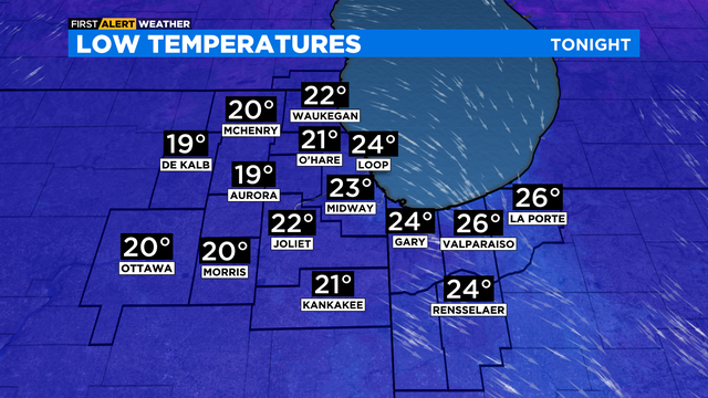
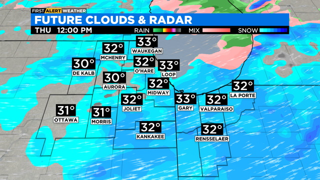
According to CBS 2 Chief Meteorologist Albert Ramon, a mix of rain and wet snow this evening is likely, then scattered snow showers for the overnight. Little to no accumulation is expected.
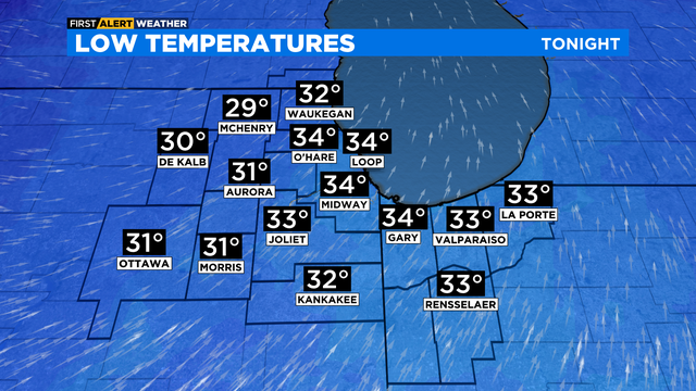
Lake effect snow chances for Thursday night into Friday, but mainly for Northwest Indiana. Highs on Friday will be colder in the low 30s.
Areas of sprinkles or drizzle will be possible after midnight through Tuesday mid-morning.

Partly cloudy skies and mid 30s for Saturday.
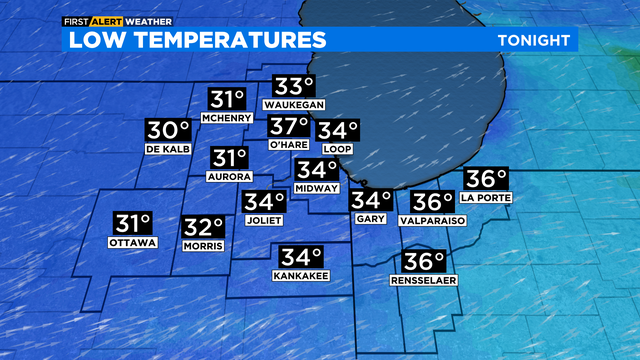
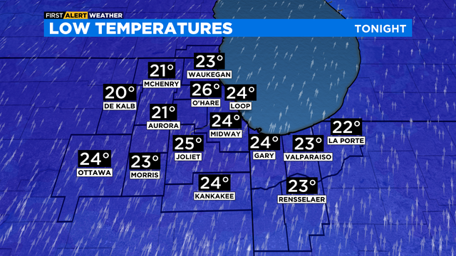
Lows will be below freezing in the upper 20s and low 30s.
Fog was set to lift late Tuesday night, and severe weather had moved on -- but chillier temperatures are coming in the morning.
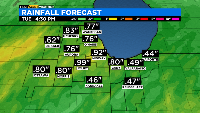
According to CBS 2 Chief Meteorologist Albert Ramon, a warm front will usher in milder air and moisture overnight. Expect widespread rain after midnight through the predawn hours of Tuesday.
The best chance for rain arrives late in the afternoon through the evening hours. Highs in the low 40s.
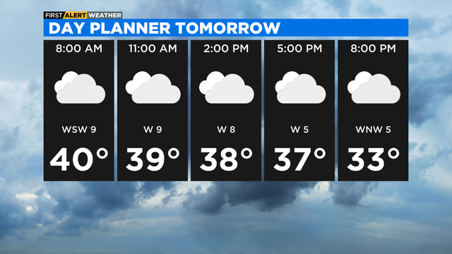
Plan for a Friday afternoon in the upper 30s under a mostly cloudy sky.

A cold front moves into the area early Friday morning, so expect highs in the 40s in the morning and afternoon temperatures in the upper 30s.
A south wind will increase tonight, gusting to as high as 40 mph.
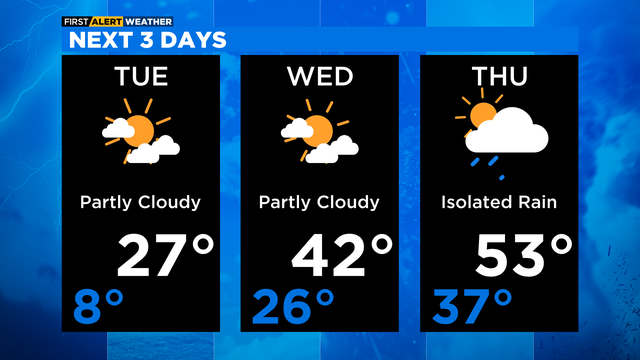
Partly cloudy skies for Tuesday with highs in the mid to upper 20s.
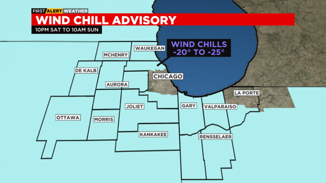
Wind chills in the advisory area could be as cold as -25 degree.
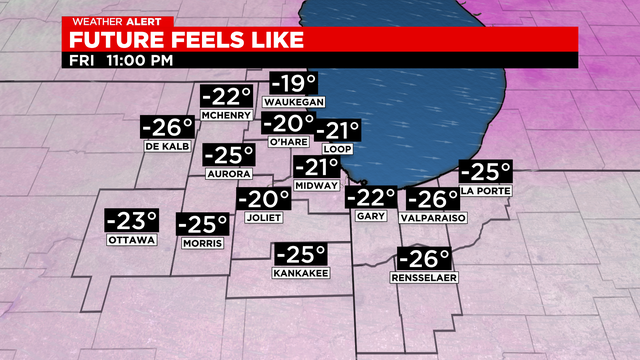
As the snowfall wraps up, dangerous cold with blowing and drifting snow is expected Friday.