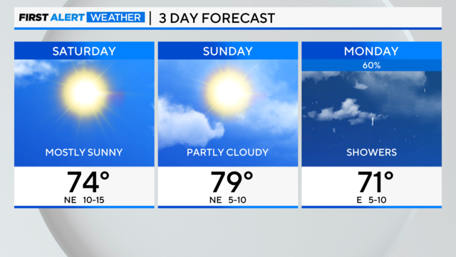
Chicago First Alert Weather: Clear and cool this weekend
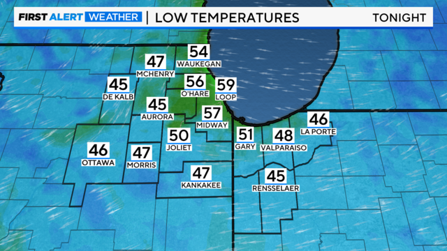
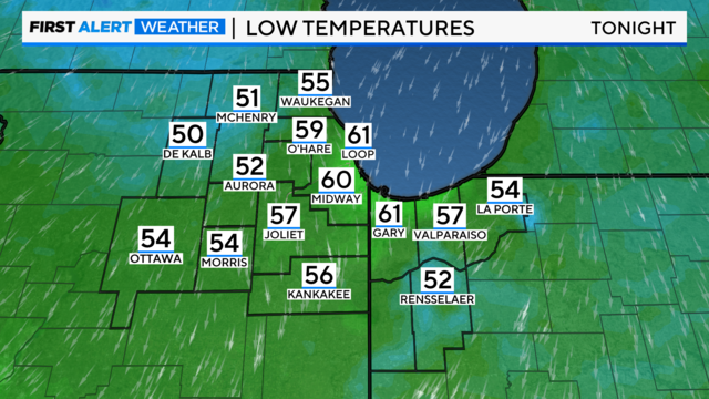
According to CBS 2 Chief Meteorologist Albert Ramon, lows tonight will be in the mid to upper 50s under a clearing sky. Low 50s are expected in the far western suburbs.
Watch CBS News

According to CBS 2 Chief Meteorologist Albert Ramon, lows tonight will be in the mid to upper 50s under a clearing sky. Low 50s are expected in the far western suburbs.
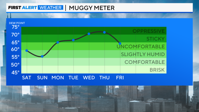
Humidity levels will slowly increase by Labor Day, then it will be noticeably muggier by Tuesday and Wednesday with highs in the low 90s.
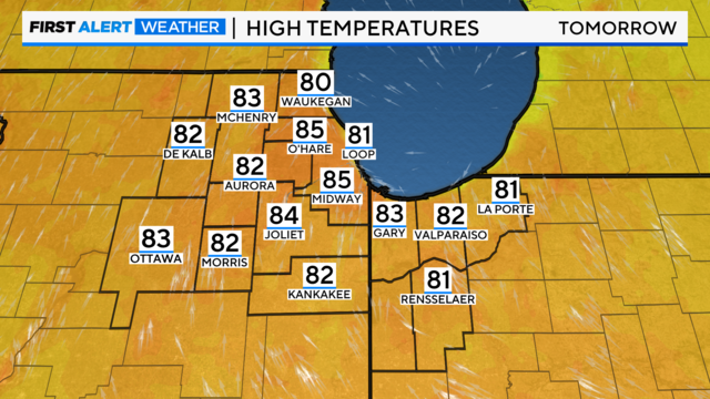
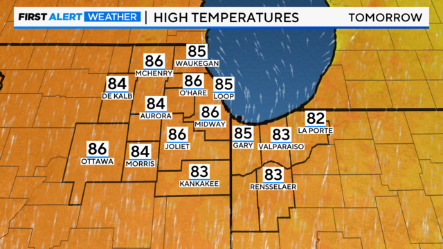
Sunny skies and a south wind will boost highs to the mid-80s for Friday.
Sunny skies and comfortable for Thursday. Highs will be in the mid to upper 70s inland, but staying in the low 70s near the lake.
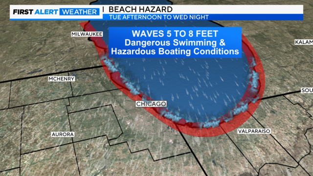
A Beach Hazard for dangerous swimming conditions is in effect until 4 a.m. Thursday morning.
Our next cold front arrives Tuesday afternoon, according to CBS 2 Chief Meteorologist Albert Ramon.
It'll be hotter and more humid for Sunday, with highs in the low 90s. The humid air will make it feel like 100 degrees in many locations in the afternoon.
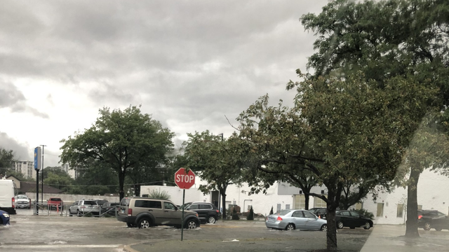
At the Golf Mill Shopping Center in Niles, some drivers found themselves in calf-deep cold water upon returning to their cars, while others found floodwaters coming up to the middle of their car doors.
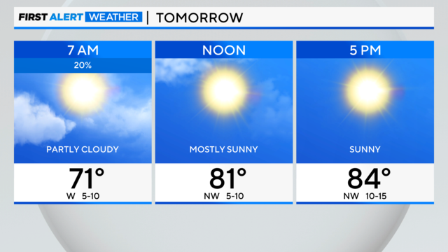
Sunny skies are expected for Saturday afternoon with highs in the mid to upper 80s.
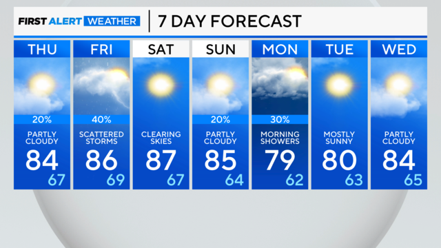
Thursday will feature morning sunshine, then turn partly cloudy in the afternoon.
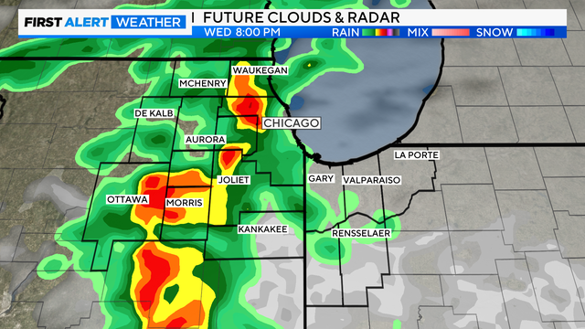
Some sunshine for the first half of Wednesday, then increasing clouds by the early afternoon.

Scattered showers and isolated storm chances return Tuesday afternoon.
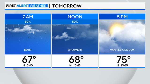
Rainfall amounts over the next 7 days will range from a half inch to more than an inch for areas southwest of Chicago.
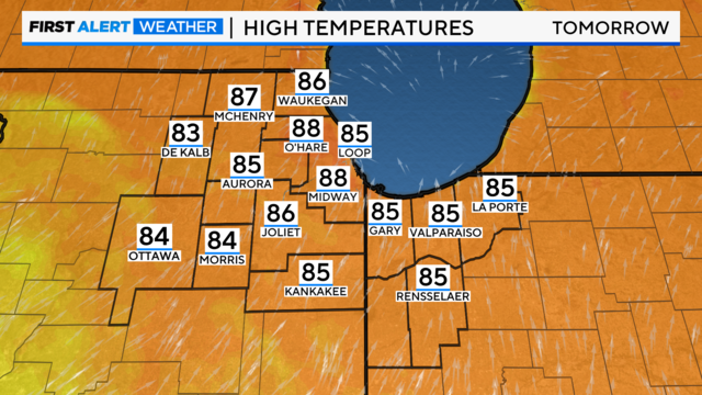
A front will push in some cooler air for Friday with highs in the low 80s, but staying in the 70s near the lake.

The National Weather Service has issued a Severe Thunderstorm Warning for multiple counties in the Chicago area.