Mostly dry holiday weekend, with some chances for scattered showers
The rain chances through Tuesday are non-zero, but there's enough dry time in between to enjoy the outdoors.
Watch CBS News

The rain chances through Tuesday are non-zero, but there's enough dry time in between to enjoy the outdoors.
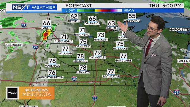
Along with some sun, a warm front to the north will help heat up the Twin Cities close to 80 degrees on Thursday.
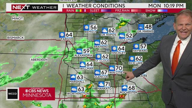
A cold front to the south will stall, bringing another system our way Monday night into Tuesday morning. This system will feature more widespread heavy rain, storms and gusty winds.
Saturday will be in the lower 80s and Sunday may just hit 80 and might even bring more rain.
An area of low pressure will move east on Thursday, taking the rain threat and clouds with it.
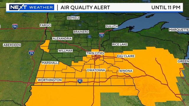
More than 80 active wildfires burning across Canada are sending wildfire smoke back to Minnesota and Wisconsin Sunday. The smoke has prompted an air quality alert for all of Minnesota — the first of 2024.
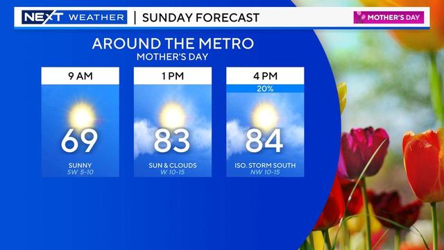
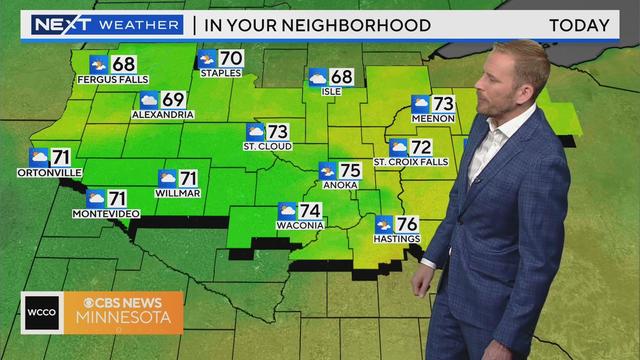
The Twin Cities have a toasty Mother's Day on tap, and spotty storms will return to southern Minnesota Sunday afternoon.
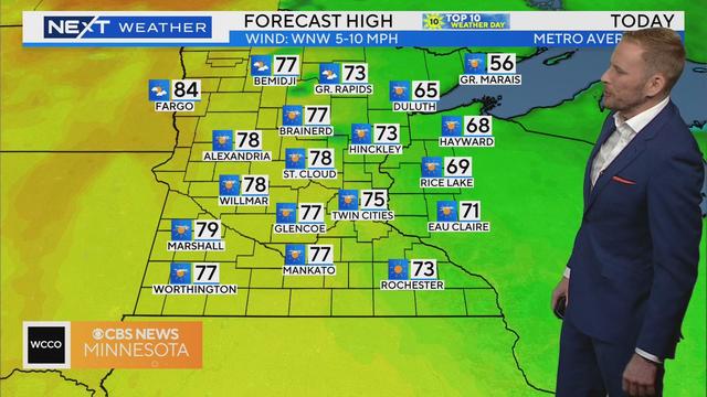
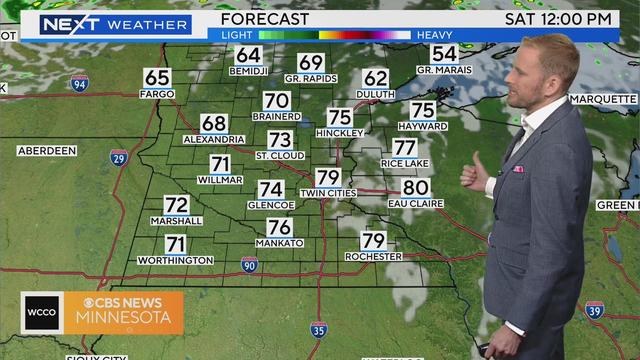
High pressure nudges in on Saturday, bringing lots of sun, calmer winds and highs in the mid-70s — making for another #Top10WxDay.
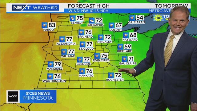
Friday will feature some spotty storms before a lovely Saturday, and sweaty Mother's Day.
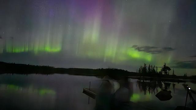
Minnesotans may be treated to more northern lights this weekend from the strongest solar storm our planet has experienced in 20 years.
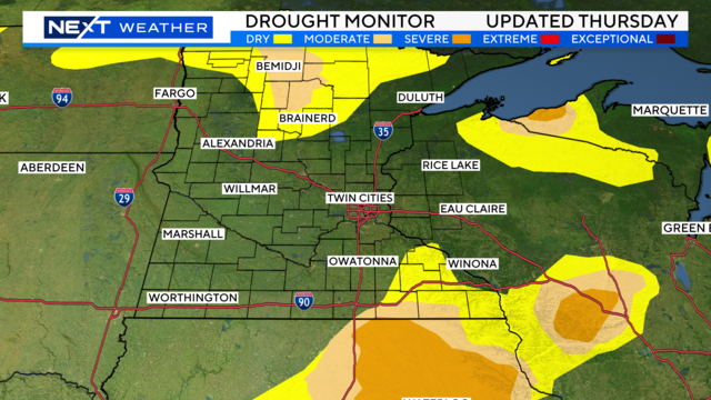
Since the end of April, Minnesota has managed to pick up at least another 2 inches of rain where it's really needed — in far southern, central and northwestern areas of the state.
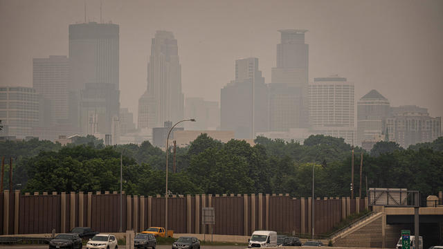
New report from the American Lung Association says nearly 2 out of 5 Americans are breathing unhealthy air.
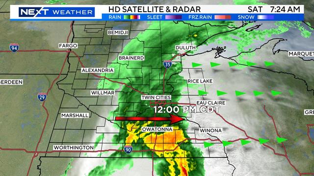
Grab an umbrella if you're heading outside Saturday morning, but you shouldn't need to use it for too long.

The Twin Cities are in for a lovely Friday, but more rain is on the way.
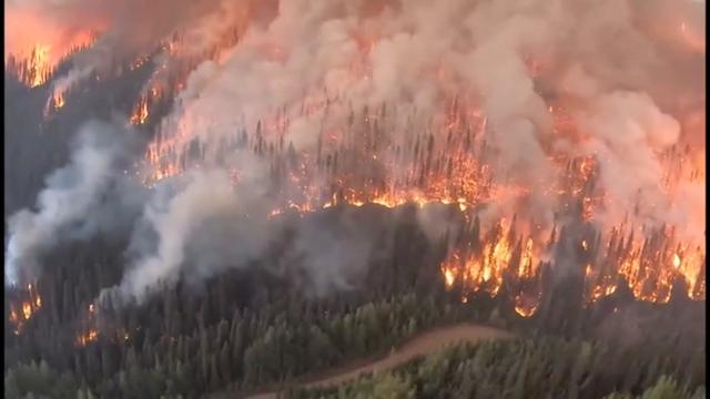
Canadian wildfires in 2023 caused multiple days of smoke and poor air quality in Minnesota.